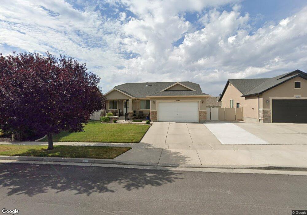
4599 W Pistol Ln Herriman, UT 84096
Estimated Value: $606,000 - $635,000
5
Beds
3
Baths
3,084
Sq Ft
$202/Sq Ft
Est. Value
About This Home
This home is located at 4599 W Pistol Ln, Herriman, UT 84096 and is currently estimated at $623,415, approximately $202 per square foot. 4599 W Pistol Ln is a home located in Salt Lake County with nearby schools including Midas Creek Elementary School, Copper Mountain Middle School, and Herriman High School.
Ownership History
Date
Name
Owned For
Owner Type
Purchase Details
Closed on
Jun 17, 2022
Sold by
Sharon Mcintosh
Bought by
Sharon Doan Mcintosh Living Trust
Current Estimated Value
Purchase Details
Closed on
Mar 13, 2020
Sold by
Barratt Brandon M and Barratt Lisa M
Bought by
Mcintosh Sharon
Home Financials for this Owner
Home Financials are based on the most recent Mortgage that was taken out on this home.
Original Mortgage
$410,400
Interest Rate
3.5%
Mortgage Type
New Conventional
Purchase Details
Closed on
Oct 11, 2006
Sold by
Mcarthur Homes At Legacy Ranch Lc
Bought by
Barratt Brandon M and Barratt Lisa M
Home Financials for this Owner
Home Financials are based on the most recent Mortgage that was taken out on this home.
Original Mortgage
$36,747
Interest Rate
6.14%
Mortgage Type
Stand Alone Second
Create a Home Valuation Report for This Property
The Home Valuation Report is an in-depth analysis detailing your home's value as well as a comparison with similar homes in the area
Home Values in the Area
Average Home Value in this Area
Purchase History
| Date | Buyer | Sale Price | Title Company |
|---|---|---|---|
| Sharon Doan Mcintosh Living Trust | -- | -- | |
| Mcintosh Sharon | -- | Sutherland Title | |
| Barratt Brandon M | -- | Surety Title |
Source: Public Records
Mortgage History
| Date | Status | Borrower | Loan Amount |
|---|---|---|---|
| Previous Owner | Mcintosh Sharon | $410,400 | |
| Previous Owner | Barratt Brandon M | $36,747 | |
| Previous Owner | Barratt Brandon M | $195,982 |
Source: Public Records
Tax History Compared to Growth
Tax History
| Year | Tax Paid | Tax Assessment Tax Assessment Total Assessment is a certain percentage of the fair market value that is determined by local assessors to be the total taxable value of land and additions on the property. | Land | Improvement |
|---|---|---|---|---|
| 2025 | $3,509 | $592,700 | $145,800 | $446,900 |
| 2024 | $3,509 | $575,600 | $141,300 | $434,300 |
| 2023 | $3,550 | $551,000 | $101,000 | $450,000 |
| 2022 | $3,624 | $560,800 | $99,000 | $461,800 |
| 2021 | $3,261 | $443,000 | $80,470 | $362,530 |
| 2020 | $2,690 | $344,500 | $78,800 | $265,700 |
| 2019 | $2,709 | $341,000 | $78,800 | $262,200 |
| 2018 | $2,559 | $317,300 | $76,400 | $240,900 |
| 2017 | $2,423 | $297,000 | $76,400 | $220,600 |
| 2016 | $2,371 | $278,800 | $76,400 | $202,400 |
| 2015 | $2,247 | $248,700 | $77,900 | $170,800 |
| 2014 | $2,099 | $234,300 | $74,200 | $160,100 |
Source: Public Records
Map
Nearby Homes
- 4587 W Flintlock Way
- 12284 S Flintlock Way
- 4494 W Osage Rd
- 12694 S Lincoln Peak Ln Unit 116
- 12694 S Lincoln Peak Ln
- 12688 S Lincoln Peak Ln Unit 115
- 12688 S Lincoln Peak Ln
- 12686 Lincoln Peak Ln
- 12693 S Lincoln Peak Ln
- 12682 S Lincoln Peak Ln
- 12682 S Lincoln Peak Ln Unit 113
- 12687 S Lincoln Peak Ln Unit 126
- 12687 S Lincoln Peak Ln
- 12676 S Lincoln Peak Ln
- 12676 S Lincoln Peak Ln Unit 112
- 12674 S Lincoln Peak Ln
- 12674 S Lincoln Peak Ln Unit 111
- 12672 S Lincoln Peak Ln Unit 110
- 12668 S Lincoln Peak Ln Unit 109
- 12671 S Lincoln Peak Ln Unit 131
- 4599 Pistol Ln
- 4609 W Pistol Ln
- 4589 Pistol Ln
- 4609 Pistol Ln
- 4594 Wildcat Ct
- 4594 W Wildcat Ct
- 4602 W Wildcat Ct
- 4602 Wildcat Ct
- 4586 W Wildcat Ct
- 4586 Wildcat Ct
- 4617 Pistol Ln
- 4579 W Pistol Ln
- 4617 W Pistol Ln
- 4579 Pistol Ln
- 4614 Wildcat Ct
- 4614 W Wildcat Ct
- 4596 W Pistol Ln
- 4576 Wildcat Ct
- 4576 W Wildcat Ct
- 4596 Pistol Ln