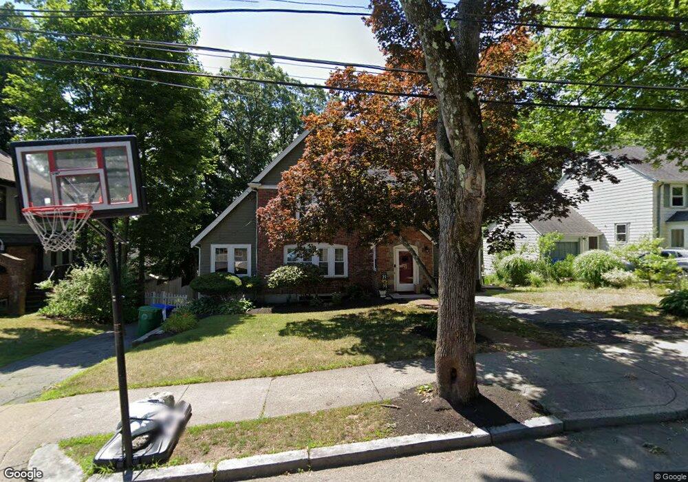
46 Alexander Rd Newton Highlands, MA 02461
Newton Highlands NeighborhoodEstimated Value: $1,416,000 - $1,594,000
3
Beds
3
Baths
1,847
Sq Ft
$834/Sq Ft
Est. Value
About This Home
This home is located at 46 Alexander Rd, Newton Highlands, MA 02461 and is currently estimated at $1,540,859, approximately $834 per square foot. 46 Alexander Rd is a home located in Middlesex County with nearby schools including Countryside Elementary School, Charles E Brown Middle School, and Newton South High School.
Ownership History
Date
Name
Owned For
Owner Type
Purchase Details
Closed on
May 5, 2011
Sold by
Bennett Matthew G and Bennett Kerry L
Bought by
Wong Daniel P and Wong Kate D
Current Estimated Value
Home Financials for this Owner
Home Financials are based on the most recent Mortgage that was taken out on this home.
Original Mortgage
$523,750
Outstanding Balance
$362,974
Interest Rate
4.82%
Mortgage Type
Purchase Money Mortgage
Estimated Equity
$1,177,885
Purchase Details
Closed on
Jul 14, 2004
Sold by
Appel Barbara R and Appel Neal B
Bought by
Bennett Kerry L and Bennett Matthew G
Home Financials for this Owner
Home Financials are based on the most recent Mortgage that was taken out on this home.
Original Mortgage
$524,000
Interest Rate
6.25%
Mortgage Type
Purchase Money Mortgage
Create a Home Valuation Report for This Property
The Home Valuation Report is an in-depth analysis detailing your home's value as well as a comparison with similar homes in the area
Home Values in the Area
Average Home Value in this Area
Purchase History
| Date | Buyer | Sale Price | Title Company |
|---|---|---|---|
| Wong Daniel P | $666,500 | -- | |
| Bennett Kerry L | $655,000 | -- |
Source: Public Records
Mortgage History
| Date | Status | Borrower | Loan Amount |
|---|---|---|---|
| Open | Wong Daniel P | $523,750 | |
| Previous Owner | Bennett Kerry L | $524,000 |
Source: Public Records
Tax History Compared to Growth
Tax History
| Year | Tax Paid | Tax Assessment Tax Assessment Total Assessment is a certain percentage of the fair market value that is determined by local assessors to be the total taxable value of land and additions on the property. | Land | Improvement |
|---|---|---|---|---|
| 2025 | $12,694 | $1,295,300 | $884,700 | $410,600 |
| 2024 | $12,274 | $1,257,600 | $858,900 | $398,700 |
| 2023 | $11,582 | $1,137,700 | $652,100 | $485,600 |
| 2022 | $11,082 | $1,053,400 | $603,800 | $449,600 |
| 2021 | $10,693 | $993,800 | $569,600 | $424,200 |
| 2020 | $10,375 | $993,800 | $569,600 | $424,200 |
| 2019 | $10,083 | $964,900 | $553,000 | $411,900 |
| 2018 | $9,719 | $898,200 | $507,600 | $390,600 |
| 2017 | $9,423 | $847,400 | $478,900 | $368,500 |
| 2016 | $8,585 | $754,400 | $447,600 | $306,800 |
| 2015 | $7,573 | $652,300 | $418,300 | $234,000 |
Source: Public Records
Map
Nearby Homes
- 125 Oakdale Rd
- 1308 Walnut St
- 19 Selwyn Rd
- 250 Woodcliff Rd
- 1292 Walnut St
- 671 Boylston St
- 628 Boylston St
- 625 Boylston St
- 36 Cannon St
- 21 Philbrick Rd
- 42 Sunhill Ln
- 35 Haynes Rd
- 1623-1625 Centre St
- 1629 Centre St
- 1597 Centre St Unit 1597
- 1597 Centre St
- 116 Upland Ave
- 45 Brandeis Rd
- 5 Halcyon Rd
- 1151 Walnut St Unit 205