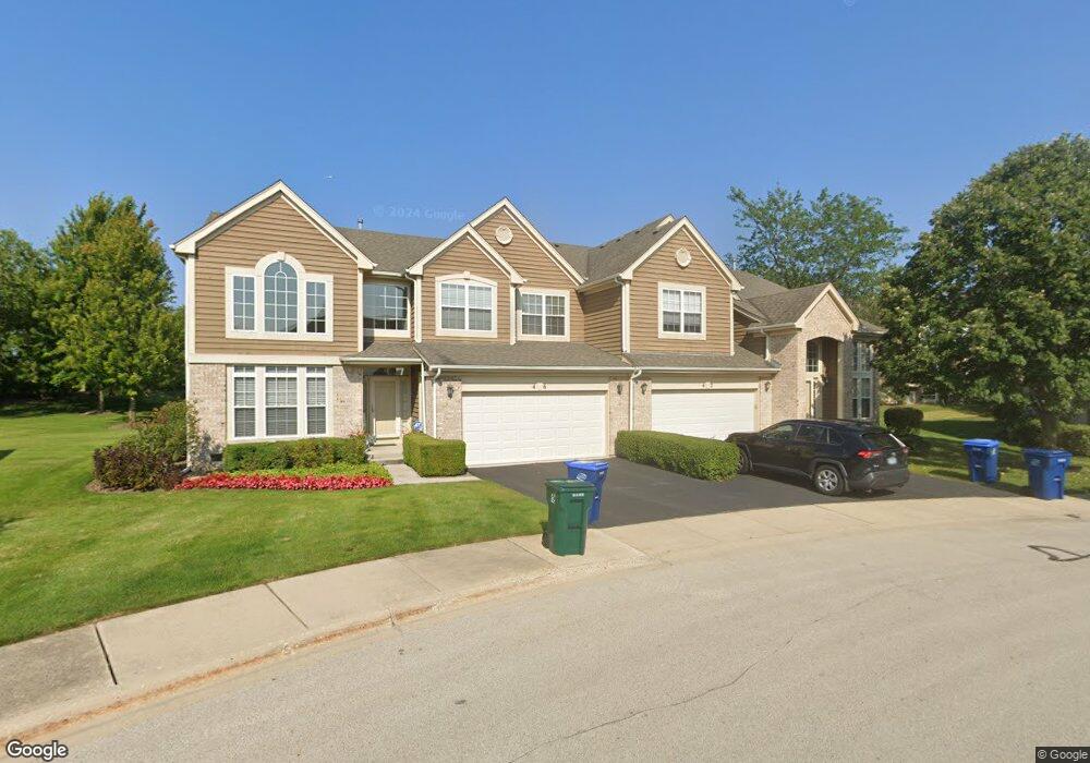
46 Andover Cir Northbrook, IL 60062
Estimated Value: $577,000 - $651,000
3
Beds
3
Baths
2,346
Sq Ft
$264/Sq Ft
Est. Value
About This Home
This home is located at 46 Andover Cir, Northbrook, IL 60062 and is currently estimated at $619,587, approximately $264 per square foot. 46 Andover Cir is a home located in Cook County with nearby schools including Hickory Point Elementary School, Shabonee Elementary School, and Wood Oaks Jr High School.
Ownership History
Date
Name
Owned For
Owner Type
Purchase Details
Closed on
Jun 26, 1998
Sold by
Dartmoor Northbrook Ltd Partnership
Bought by
Rabin Steven and Rabin Sandi
Current Estimated Value
Home Financials for this Owner
Home Financials are based on the most recent Mortgage that was taken out on this home.
Original Mortgage
$200,000
Outstanding Balance
$37,106
Interest Rate
7.18%
Estimated Equity
$582,481
Create a Home Valuation Report for This Property
The Home Valuation Report is an in-depth analysis detailing your home's value as well as a comparison with similar homes in the area
Home Values in the Area
Average Home Value in this Area
Purchase History
| Date | Buyer | Sale Price | Title Company |
|---|---|---|---|
| Rabin Steven | $341,000 | -- |
Source: Public Records
Mortgage History
| Date | Status | Borrower | Loan Amount |
|---|---|---|---|
| Open | Rabin Steven | $200,000 |
Source: Public Records
Tax History
| Year | Tax Paid | Tax Assessment Tax Assessment Total Assessment is a certain percentage of the fair market value that is determined by local assessors to be the total taxable value of land and additions on the property. | Land | Improvement |
|---|---|---|---|---|
| 2025 | $9,804 | $52,000 | $6,705 | $45,295 |
| 2024 | $9,804 | $48,001 | $9,001 | $39,000 |
| 2023 | $9,428 | $48,001 | $9,001 | $39,000 |
| 2022 | $9,428 | $48,001 | $9,001 | $39,000 |
| 2021 | $8,941 | $41,314 | $3,831 | $37,483 |
| 2020 | $8,911 | $41,314 | $3,831 | $37,483 |
| 2019 | $8,692 | $45,400 | $3,831 | $41,569 |
| 2018 | $9,335 | $44,916 | $3,352 | $41,564 |
| 2017 | $9,099 | $44,916 | $3,352 | $41,564 |
| 2016 | $8,927 | $44,916 | $3,352 | $41,564 |
| 2015 | $8,659 | $38,100 | $2,714 | $35,386 |
| 2014 | $8,463 | $38,100 | $2,714 | $35,386 |
| 2013 | $8,210 | $38,100 | $2,714 | $35,386 |
Source: Public Records
Map
Nearby Homes
- 139 Sanders Rd
- 15 Caribou Crossing
- 232 Arrowwood Dr
- 320 Buckthorn Cir
- 153 Pointe Dr Unit 201
- 654 Picardy Cir
- 1815 Lewis Dr
- 1765 Lewis Dr
- 1755 Lewis Dr
- 1735 Lewis Dr
- 1715 Lewis Dr
- 773 Sarah Ln
- 1685 Landy Ln
- 4050 Dundee Rd Unit 105C
- 1675 Landy Ln
- 1680 Landy Ln
- 270 Jonah Ct
- 1670 Landy Ln
- 280 Jonah Ct
- 70 Spencer Ct
- 42 Andover Cir
- 58 Andover Cir Unit 25
- 38 Andover Cir Unit 22
- 37 Andover Cir Unit 38
- 34 Andover Cir
- 74 Wellesley Cir
- 74 Wellesley Cir Unit 14
- 72 Wellesley Cir Unit 15
- 31 Andover Cir Unit 37
- 64 Wellesley Cir Unit 11
- 81 Andover Cir
- 26 Andover Cir Unit 20
- 23 Andover Cir Unit 36
- 66 Andover Cir
- 80 Wellesley Cir Unit 18
- 85 Andover Cir Unit 34
- 60 Wellesley Cir
- 22 Andover Cir
- 89 Andover Cir
- 84 Wellesley Cir Unit 17
Your Personal Tour Guide
Ask me questions while you tour the home.