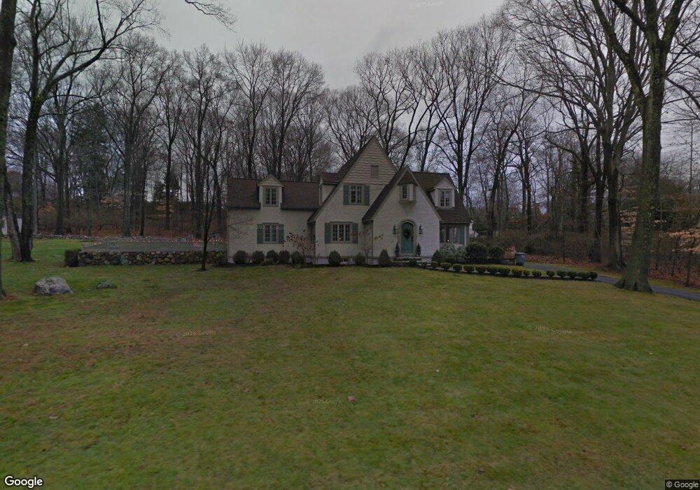
46 Birch Rd Darien, CT 06820
Estimated Value: $2,529,601 - $2,647,000
4
Beds
4
Baths
2,706
Sq Ft
$955/Sq Ft
Est. Value
About This Home
This home is located at 46 Birch Rd, Darien, CT 06820 and is currently estimated at $2,582,900, approximately $954 per square foot. 46 Birch Rd is a home located in Fairfield County with nearby schools including Ox Ridge Elementary School, Middlesex Middle School, and Darien High School.
Ownership History
Date
Name
Owned For
Owner Type
Purchase Details
Closed on
Dec 16, 2009
Sold by
Knauf Michael and Knauf Janine
Bought by
Gault Michael R and Lane Samantha M
Current Estimated Value
Home Financials for this Owner
Home Financials are based on the most recent Mortgage that was taken out on this home.
Original Mortgage
$417,000
Interest Rate
5%
Purchase Details
Closed on
Jul 5, 2000
Sold by
Ramsden Peter B and Ramsden Laura F
Bought by
Knauf Michael and Knauf Janine
Purchase Details
Closed on
Mar 15, 1999
Sold by
King Arthur and King Elizabeth
Bought by
Ramsden Peter B and Ramsden Laura F
Create a Home Valuation Report for This Property
The Home Valuation Report is an in-depth analysis detailing your home's value as well as a comparison with similar homes in the area
Home Values in the Area
Average Home Value in this Area
Purchase History
| Date | Buyer | Sale Price | Title Company |
|---|---|---|---|
| Gault Michael R | $1,534,000 | -- | |
| Knauf Michael | $975,000 | -- | |
| Ramsden Peter B | $843,563 | -- |
Source: Public Records
Mortgage History
| Date | Status | Borrower | Loan Amount |
|---|---|---|---|
| Open | Ramsden Peter B | $382,000 | |
| Closed | Ramsden Peter B | $406,500 | |
| Closed | Ramsden Peter B | $417,000 | |
| Closed | Ramsden Peter B | $150,000 |
Source: Public Records
Tax History
| Year | Tax Paid | Tax Assessment Tax Assessment Total Assessment is a certain percentage of the fair market value that is determined by local assessors to be the total taxable value of land and additions on the property. | Land | Improvement |
|---|---|---|---|---|
| 2025 | $22,535 | $1,455,720 | $1,101,800 | $353,920 |
| 2024 | $21,385 | $1,455,720 | $1,101,800 | $353,920 |
| 2023 | $18,923 | $1,074,570 | $787,010 | $287,560 |
| 2022 | $18,515 | $1,074,570 | $787,010 | $287,560 |
| 2021 | $18,096 | $1,074,570 | $787,010 | $287,560 |
| 2020 | $17,580 | $1,074,570 | $787,010 | $287,560 |
| 2019 | $17,698 | $1,074,570 | $787,010 | $287,560 |
| 2018 | $18,308 | $1,138,550 | $762,580 | $375,970 |
| 2017 | $18,399 | $1,138,550 | $762,580 | $375,970 |
| 2016 | $17,955 | $1,138,550 | $762,580 | $375,970 |
| 2015 | $17,477 | $1,138,550 | $762,580 | $375,970 |
| 2014 | $17,090 | $1,138,550 | $762,580 | $375,970 |
Source: Public Records
Map
Nearby Homes
- 29 Richmond Dr
- 146 Ridge Acres Rd
- 97 Richards Ave Unit B10
- 97 Richards Ave Unit E12
- 105 Richards Ave Unit 1407
- 6 Ward Ln Unit 6
- 7 Tommys Ln
- 20 Marianne Rd
- 18 Oakhill Ave
- 201 W Norwalk Rd
- 5 Topping Ln
- 561 Middlesex Rd
- 10 Stony Brook Rd
- 2 Rochelle Rd
- 10 Ledgebrook Dr Unit 1
- 20 Locust Hill Rd
- 9 Hollow Spring Rd
- 192 Gillies Ln
- 6 Acorn Ln
- 24 Scribner Ave
Your Personal Tour Guide
Ask me questions while you tour the home.