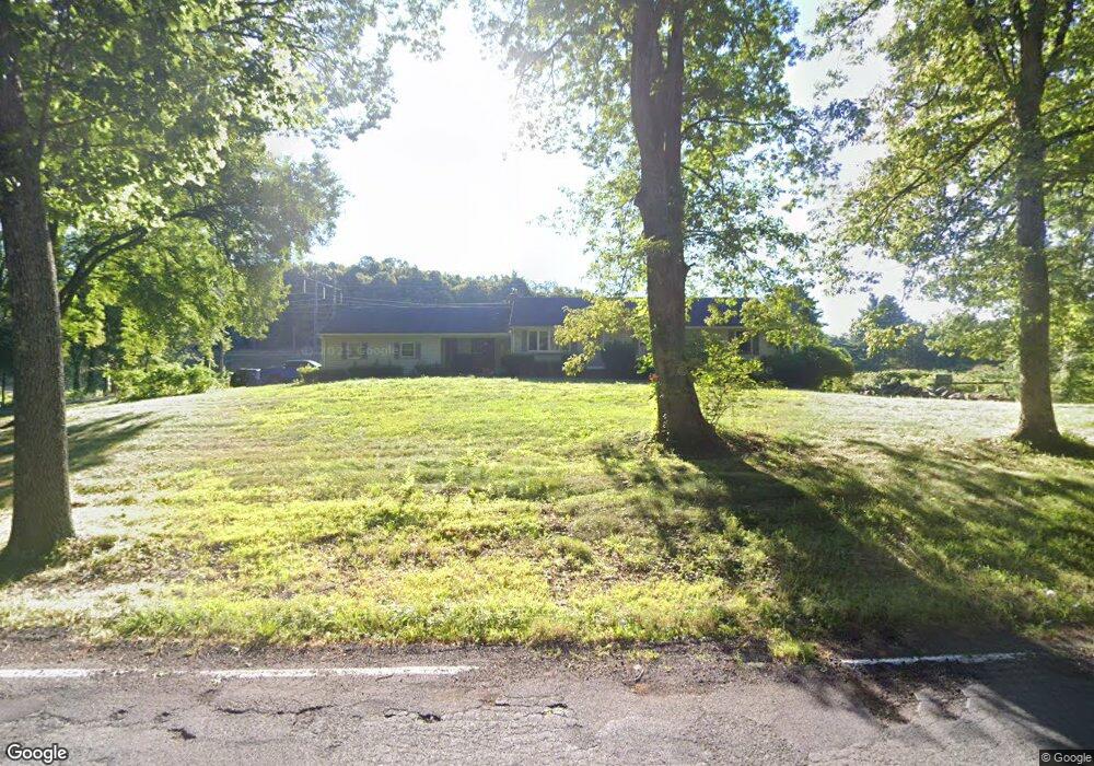
46 Bradley Rd Somers, CT 06071
Estimated Value: $422,447 - $554,000
3
Beds
3
Baths
1,680
Sq Ft
$280/Sq Ft
Est. Value
About This Home
This home is located at 46 Bradley Rd, Somers, CT 06071 and is currently estimated at $470,362, approximately $279 per square foot. 46 Bradley Rd is a home located in Tolland County with nearby schools including Somers Elementary School, Mabelle B. Avery Middle School, and Somers High School.
Ownership History
Date
Name
Owned For
Owner Type
Purchase Details
Closed on
Jun 27, 2002
Sold by
Jacques Marcel and Jacques Madeline
Bought by
Higgins Patrick
Current Estimated Value
Home Financials for this Owner
Home Financials are based on the most recent Mortgage that was taken out on this home.
Original Mortgage
$212,620
Interest Rate
6.92%
Purchase Details
Closed on
Dec 16, 1987
Sold by
Thorne Karen D
Bought by
Jacques Marcel
Create a Home Valuation Report for This Property
The Home Valuation Report is an in-depth analysis detailing your home's value as well as a comparison with similar homes in the area
Home Values in the Area
Average Home Value in this Area
Purchase History
| Date | Buyer | Sale Price | Title Company |
|---|---|---|---|
| Higgins Patrick | $249,000 | -- | |
| Higgins Patrick | $249,000 | -- | |
| Jacques Marcel | $190,000 | -- |
Source: Public Records
Mortgage History
| Date | Status | Borrower | Loan Amount |
|---|---|---|---|
| Open | Jacques Marcel | $200,300 | |
| Closed | Jacques Marcel | $211,000 | |
| Closed | Jacques Marcel | $212,620 |
Source: Public Records
Tax History Compared to Growth
Tax History
| Year | Tax Paid | Tax Assessment Tax Assessment Total Assessment is a certain percentage of the fair market value that is determined by local assessors to be the total taxable value of land and additions on the property. | Land | Improvement |
|---|---|---|---|---|
| 2025 | $5,223 | $172,900 | $66,800 | $106,100 |
| 2024 | $5,007 | $172,900 | $66,800 | $106,100 |
| 2023 | $4,895 | $172,900 | $66,800 | $106,100 |
| 2022 | $4,765 | $172,900 | $66,800 | $106,100 |
| 2021 | $4,610 | $172,900 | $66,800 | $106,100 |
| 2020 | $4,639 | $169,500 | $57,600 | $111,900 |
| 2019 | $4,456 | $162,800 | $62,800 | $100,000 |
| 2018 | $4,456 | $162,800 | $62,800 | $100,000 |
| 2017 | $4,147 | $162,800 | $62,800 | $100,000 |
| 2016 | $3,943 | $162,800 | $62,800 | $100,000 |
| 2015 | $4,129 | $176,700 | $68,200 | $108,500 |
| 2014 | $4,129 | $176,700 | $68,200 | $108,500 |
Source: Public Records
Map
Nearby Homes
- 23 Hampden Rd
- 144 Watchaug Rd
- 49 Stafford Rd
- 200 Hampden Rd
- 175 Stafford Rd
- 169 Stafford Rd
- 63 Rose Haven Rd
- 64 Potash Hill Ln
- 190 Root Rd
- 41 Martin Farms Rd
- 557 Hall Hill Rd
- 50 Martin Farms Rd
- 49 Bridle Path Dr
- 64 Bradfield Dr
- 603 Hall Hill Rd
- 12 & 16 Haas Rd
- 17 Long Hill Dr
- 21 Old Orchard Rd
- 35 Therese Dr
- 49 Franklin Woods Dr
- 31 Bradley Rd
- 28 Bradley Rd
- 45 Bradley Rd
- 593 Springfield Rd
- 560 Springfield Rd
- 599 Springfield Rd
- 552 Springfield Rd
- 35 Bradley Rd
- 553 Springfield Rd
- 21 Bradley Rd
- 88 King Rd
- 7 Hampden Rd
- 543 Springfield Rd
- 608 Springfield Rd
- 100 King Rd
- 18 Bradley Rd
- 39 Hampden Rd
- 45 Hampden Rd
- 22 Hampden Rd
- 12 Hampden Rd