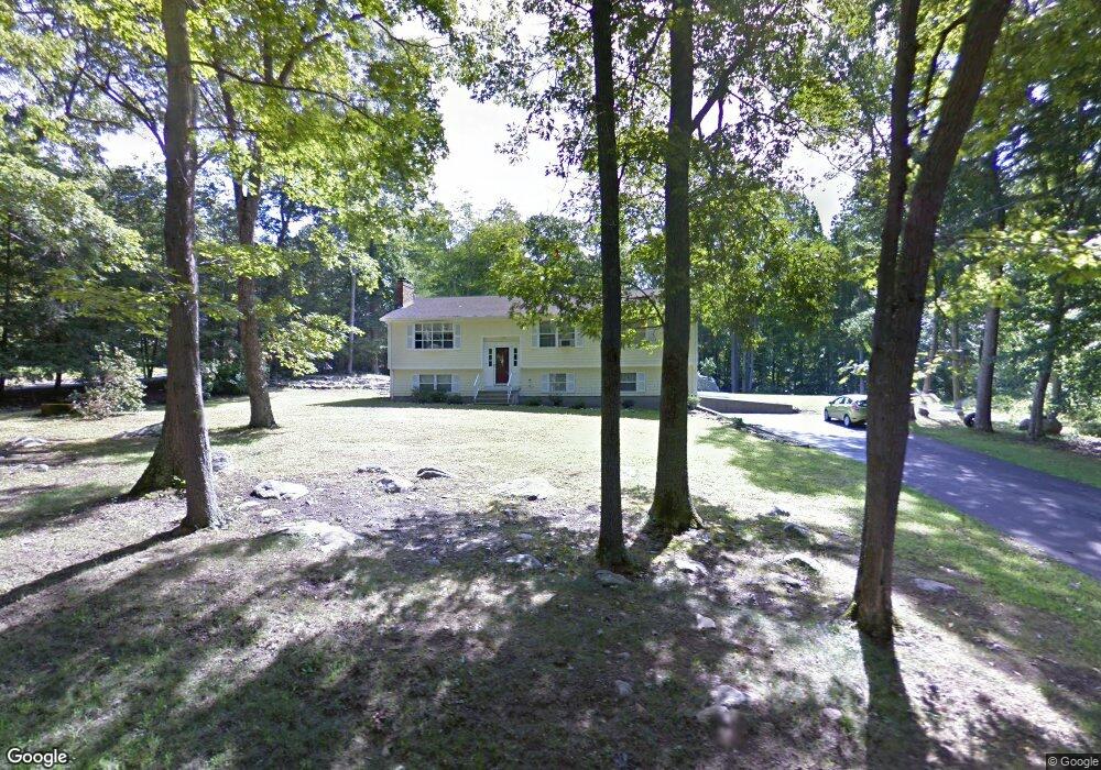
46 Brainard Rd Niantic, CT 06357
Estimated Value: $255,000 - $541,000
3
Beds
3
Baths
1,346
Sq Ft
$331/Sq Ft
Est. Value
About This Home
This home is located at 46 Brainard Rd, Niantic, CT 06357 and is currently estimated at $445,273, approximately $330 per square foot. 46 Brainard Rd is a home located in New London County with nearby schools including East Lyme Middle School, East Lyme High School, and The Light House Voc-Ed Center.
Ownership History
Date
Name
Owned For
Owner Type
Purchase Details
Closed on
Mar 26, 2025
Sold by
Roderick M Cornish T M and Roderick Cornish
Bought by
Abarca Nelly G
Current Estimated Value
Purchase Details
Closed on
Nov 14, 2013
Sold by
Terracciano Family Lp
Bought by
Abarca-Torres Yolanda P
Purchase Details
Closed on
Sep 10, 2001
Sold by
Toolen Vince A
Bought by
Abarca Nelly G
Home Financials for this Owner
Home Financials are based on the most recent Mortgage that was taken out on this home.
Original Mortgage
$176,832
Interest Rate
7.05%
Mortgage Type
Purchase Money Mortgage
Purchase Details
Closed on
Jun 24, 1994
Sold by
Raven Helene C
Bought by
Toolen Vince A
Create a Home Valuation Report for This Property
The Home Valuation Report is an in-depth analysis detailing your home's value as well as a comparison with similar homes in the area
Home Values in the Area
Average Home Value in this Area
Purchase History
| Date | Buyer | Sale Price | Title Company |
|---|---|---|---|
| Abarca Nelly G | $225,000 | None Available | |
| Abarca-Torres Yolanda P | $225,000 | -- | |
| Abarca Nelly G | $235,777 | -- | |
| Toolen Vince A | $62,500 | -- | |
| Abarca-Torres Yolanda P | $225,000 | -- | |
| Abarca Nelly G | $235,777 | -- | |
| Toolen Vince A | $62,500 | -- |
Source: Public Records
Mortgage History
| Date | Status | Borrower | Loan Amount |
|---|---|---|---|
| Previous Owner | Toolen Vince A | $215,000 | |
| Previous Owner | Toolen Vince A | $176,832 |
Source: Public Records
Tax History
| Year | Tax Paid | Tax Assessment Tax Assessment Total Assessment is a certain percentage of the fair market value that is determined by local assessors to be the total taxable value of land and additions on the property. | Land | Improvement |
|---|---|---|---|---|
| 2025 | $6,429 | $229,530 | $105,560 | $123,970 |
| 2024 | $6,048 | $229,530 | $105,560 | $123,970 |
| 2023 | $5,711 | $229,530 | $105,560 | $123,970 |
| 2022 | $5,472 | $229,530 | $105,560 | $123,970 |
| 2021 | $5,628 | $197,400 | $105,560 | $91,840 |
| 2020 | $5,634 | $198,660 | $105,560 | $93,100 |
| 2019 | $5,600 | $198,660 | $105,560 | $93,100 |
| 2018 | $5,433 | $198,660 | $105,560 | $93,100 |
| 2017 | $5,197 | $198,660 | $105,560 | $93,100 |
| 2016 | $4,974 | $196,140 | $105,560 | $90,580 |
| 2015 | $4,847 | $196,140 | $105,560 | $90,580 |
| 2014 | $4,713 | $196,140 | $105,560 | $90,580 |
Source: Public Records
Map
Nearby Homes
- 19 Sapia Dr
- 12 Spinnaker Dr
- 31 Regatta Dr
- 15 Griswold Rd
- 127 Black Point Rd Unit 7
- 26 Mohawk Dr
- 36 Attawan Rd
- 55 Corey Ln
- 97 W Main St Unit 36
- 42 S Washington Ave
- 61 Whitecap Rd
- 43 Roxbury Ct
- 47 Village Crossing Unit 47
- 46 Village Crossing Unit 46
- 43 Village Crossing Unit 43
- 468 Main St Unit 318
- 15 Freedom Way Unit 105
- 15 Freedom Way Unit 92
- 22 Riverdale Landing
- 37 Stoneywood Dr
Your Personal Tour Guide
Ask me questions while you tour the home.