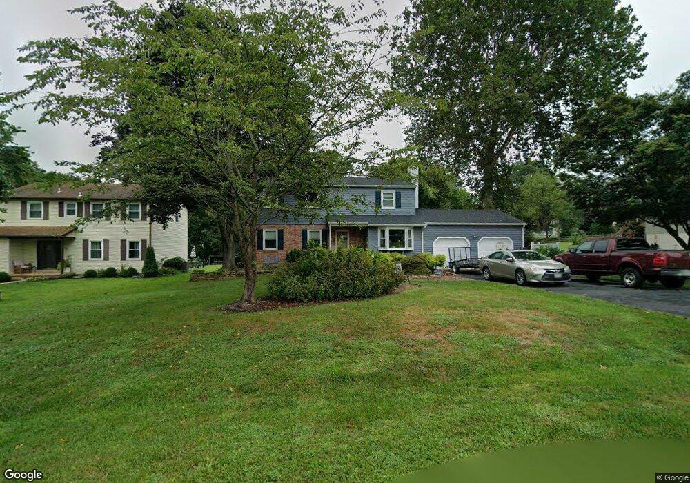
46 Cambridge Rd Elkton, MD 21921
Estimated Value: $394,255 - $456,000
Studio
3
Baths
1,732
Sq Ft
$249/Sq Ft
Est. Value
About This Home
This home is located at 46 Cambridge Rd, Elkton, MD 21921 and is currently estimated at $430,564, approximately $248 per square foot. 46 Cambridge Rd is a home located in Cecil County with nearby schools including Kenmore Elementary School, Cherry Hill Middle School, and Rising Sun High School.
Ownership History
Date
Name
Owned For
Owner Type
Purchase Details
Closed on
May 28, 2004
Sold by
Rogers Amy M
Bought by
Kohan Amy M
Current Estimated Value
Purchase Details
Closed on
Mar 30, 2001
Sold by
Rogers Gregory S and Rogers Amy M
Bought by
Rogers Amy M
Purchase Details
Closed on
Jul 25, 1998
Sold by
Serianni Gary and Serianni Barbara
Bought by
Rogers Gregory S and Rogers Amy M
Purchase Details
Closed on
Aug 31, 1994
Sold by
Brown
Bought by
Serianni Gary
Home Financials for this Owner
Home Financials are based on the most recent Mortgage that was taken out on this home.
Original Mortgage
$122,400
Interest Rate
8.44%
Create a Home Valuation Report for This Property
The Home Valuation Report is an in-depth analysis detailing your home's value as well as a comparison with similar homes in the area
Purchase History
| Date | Buyer | Sale Price | Title Company |
|---|---|---|---|
| Kohan Amy M | -- | -- | |
| Rogers Amy M | -- | -- | |
| Rogers Gregory S | $139,000 | -- | |
| Serianni Gary | $136,000 | -- |
Source: Public Records
Mortgage History
| Date | Status | Borrower | Loan Amount |
|---|---|---|---|
| Previous Owner | Serianni Gary | $122,400 | |
| Closed | Rogers Gregory S | -- |
Source: Public Records
Tax History
| Year | Tax Paid | Tax Assessment Tax Assessment Total Assessment is a certain percentage of the fair market value that is determined by local assessors to be the total taxable value of land and additions on the property. | Land | Improvement |
|---|---|---|---|---|
| 2025 | $3,331 | $298,900 | $78,500 | $220,400 |
| 2024 | $2,847 | $289,400 | $0 | $0 |
| 2023 | $2,451 | $279,900 | $0 | $0 |
| 2022 | $3,106 | $270,400 | $78,500 | $191,900 |
| 2021 | $3,043 | $261,800 | $0 | $0 |
| 2020 | $2,980 | $253,200 | $0 | $0 |
| 2019 | $2,881 | $244,600 | $78,500 | $166,100 |
| 2018 | $2,799 | $237,467 | $0 | $0 |
| 2017 | $2,717 | $230,333 | $0 | $0 |
| 2016 | $2,454 | $223,200 | $0 | $0 |
| 2015 | $2,454 | $217,067 | $0 | $0 |
| 2014 | $2,146 | $210,933 | $0 | $0 |
Source: Public Records
Map
Nearby Homes
- 7 Elk Valley Ln
- 672 Training Center Dr
- 60 Chase Cir
- 0 Singerly Rd
- 192 Rock Church Rd
- 2100 Singerly Rd
- 2440 Blue Ball Rd
- 84 Edgewood Dr N
- 990 Chesterville Rd
- 54 Oakridge Ct
- 3160 Telegraph Rd
- 11 Buttercup Cir
- 28 Buttercup Cir
- 30 E Rosemont Cir
- 406 Leahy Dr
- 402 Leahy Dr
- 70 Willow Ct
- 507 Leahy Dr
- 405 Leahy Dr
- 224 Blake Rd
- 52 Cambridge Rd
- 40 Cambridge Rd
- 34 Cambridge Rd
- 55 Sandhurst Ln
- 43 Cambridge Rd
- 37 Cambridge Rd
- 66 Cambridge Rd
- 26 Cambridge Rd
- 51 Sandhurst Ln
- 35 Silchester Ct
- 25 Silchester Ct
- 29 Cambridge Rd
- 65 Cambridge Rd
- 76 Cambridge Rd
- 24 Sandhurst Ln
- 45 Silchester Ct
- 95 Silchester Dr
- 47 Sandhurst Ln
- 103 Silchester Dr
- 75 Silchester Dr
Your Personal Tour Guide
Ask me questions while you tour the home.