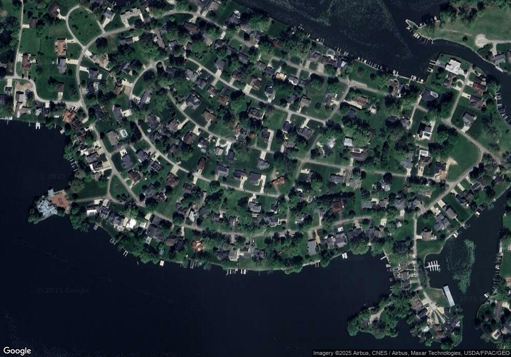
46 Cornell Rd Hebron, OH 43025
Estimated Value: $460,260 - $614,000
3
Beds
2
Baths
1,770
Sq Ft
$304/Sq Ft
Est. Value
About This Home
This home is located at 46 Cornell Rd, Hebron, OH 43025 and is currently estimated at $537,315, approximately $303 per square foot. 46 Cornell Rd is a home with nearby schools including Jackson Intermediate School, Lakewood Middle School, and Lakewood High School.
Ownership History
Date
Name
Owned For
Owner Type
Purchase Details
Closed on
Sep 10, 2019
Sold by
Sponhaltz Zachary P
Bought by
Taylor Gary and Taylor Linda
Current Estimated Value
Purchase Details
Closed on
Oct 9, 2018
Sold by
Sponhaltz Rex A
Bought by
Sponhaltz Zachary P and The Sponhaltz Preservation Trust
Purchase Details
Closed on
May 30, 2018
Sold by
Goodall Edward T and Goodall Kathleen
Bought by
Sponhaltz Rex A
Create a Home Valuation Report for This Property
The Home Valuation Report is an in-depth analysis detailing your home's value as well as a comparison with similar homes in the area
Home Values in the Area
Average Home Value in this Area
Purchase History
| Date | Buyer | Sale Price | Title Company |
|---|---|---|---|
| Taylor Gary | $45,000 | Chicago Title | |
| Sponhaltz Zachary P | -- | None Available | |
| Sponhaltz Rex A | $37,500 | First Ohio Title Insurance |
Source: Public Records
Mortgage History
| Date | Status | Borrower | Loan Amount |
|---|---|---|---|
| Previous Owner | Taylor Gary | $150,000 |
Source: Public Records
Tax History Compared to Growth
Tax History
| Year | Tax Paid | Tax Assessment Tax Assessment Total Assessment is a certain percentage of the fair market value that is determined by local assessors to be the total taxable value of land and additions on the property. | Land | Improvement |
|---|---|---|---|---|
| 2024 | $5,130 | $136,570 | $32,760 | $103,810 |
| 2023 | $5,146 | $136,570 | $32,760 | $103,810 |
| 2022 | $5,099 | $116,630 | $15,370 | $101,260 |
| 2021 | $2,925 | $63,320 | $15,370 | $47,950 |
| 2020 | $336 | $7,280 | $7,280 | $0 |
| 2019 | $275 | $5,600 | $5,600 | $0 |
| 2018 | $278 | $0 | $0 | $0 |
| 2017 | $263 | $0 | $0 | $0 |
| 2016 | $263 | $0 | $0 | $0 |
| 2015 | $247 | $0 | $0 | $0 |
| 2014 | -- | $0 | $0 | $0 |
| 2013 | $244 | $0 | $0 | $0 |
Source: Public Records
Map
Nearby Homes
- 22 Barton Place
- 149 Amherst Dr
- 206 Freeman Memorial Dr
- 955 Lakeshore Dr E
- 4455 Hunts Landing Rd Unit 8
- 4401 Hunts Landing Rd Unit 202
- 4401 Hunts Landing Rd Unit 304
- 4401 Hunts Landing Rd Unit 204
- 459 Lakeshore Dr E
- 541 Lakeshore Dr E
- 610 Newport Ln
- 613 Newport Ln
- 615 Newport Ln
- 28 Bay View Dr
- 142 Narragansett Dr
- 112 Narragansett Dr
- 11290 Honey Creek Rd
- 10726 Columbus Ave
- 10800 Honey Creek Rd
- 11918 Township Road 406
- 62 Cornell Rd
- 195 Wilshire Dr
- 227 Wilshire Dr
- 70 Cornell Rd
- 25 Hillcrest Dr
- 257 Wilshire Dr
- 335 Wilshire Dr
- 317-319 Wilshire Dr
- 286 Lakeshore Dr W
- 226 Wilshire Dr
- 246 Wilshire Dr
- 306 Lakeshore Dr W
- 258 Lakeshore Dr W
- 256 Wilshire Dr
- 102 Cornell Rd
- 271 Wilshire Dr
- 326 Lakeshore Dr W
- 206 Wilshire Dr
- 97 Wilshire Dr
- 276 Wilshire Dr
