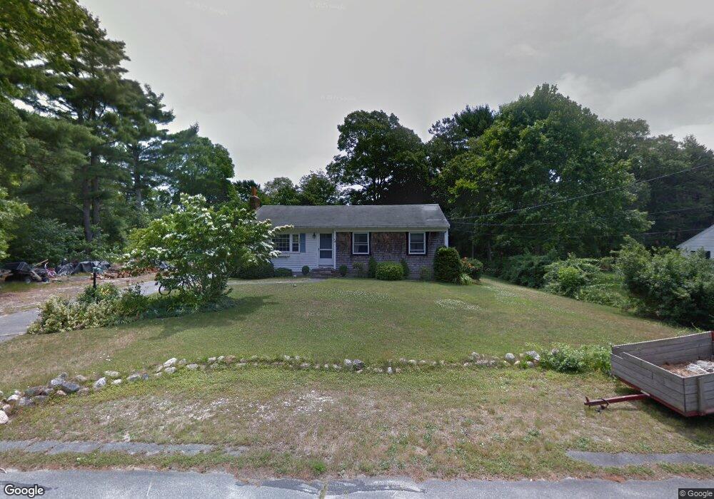
46 Donegal Cir Centerville, MA 02632
Centerville NeighborhoodEstimated Value: $547,000 - $591,000
3
Beds
1
Bath
1,001
Sq Ft
$562/Sq Ft
Est. Value
About This Home
This home is located at 46 Donegal Cir, Centerville, MA 02632 and is currently estimated at $562,343, approximately $561 per square foot. 46 Donegal Cir is a home located in Barnstable County with nearby schools including West Villages Elementary School, Barnstable United Elementary School, and Barnstable Intermediate School.
Ownership History
Date
Name
Owned For
Owner Type
Purchase Details
Closed on
Jul 31, 2025
Sold by
Montcalm Christopher L and Montcalm Ann M
Bought by
Montcalm Christopher L and Montcalm Ann M
Current Estimated Value
Home Financials for this Owner
Home Financials are based on the most recent Mortgage that was taken out on this home.
Original Mortgage
$371,000
Outstanding Balance
$370,040
Interest Rate
6.77%
Mortgage Type
New Conventional
Estimated Equity
$192,303
Purchase Details
Closed on
Sep 1, 2000
Sold by
Wynne Anne F
Bought by
Montcalm Christopher L and Montcalm Ann Marie
Home Financials for this Owner
Home Financials are based on the most recent Mortgage that was taken out on this home.
Original Mortgage
$139,847
Interest Rate
8.16%
Mortgage Type
Purchase Money Mortgage
Purchase Details
Closed on
May 13, 1993
Sold by
Sweetnam Richard W
Bought by
Wynne Anne F
Create a Home Valuation Report for This Property
The Home Valuation Report is an in-depth analysis detailing your home's value as well as a comparison with similar homes in the area
Home Values in the Area
Average Home Value in this Area
Purchase History
| Date | Buyer | Sale Price | Title Company |
|---|---|---|---|
| Montcalm Christopher L | -- | -- | |
| Montcalm Christopher L | -- | -- | |
| Montcalm Christopher L | $141,500 | -- | |
| Montcalm Christopher L | $141,500 | -- | |
| Wynne Anne F | $48,000 | -- | |
| Wynne Anne F | $48,000 | -- |
Source: Public Records
Mortgage History
| Date | Status | Borrower | Loan Amount |
|---|---|---|---|
| Open | Montcalm Christopher L | $371,000 | |
| Closed | Montcalm Christopher L | $371,000 | |
| Previous Owner | Wynne Anne F | $143,000 | |
| Previous Owner | Wynne Anne F | $139,847 |
Source: Public Records
Tax History
| Year | Tax Paid | Tax Assessment Tax Assessment Total Assessment is a certain percentage of the fair market value that is determined by local assessors to be the total taxable value of land and additions on the property. | Land | Improvement |
|---|---|---|---|---|
| 2025 | $3,577 | $442,100 | $152,600 | $289,500 |
| 2024 | $3,432 | $439,400 | $152,600 | $286,800 |
| 2023 | $3,234 | $387,800 | $138,700 | $249,100 |
| 2022 | $3,054 | $316,800 | $102,700 | $214,100 |
| 2021 | $2,911 | $277,500 | $102,700 | $174,800 |
| 2020 | $2,986 | $272,400 | $102,700 | $169,700 |
| 2019 | $2,854 | $253,000 | $102,700 | $150,300 |
| 2018 | $2,612 | $232,800 | $108,200 | $124,600 |
| 2017 | $2,441 | $226,900 | $108,200 | $118,700 |
| 2016 | $2,482 | $227,700 | $109,000 | $118,700 |
| 2015 | $2,413 | $222,400 | $105,700 | $116,700 |
Source: Public Records
Map
Nearby Homes
- 200 Lumbert Mill Rd
- 51 Larch Ln
- 315 Prince Hinckley Rd
- 7 Ebenezer
- 296 Buckskin Path
- 53 Meadow Farm Rd
- 52 Meadow Farm Rd
- 87 Foxglove Rd
- 103 Pine Tree Dr
- 900 Old Stage Rd
- 82 Yacht Club Rd
- 1028 Old Falmouth Rd
- 351 Swift Ave
- 369 Bumps River Rd
- 19 Marrick Ct
- 62 Three Ponds Dr
- 66 Tern Ln
- 12 S Cedar Rd
- 89 Swift Ave
- 80 Branch Terrace
Your Personal Tour Guide
Ask me questions while you tour the home.