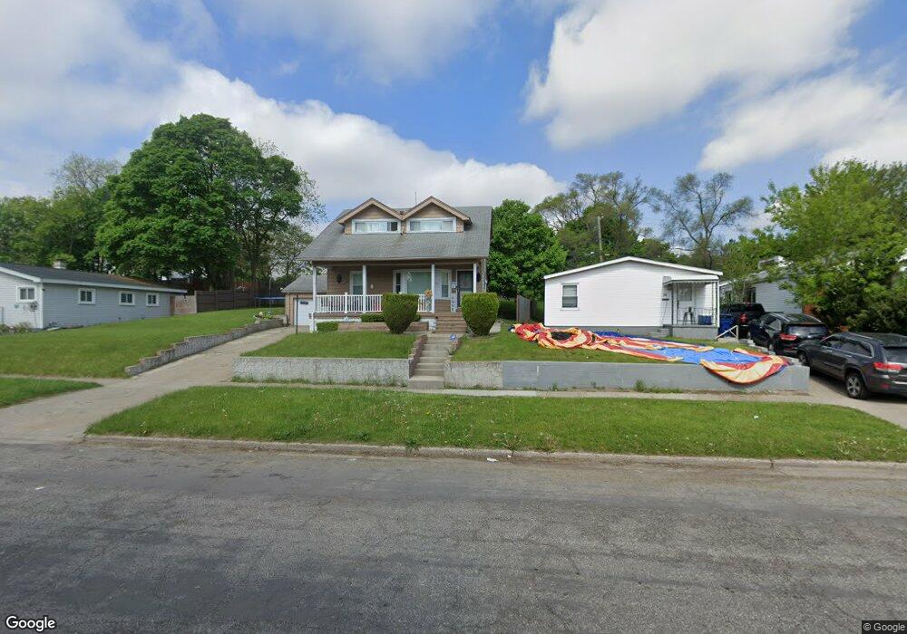
46 Earlmoor Blvd Pontiac, MI 48341
Estimated Value: $95,195 - $145,000
3
Beds
1
Bath
1,158
Sq Ft
$108/Sq Ft
Est. Value
About This Home
This home is located at 46 Earlmoor Blvd, Pontiac, MI 48341 and is currently estimated at $124,799, approximately $107 per square foot. 46 Earlmoor Blvd is a home located in Oakland County with nearby schools including Walt Whitman Elementary School, Pontiac Middle School, and Pontiac High School.
Ownership History
Date
Name
Owned For
Owner Type
Purchase Details
Closed on
Mar 20, 2012
Sold by
Oakland County Treasurer
Bought by
Perez Efrain
Current Estimated Value
Purchase Details
Closed on
Jan 24, 1997
Sold by
Lance Andrew
Bought by
Perez Efrain
Home Financials for this Owner
Home Financials are based on the most recent Mortgage that was taken out on this home.
Original Mortgage
$51,612
Interest Rate
7.81%
Purchase Details
Closed on
Apr 5, 1996
Sold by
Shulman Judith B
Bought by
Perez Efrain
Create a Home Valuation Report for This Property
The Home Valuation Report is an in-depth analysis detailing your home's value as well as a comparison with similar homes in the area
Home Values in the Area
Average Home Value in this Area
Purchase History
| Date | Buyer | Sale Price | Title Company |
|---|---|---|---|
| Perez Efrain | $345 | None Available | |
| Perez Efrain | $51,400 | -- | |
| Perez Efrain | $23,000 | -- |
Source: Public Records
Mortgage History
| Date | Status | Borrower | Loan Amount |
|---|---|---|---|
| Previous Owner | Perez Efrain | $51,612 |
Source: Public Records
Tax History Compared to Growth
Tax History
| Year | Tax Paid | Tax Assessment Tax Assessment Total Assessment is a certain percentage of the fair market value that is determined by local assessors to be the total taxable value of land and additions on the property. | Land | Improvement |
|---|---|---|---|---|
| 2024 | $741 | $29,490 | $0 | $0 |
| 2023 | $706 | $25,610 | $0 | $0 |
| 2022 | $744 | $21,810 | $0 | $0 |
| 2021 | $723 | $19,050 | $0 | $0 |
| 2020 | $642 | $16,910 | $0 | $0 |
| 2019 | $692 | $14,790 | $0 | $0 |
| 2018 | $660 | $13,810 | $0 | $0 |
| 2017 | $635 | $13,650 | $0 | $0 |
| 2016 | $662 | $13,190 | $0 | $0 |
| 2015 | -- | $12,110 | $0 | $0 |
| 2014 | -- | $10,700 | $0 | $0 |
| 2011 | -- | $19,320 | $0 | $0 |
Source: Public Records
Map
Nearby Homes
- 200 Cedardale Ave
- 371 Nebraska Ave
- 151 South Blvd W
- 209 Ferry Ave
- 323 Ferry Ave
- 567 Highland Ave
- 472 S Jessie St
- 466 Colorado Ave
- 583 Going St
- 472 Wyoming Ave
- 587 California Ave
- 455 Irwin Ave
- 200 Astorwood St
- 200 Crystal Lake Dr
- 485 Colorado Ave
- 305 South Blvd W
- 317 Prospect St
- 598 Montana Ave
- 228 Hughes Ave
- 232 Hughes Ave
- 50 Earlmoor Blvd
- 54 Earlmoor Blvd
- 32 Pleasantview Dr
- 32 Earlmoor Blvd
- 36 Pleasantview Dr
- 30 Earlmoor Blvd
- 23 Hillsmont Ave
- 27 Hillsmont Ave
- 40 Pleasantview Dr
- 66 Earlmoor Blvd
- 35 Pleasantview Dr
- 45 Earlmoor Blvd
- 35 Hillsmont Ave
- 41 Earlmoor Blvd
- 55 Earlmoor Blvd
- 44 Pleasantview Dr
- 39 Pleasantview Dr
- 45 Pleasantview Dr
- 20 Earlmoor Blvd
- 33 Earlmoor Blvd