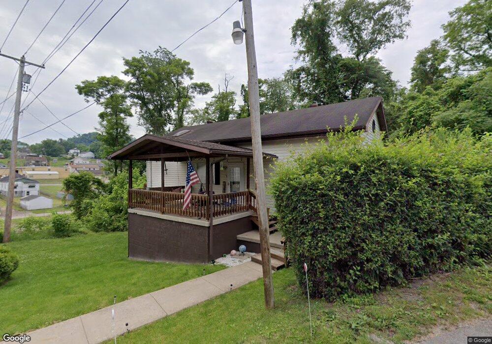
46 Flint St Clarksburg, WV 26301
Estimated Value: $124,649 - $184,000
3
Beds
2
Baths
1,900
Sq Ft
$79/Sq Ft
Est. Value
About This Home
This home is located at 46 Flint St, Clarksburg, WV 26301 and is currently estimated at $150,662, approximately $79 per square foot. 46 Flint St is a home located in Harrison County with nearby schools including St. Mary's Grade School, Mother Goose Land Kindergarten, and Emmanuel Christian School.
Ownership History
Date
Name
Owned For
Owner Type
Purchase Details
Closed on
Sep 2, 2022
Sold by
Robinson Chester P
Bought by
Wilson Logan W
Current Estimated Value
Home Financials for this Owner
Home Financials are based on the most recent Mortgage that was taken out on this home.
Original Mortgage
$107,730
Outstanding Balance
$103,020
Interest Rate
5.54%
Mortgage Type
New Conventional
Estimated Equity
$47,642
Purchase Details
Closed on
Sep 20, 2018
Sold by
Cosgary Robert L
Bought by
Robinson Chester P
Home Financials for this Owner
Home Financials are based on the most recent Mortgage that was taken out on this home.
Original Mortgage
$77,676
Interest Rate
4.5%
Mortgage Type
New Conventional
Purchase Details
Closed on
Oct 10, 2012
Sold by
Federal Home Loan Mortgage Corporation
Bought by
Citimortgage Inc
Create a Home Valuation Report for This Property
The Home Valuation Report is an in-depth analysis detailing your home's value as well as a comparison with similar homes in the area
Home Values in the Area
Average Home Value in this Area
Purchase History
| Date | Buyer | Sale Price | Title Company |
|---|---|---|---|
| Wilson Logan W | $113,400 | None Listed On Document | |
| Robinson Chester P | $74,000 | None Available | |
| Citimortgage Inc | -- | None Available |
Source: Public Records
Mortgage History
| Date | Status | Borrower | Loan Amount |
|---|---|---|---|
| Open | Wilson Logan W | $107,730 | |
| Closed | Wilson Logan W | $6,500 | |
| Previous Owner | Robinson Chester P | $77,676 |
Source: Public Records
Tax History Compared to Growth
Tax History
| Year | Tax Paid | Tax Assessment Tax Assessment Total Assessment is a certain percentage of the fair market value that is determined by local assessors to be the total taxable value of land and additions on the property. | Land | Improvement |
|---|---|---|---|---|
| 2025 | $374 | $32,100 | $3,060 | $29,040 |
| 2024 | $374 | $29,880 | $3,060 | $26,820 |
| 2023 | $343 | $27,720 | $3,060 | $24,660 |
| 2022 | $324 | $27,480 | $3,060 | $24,420 |
| 2021 | $316 | $27,120 | $3,060 | $24,060 |
| 2020 | $309 | $26,820 | $3,060 | $23,760 |
| 2019 | $500 | $21,660 | $3,060 | $18,600 |
| 2018 | $475 | $20,700 | $2,340 | $18,360 |
| 2017 | $465 | $20,340 | $2,340 | $18,000 |
| 2016 | $436 | $19,320 | $1,680 | $17,640 |
| 2015 | $429 | $18,900 | $1,680 | $17,220 |
| 2014 | $423 | $18,660 | $1,680 | $16,980 |
Source: Public Records
Map
Nearby Homes
- 100 Factory St
- 376 Simpson St
- 69 Celtic Dr
- 122 Kelly St
- 109 Brown St
- 120 Brown St
- 1108 Nutter St
- 615 E Main St
- 410 E Main St
- 503 E Main St
- 340 Buckhannon Ave
- 324 Fowler Ave
- 309 Spring Ave
- 148 Jackson Ave
- TBD Jack Run Rd
- 159 E Main St
- 308 Point St
- 243 1/2 S Maple Ave
- 315 S Monticello Ave
- 0 Jack Run Rd
- 986 Summit Park Ave
- 10 Factory St
- 1001 Factory St
- 46 Factory St
- 248 Simpson St
- 62 Factory St
- 227 Simpson St
- 793 Summit Park Ave
- 790 Summit Park Ave
- 67 Factory St
- 1016 1/2 Factory St
- 26 Summit Park Ave
- 75 Factory St
- 192 Simpson St
- 973 Summit Park Ave
- 89 Factory St
- 88 Bluewood Dr
- 277 Simpson St
- 637 Summit Park Ave
- 765 Summit Park Ave