Estimated Value: $805,981 - $926,000
3
Beds
2
Baths
1,358
Sq Ft
$637/Sq Ft
Est. Value
About This Home
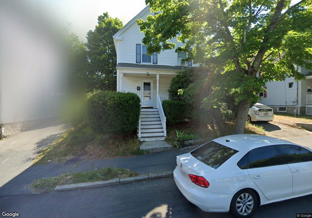
This home is located at 46 Hale St, Newton Upper Falls, MA 02464 and is currently estimated at $864,495, approximately $636 per square foot. 46 Hale St is a home located in Middlesex County with nearby schools including Countryside Elementary School, Charles E Brown Middle School, and Newton South High School.
Ownership History
Date
Name
Owned For
Owner Type
Purchase Details
Closed on
Oct 5, 2018
Sold by
Brandwein Russell J and Brandwein Mary S
Bought by
Russell J Brandwein T
Current Estimated Value
Purchase Details
Closed on
Jul 25, 1977
Bought by
Brandwein Russel J and Brandwein Mary Sue
Create a Home Valuation Report for This Property
The Home Valuation Report is an in-depth analysis detailing your home's value as well as a comparison with similar homes in the area
Home Values in the Area
Average Home Value in this Area
Purchase History
| Date | Buyer | Sale Price | Title Company |
|---|---|---|---|
| Russell J Brandwein T | -- | -- | |
| Brandwein Russel J | $32,000 | -- |
Source: Public Records
Mortgage History
| Date | Status | Borrower | Loan Amount |
|---|---|---|---|
| Previous Owner | Brandwein Russel J | $60,000 | |
| Previous Owner | Brandwein Russel J | $50,000 |
Source: Public Records
Tax History Compared to Growth
Tax History
| Year | Tax Paid | Tax Assessment Tax Assessment Total Assessment is a certain percentage of the fair market value that is determined by local assessors to be the total taxable value of land and additions on the property. | Land | Improvement |
|---|---|---|---|---|
| 2025 | $6,835 | $697,400 | $0 | $0 |
| 2024 | $6,608 | $0 | $0 | $0 |
| 2023 | $6,252 | $614,100 | $544,400 | $69,700 |
| 2022 | $5,982 | $568,600 | $504,100 | $64,500 |
| 2021 | $5,772 | $536,400 | $475,600 | $60,800 |
| 2020 | $5,600 | $536,400 | $475,600 | $60,800 |
| 2019 | $5,442 | $520,800 | $461,700 | $59,100 |
| 2018 | $5,140 | $475,000 | $416,500 | $58,500 |
| 2017 | $4,983 | $448,100 | $392,900 | $55,200 |
| 2016 | $4,766 | $418,800 | $367,200 | $51,600 |
| 2015 | $4,544 | $391,400 | $343,200 | $48,200 |
Source: Public Records
Map
Nearby Homes
- 20 Pennsylvania Ave
- 20 Pennsylvania Ave Unit 20
- 18-20 Pennsylvania Ave Unit 18
- 27 Indiana Terrace Unit 29
- 300 Elliot St Unit 300
- 54 Indiana Terrace
- 12 Shawmut Park
- 51 Pettee St Unit 11
- 45 River Ave Unit 45
- 66 Linden St
- 66 Rockland Place
- 1003 Chestnut St
- 102 Thurston Rd Unit 100
- 27 Hamilton Place
- 992 Chestnut St
- 103 Thurston Rd
- 989 Chestnut St Unit 8
- 1 Williams Ct
- 183 Oak St Unit 307
- 183 Oak St Unit 404