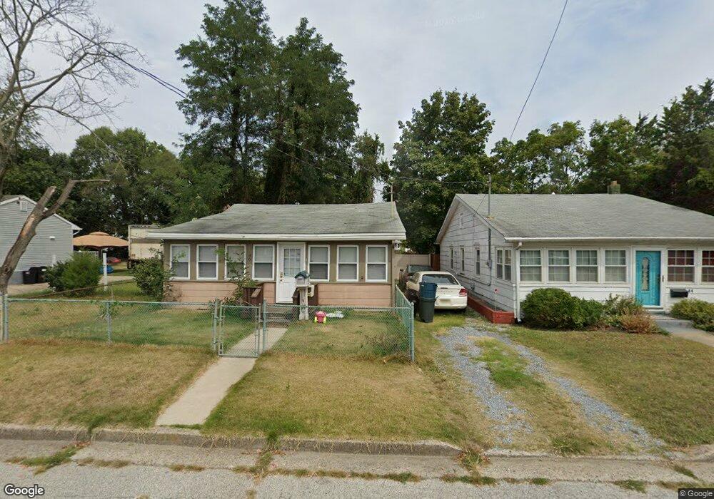
46 Harding Ave Pennsville, NJ 08070
Estimated Value: $184,000 - $220,000
3
Beds
1
Bath
864
Sq Ft
$227/Sq Ft
Est. Value
About This Home
This home is located at 46 Harding Ave, Pennsville, NJ 08070 and is currently estimated at $196,426, approximately $227 per square foot. 46 Harding Ave is a home located in Salem County with nearby schools including Valley Park Elementary School, Central Park Elementary School, and Penn Beach Elementary School.
Ownership History
Date
Name
Owned For
Owner Type
Purchase Details
Closed on
Nov 6, 2009
Sold by
Deutsche Bank National Trust Co
Bought by
Davenport Hank and Davenport Deborah
Current Estimated Value
Purchase Details
Closed on
Jun 30, 1999
Sold by
Ferrell Patricia W
Bought by
Mathison James A
Home Financials for this Owner
Home Financials are based on the most recent Mortgage that was taken out on this home.
Original Mortgage
$50,000
Interest Rate
7%
Mortgage Type
Seller Take Back
Create a Home Valuation Report for This Property
The Home Valuation Report is an in-depth analysis detailing your home's value as well as a comparison with similar homes in the area
Home Values in the Area
Average Home Value in this Area
Purchase History
| Date | Buyer | Sale Price | Title Company |
|---|---|---|---|
| Davenport Hank | $53,000 | -- | |
| Mathison James A | $50,000 | -- |
Source: Public Records
Mortgage History
| Date | Status | Borrower | Loan Amount |
|---|---|---|---|
| Previous Owner | Mathison James A | $50,000 |
Source: Public Records
Tax History Compared to Growth
Tax History
| Year | Tax Paid | Tax Assessment Tax Assessment Total Assessment is a certain percentage of the fair market value that is determined by local assessors to be the total taxable value of land and additions on the property. | Land | Improvement |
|---|---|---|---|---|
| 2025 | $4,272 | $83,800 | $40,800 | $43,000 |
| 2024 | $4,113 | $83,800 | $40,800 | $43,000 |
| 2023 | $4,113 | $83,800 | $40,800 | $43,000 |
| 2022 | $3,984 | $83,800 | $40,800 | $43,000 |
| 2021 | $3,874 | $83,800 | $40,800 | $43,000 |
| 2020 | $3,757 | $83,800 | $40,800 | $43,000 |
| 2019 | $3,571 | $83,800 | $40,800 | $43,000 |
| 2018 | $3,443 | $83,800 | $40,800 | $43,000 |
| 2017 | $3,321 | $83,800 | $40,800 | $43,000 |
| 2016 | $3,056 | $83,800 | $40,800 | $43,000 |
| 2015 | $2,916 | $83,800 | $40,800 | $43,000 |
| 2014 | $2,838 | $83,800 | $40,800 | $43,000 |
Source: Public Records
Map
Nearby Homes
- 37 Brandriff Ave
- 110 N River Dr
- 73 N Broadway
- 101 N Broadway
- 25 Oriental Ave
- 51 Marlyn Ave
- 24 W Pittsfield St
- 104 Queen Ave
- 0 S Broadway Unit NJSA2013398
- 4 S Broadway
- 176 N Broadway
- 32 S Broadway
- 67 Sparks Ave
- 60 E Pittsfield St
- 80 Union St
- 74 S Broadway
- 240 N Broadway
- Part of Lot 34 Heron Ave
- 93 River Drive Ave
- 20 Grace Ave
- 44 Harding Ave
- 50 Harding Ave
- 40 Harding Ave
- 39 Brandriff Ave
- 52 Harding Ave
- 41 Brandriff Ave
- 38 Harding Ave
- 43 Harding Ave
- 35 Brandriff Ave
- 49 Harding Ave
- 54 Harding Ave
- 41 Harding Ave
- 36 Harding Ave
- 33 Brandriff Ave
- 31 Brandriff Ave
- 53 Harding Ave
- 47 Brandriff Ave
- 34 Harding Ave
- 56 Harding Ave
- 40 Lakeview Ave