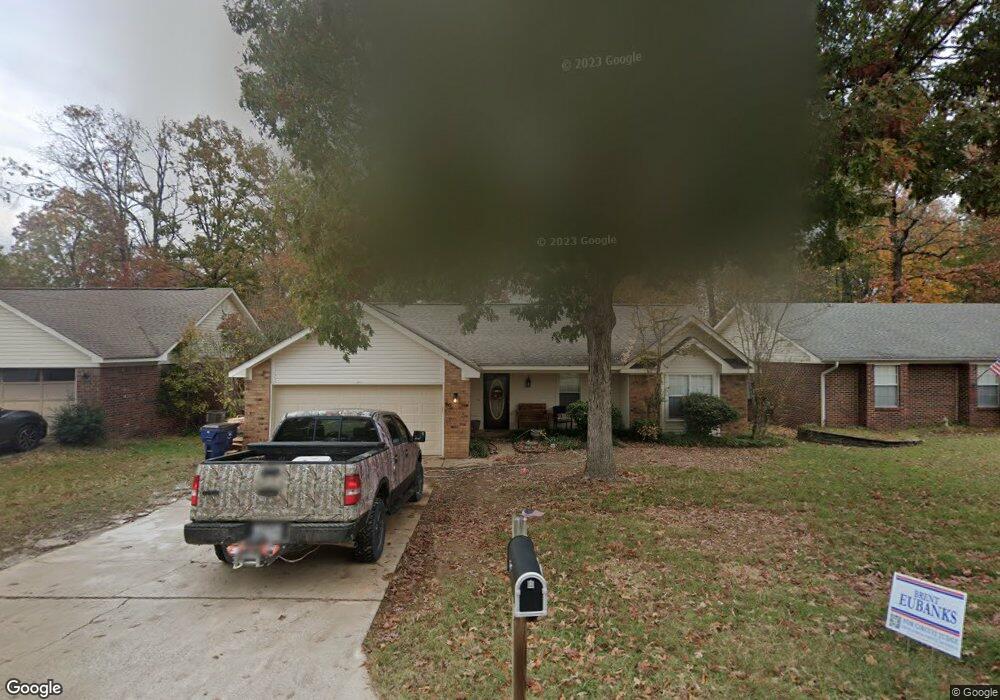
46 High Timber Dr Maumelle, AR 72113
Estimated Value: $198,000 - $222,355
Studio
2
Baths
1,426
Sq Ft
$150/Sq Ft
Est. Value
About This Home
This home is located at 46 High Timber Dr, Maumelle, AR 72113 and is currently estimated at $213,839, approximately $149 per square foot. 46 High Timber Dr is a home located in Pulaski County with nearby schools including Pine Forest Elementary School, Maumelle Middle School, and Maumelle High School.
Ownership History
Date
Name
Owned For
Owner Type
Purchase Details
Closed on
Jun 4, 2014
Sold by
Baker Rebekah Kathryn
Bought by
Baker Brian Scott
Current Estimated Value
Purchase Details
Closed on
Dec 16, 2009
Sold by
Hilton Tina G
Bought by
Baker Brian Scott and Baker Rebekah Kathryn
Home Financials for this Owner
Home Financials are based on the most recent Mortgage that was taken out on this home.
Original Mortgage
$98,188
Interest Rate
4.46%
Mortgage Type
FHA
Create a Home Valuation Report for This Property
The Home Valuation Report is an in-depth analysis detailing your home's value as well as a comparison with similar homes in the area
Home Values in the Area
Average Home Value in this Area
Purchase History
| Date | Buyer | Sale Price | Title Company |
|---|---|---|---|
| Baker Brian Scott | $15,000 | None Available | |
| Baker Brian Scott | $100,000 | Lenders Title Company |
Source: Public Records
Mortgage History
| Date | Status | Borrower | Loan Amount |
|---|---|---|---|
| Previous Owner | Baker Brian Scott | $98,188 |
Source: Public Records
Tax History
| Year | Tax Paid | Tax Assessment Tax Assessment Total Assessment is a certain percentage of the fair market value that is determined by local assessors to be the total taxable value of land and additions on the property. | Land | Improvement |
|---|---|---|---|---|
| 2025 | $1,767 | $34,618 | $5,800 | $28,818 |
| 2024 | $1,809 | $34,618 | $5,800 | $28,818 |
| 2023 | $1,809 | $34,618 | $5,800 | $28,818 |
| 2022 | $1,545 | $34,618 | $5,800 | $28,818 |
| 2021 | $1,644 | $26,140 | $5,600 | $20,540 |
| 2020 | $1,269 | $26,140 | $5,600 | $20,540 |
| 2019 | $1,269 | $26,140 | $5,600 | $20,540 |
| 2018 | $1,294 | $26,140 | $5,600 | $20,540 |
| 2017 | $1,294 | $26,140 | $5,600 | $20,540 |
| 2016 | $1,484 | $29,150 | $5,800 | $23,350 |
| 2015 | $1,796 | $29,150 | $5,800 | $23,350 |
| 2014 | $1,796 | $28,550 | $5,800 | $22,750 |
Source: Public Records
Map
Nearby Homes
- 78 Rolling Oaks Dr
- 40 Oak Ridge Dr
- 43 Oak Ridge Dr
- 16 Red Oak Place
- 10 Willow Oak Loop
- 37 Garden Oaks Dr
- 88 Oak Forest Loop
- 9 Pin Oak Loop
- 39 Pin Oak Loop
- 32 Kingspark Dr
- 0 Hwy 365 N Unit Tanning Rd South
- 58 Vantage Dr
- 5 Havenwood Ln
- 81 Meadow Ridge Loop
- 200 Pine Forest Dr
- 44 Meadow Ridge Loop
- 113 Shady Dr
- 14625 Stonebrook Ln
- 14415 Stonebrook Ln
- Lot 8 Ellia's Cove
- 44 High Timber Dr
- 48 High Timber Dr
- 42 High Timber Dr
- 7 High Timber Cove
- 0 High Timber Dr
- 6 High Timber Cove
- 45 High Timber Dr
- 43 High Timber Dr
- 47 High Timber Dr
- 82 Rolling Oaks Dr
- 5 High Timber Cove
- 41 High Timber Dr
- 30 High Timber Dr
- 49 High Timber Dr
- 80 Rolling Oaks Dr
- 4 High Timber Cove
- 39 High Timber Dr
- 28 High Timber Dr
- 16 High Timber Dr
- 60 Oak Ridge Dr
Your Personal Tour Guide
Ask me questions while you tour the home.