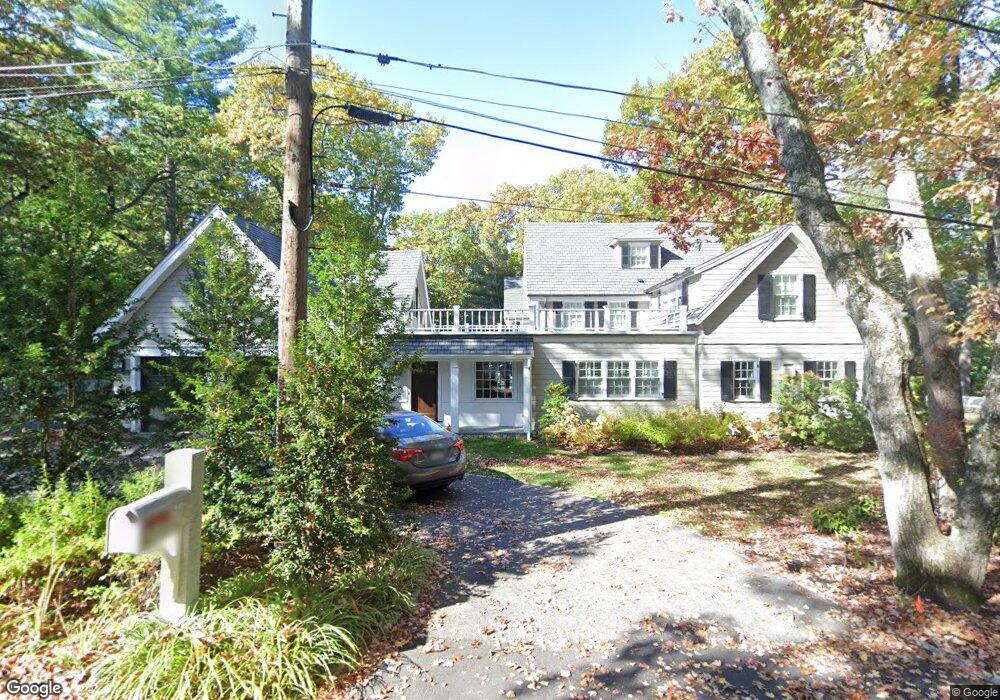
46 Hilltop Rd Weston, MA 02493
Estimated Value: $2,247,000 - $3,074,406
5
Beds
3
Baths
2,715
Sq Ft
$1,029/Sq Ft
Est. Value
About This Home
This home is located at 46 Hilltop Rd, Weston, MA 02493 and is currently estimated at $2,794,469, approximately $1,029 per square foot. 46 Hilltop Rd is a home located in Middlesex County with nearby schools including Country Elementary School, Woodland Elementary School, and Field Elementary School.
Ownership History
Date
Name
Owned For
Owner Type
Purchase Details
Closed on
Oct 22, 2010
Sold by
Snow Carol
Bought by
Yates-Mack Barrett E and Mack Timothy S
Current Estimated Value
Home Financials for this Owner
Home Financials are based on the most recent Mortgage that was taken out on this home.
Original Mortgage
$700,000
Outstanding Balance
$462,396
Interest Rate
4.37%
Mortgage Type
Purchase Money Mortgage
Estimated Equity
$2,332,073
Purchase Details
Closed on
Feb 14, 1992
Sold by
Britton Michael E and Britton Susan W
Bought by
Crane Carol S and Crane Thomas S
Home Financials for this Owner
Home Financials are based on the most recent Mortgage that was taken out on this home.
Original Mortgage
$140,000
Interest Rate
8.18%
Mortgage Type
Purchase Money Mortgage
Create a Home Valuation Report for This Property
The Home Valuation Report is an in-depth analysis detailing your home's value as well as a comparison with similar homes in the area
Home Values in the Area
Average Home Value in this Area
Purchase History
| Date | Buyer | Sale Price | Title Company |
|---|---|---|---|
| Yates-Mack Barrett E | $875,000 | -- | |
| Crane Carol S | $410,000 | -- |
Source: Public Records
Mortgage History
| Date | Status | Borrower | Loan Amount |
|---|---|---|---|
| Open | Crane Carol S | $100,000 | |
| Open | Yates-Mack Barrett E | $700,000 | |
| Previous Owner | Crane Carol S | $142,000 | |
| Previous Owner | Crane Carol S | $75,000 | |
| Previous Owner | Crane Carol S | $140,000 |
Source: Public Records
Tax History
| Year | Tax Paid | Tax Assessment Tax Assessment Total Assessment is a certain percentage of the fair market value that is determined by local assessors to be the total taxable value of land and additions on the property. | Land | Improvement |
|---|---|---|---|---|
| 2025 | $29,505 | $2,658,100 | $905,800 | $1,752,300 |
| 2024 | $28,686 | $2,579,700 | $905,800 | $1,673,900 |
| 2023 | $28,320 | $2,391,900 | $905,800 | $1,486,100 |
| 2022 | $27,326 | $2,133,200 | $853,400 | $1,279,800 |
| 2021 | $26,083 | $2,009,500 | $809,400 | $1,200,100 |
| 2020 | $0 | $1,938,900 | $809,400 | $1,129,500 |
| 2019 | $23,567 | $1,871,900 | $749,600 | $1,122,300 |
| 2018 | $0 | $1,871,900 | $749,600 | $1,122,300 |
| 2017 | $23,212 | $1,871,900 | $749,600 | $1,122,300 |
| 2016 | $22,762 | $1,871,900 | $749,600 | $1,122,300 |
| 2015 | $11,091 | $903,200 | $713,900 | $189,300 |
Source: Public Records
Map
Nearby Homes
- 81 Montvale Rd
- 173 Conant Rd
- 183 Conant Rd
- 11 Hillcrest Rd
- 40 Bakers Hill Rd
- 30 Warren Ave
- 8 Hidden Rd
- 55 Forest Ridge Rd
- 131 Wellesley St
- 133 Wellesley St
- 135 Wellesley St
- 35 Bemis St
- 226 Ash St
- 59 Bradyll Rd
- 100 Bradford Rd
- 76 Robin Rd
- 14 Westland Rd
- 741 Boston Post Rd
- 180 Ash St
- 1 Pine Summit Cir
- 45 Hilltop Rd
- 44 Hilltop Rd
- 38 Hilltop Rd
- 42 Hilltop Rd
- 34 Hilltop Rd
- 47 Hilltop Rd
- 56 Pigeon Hill Rd
- 32 Pigeon Hill Rd
- 29 Hilltop Rd
- 70 Pigeon Hill Rd
- 7 Hilltop Rd
- 69 Pigeon Hill Rd
- 25 Hilltop Rd
- 11 Hilltop Rd
- 26 Pigeon Hill Rd
- 20 Pigeon Hill Rd
- 19 Hilltop Rd
- 19 Hilltop Rd Unit 1
- 21 Hilltop Rd
- 17 Hilltop Rd
Your Personal Tour Guide
Ask me questions while you tour the home.