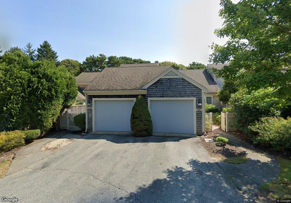
46 Kates Path Yarmouth Port, MA 02675
Yarmouth Port NeighborhoodEstimated Value: $558,000 - $643,000
2
Beds
4
Baths
1,292
Sq Ft
$468/Sq Ft
Est. Value
About This Home
This home is located at 46 Kates Path, Yarmouth Port, MA 02675 and is currently estimated at $604,227, approximately $467 per square foot. 46 Kates Path is a home located in Barnstable County with nearby schools including Dennis-Yarmouth Regional High School.
Ownership History
Date
Name
Owned For
Owner Type
Purchase Details
Closed on
Jul 10, 2020
Sold by
Deutsch Michael J and Deutsch Laura F
Bought by
Bolles Main Street Rt
Current Estimated Value
Purchase Details
Closed on
Oct 27, 2006
Sold by
Mulroney Lenore P and Mulroney William C
Bought by
Deutsch Laura F and Deutsch Michael J
Purchase Details
Closed on
Jun 26, 1998
Sold by
Rowan Chauncey
Bought by
Mulroney William C and Mulroney Lenore P
Purchase Details
Closed on
Nov 27, 1989
Sold by
The Green Co Inc
Bought by
Rowan Chauncey
Home Financials for this Owner
Home Financials are based on the most recent Mortgage that was taken out on this home.
Original Mortgage
$70,000
Interest Rate
9.83%
Mortgage Type
Purchase Money Mortgage
Create a Home Valuation Report for This Property
The Home Valuation Report is an in-depth analysis detailing your home's value as well as a comparison with similar homes in the area
Home Values in the Area
Average Home Value in this Area
Purchase History
| Date | Buyer | Sale Price | Title Company |
|---|---|---|---|
| Bolles Main Street Rt | $435,000 | None Available | |
| Bolles Main Street Rt | $435,000 | None Available | |
| Deutsch Laura F | $420,000 | -- | |
| Deutsch Laura F | $420,000 | -- | |
| Deutsch Laura F | $420,000 | -- | |
| Deutsch Laura F | $420,000 | -- | |
| Mulroney William C | $205,000 | -- | |
| Mulroney William C | $205,000 | -- | |
| Rowan Chauncey | $177,000 | -- | |
| Rowan Chauncey | $177,000 | -- |
Source: Public Records
Mortgage History
| Date | Status | Borrower | Loan Amount |
|---|---|---|---|
| Previous Owner | Rowan Chauncey | $70,000 |
Source: Public Records
Tax History Compared to Growth
Tax History
| Year | Tax Paid | Tax Assessment Tax Assessment Total Assessment is a certain percentage of the fair market value that is determined by local assessors to be the total taxable value of land and additions on the property. | Land | Improvement |
|---|---|---|---|---|
| 2025 | $3,750 | $529,700 | $0 | $529,700 |
| 2024 | $3,767 | $510,500 | $0 | $510,500 |
| 2023 | $3,394 | $418,500 | $0 | $418,500 |
| 2022 | $3,875 | $422,100 | $0 | $422,100 |
| 2021 | $3,771 | $394,500 | $0 | $394,500 |
| 2020 | $3,806 | $380,600 | $0 | $380,600 |
| 2019 | $3,570 | $353,500 | $0 | $353,500 |
| 2018 | $3,358 | $326,300 | $0 | $326,300 |
| 2017 | $3,133 | $312,700 | $0 | $312,700 |
| 2016 | $2,985 | $299,100 | $0 | $299,100 |
| 2015 | $2,989 | $297,700 | $0 | $297,700 |
Source: Public Records
Map
Nearby Homes
- 34 Kates Path
- 34 Kates Path Unit 34
- 17 Kates Path Unit A
- 228 Kates Path
- 64 Kates Path
- 43 Canterbury Rd
- 44 Stratford Ln
- 50 John Hall Cartway
- 50 John Hall Cartway Unit 50
- 42 John Hall Cartway Unit 42
- 7 Forest Gate Unit 7
- 25 Oak Glen Village Unit 25
- 25 Oak Glen
- 30 W Woods
- 30 W Woods Cir Unit 30
- 2 Pine Grove
- 86 Pompano Rd
- 51 Bray Farm Rd N
- 6 Nimble Hill Dr
- 1 Barnacle Rd
- 44 Kates Path
- 42 Kates Path
- 40 Kates Path
- 36 Kates Path
- 46 Kate's Path Unit 46
- 42 Kates Path Unit B
- 44 Kates Path Unit 44C
- 38 Kates Path Unit C
- 42 Kates Path Unit B
- 40 Kates Path Unit A
- 42 Kates Path Unit 42
- 46 Kates Path Unit E
- 42 Kate's Point Unit B
- 60 Kate's Point Unit 60
- 28 Kates Path
- 34 Kates Path Unit D
- 28 Kates Village Path Unit 28
- 34 Kates Village D
- 17 Kate's Path
- 17 Kate's Path Unit 17