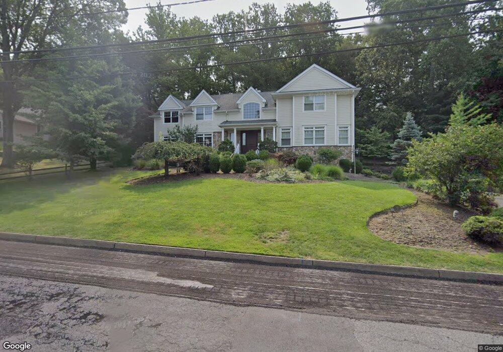
46 Leroy St Tenafly, NJ 07670
Estimated Value: $2,548,868 - $3,278,000
--
Bed
--
Bath
4,941
Sq Ft
$604/Sq Ft
Est. Value
About This Home
This home is located at 46 Leroy St, Tenafly, NJ 07670 and is currently estimated at $2,984,623, approximately $604 per square foot. 46 Leroy St is a home located in Bergen County with nearby schools including Tenafly Middle School, Tenafly High School, and The Elisabeth Morrow School.
Ownership History
Date
Name
Owned For
Owner Type
Purchase Details
Closed on
Jun 12, 1998
Sold by
Grodin Elaine B
Bought by
Kim John and Lee Laura
Current Estimated Value
Home Financials for this Owner
Home Financials are based on the most recent Mortgage that was taken out on this home.
Original Mortgage
$308,000
Interest Rate
6.72%
Create a Home Valuation Report for This Property
The Home Valuation Report is an in-depth analysis detailing your home's value as well as a comparison with similar homes in the area
Home Values in the Area
Average Home Value in this Area
Purchase History
| Date | Buyer | Sale Price | Title Company |
|---|---|---|---|
| Kim John | $385,000 | -- |
Source: Public Records
Mortgage History
| Date | Status | Borrower | Loan Amount |
|---|---|---|---|
| Closed | Kim John | $308,000 |
Source: Public Records
Tax History Compared to Growth
Tax History
| Year | Tax Paid | Tax Assessment Tax Assessment Total Assessment is a certain percentage of the fair market value that is determined by local assessors to be the total taxable value of land and additions on the property. | Land | Improvement |
|---|---|---|---|---|
| 2025 | $48,297 | $1,700,000 | $618,300 | $1,081,700 |
| 2024 | $47,124 | $1,700,000 | $618,300 | $1,081,700 |
| 2023 | $45,985 | $1,700,000 | $618,300 | $1,081,700 |
| 2022 | $45,985 | $1,700,000 | $618,300 | $1,081,700 |
| 2021 | $46,226 | $1,739,800 | $618,300 | $1,121,500 |
| 2020 | $45,548 | $1,739,800 | $618,300 | $1,121,500 |
| 2019 | $44,748 | $1,739,800 | $618,300 | $1,121,500 |
| 2018 | $44,052 | $1,739,800 | $618,300 | $1,121,500 |
| 2017 | $43,895 | $1,739,800 | $618,300 | $1,121,500 |
| 2016 | $43,025 | $1,739,800 | $618,300 | $1,121,500 |
| 2015 | $42,068 | $1,739,800 | $618,300 | $1,121,500 |
| 2014 | $41,285 | $1,739,800 | $618,300 | $1,121,500 |
Source: Public Records
Map
Nearby Homes
- 162 Elm St
- 84 Howard Park Dr
- 121 Churchill Rd
- 158 Oxford Dr
- 29 Woodland Park Dr
- 468 Lydecker St
- 136 Stonehurst Dr
- 109 Stonehurst Dr
- 12 Westervelt Ave
- 20 Westervelt Ave
- 22 Old Smith Rd
- 180 Glenwood Rd
- 51 W Hudson Ave Unit 16
- 405 Highview Rd
- 55 Ridge Rd
- 78 Roberts Rd
- 71 Roberts Rd
- 63 W Hudson Ave Unit C5
- 74 Roberts Rd
- 61 Glenwood Rd