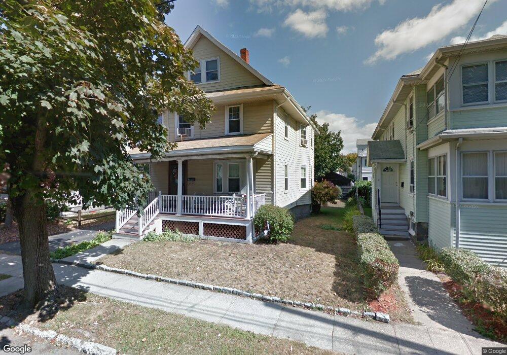
46 Lunt St Quincy, MA 02171
North Quincy NeighborhoodEstimated Value: $730,653 - $779,000
4
Beds
1
Bath
1,723
Sq Ft
$444/Sq Ft
Est. Value
About This Home
This home is located at 46 Lunt St, Quincy, MA 02171 and is currently estimated at $765,413, approximately $444 per square foot. 46 Lunt St is a home located in Norfolk County with nearby schools including Francis W. Parker Elementary School, Atlantic Middle School, and North Quincy High School.
Create a Home Valuation Report for This Property
The Home Valuation Report is an in-depth analysis detailing your home's value as well as a comparison with similar homes in the area
Home Values in the Area
Average Home Value in this Area
Tax History
| Year | Tax Paid | Tax Assessment Tax Assessment Total Assessment is a certain percentage of the fair market value that is determined by local assessors to be the total taxable value of land and additions on the property. | Land | Improvement |
|---|---|---|---|---|
| 2025 | $7,760 | $673,000 | $366,000 | $307,000 |
| 2024 | $7,515 | $666,800 | $366,000 | $300,800 |
| 2023 | $6,814 | $612,200 | $332,800 | $279,400 |
| 2022 | $6,323 | $527,800 | $266,200 | $261,600 |
| 2021 | $6,287 | $517,900 | $266,200 | $251,700 |
| 2020 | $6,055 | $487,100 | $261,000 | $226,100 |
| 2019 | $5,852 | $466,300 | $251,000 | $215,300 |
| 2018 | $5,838 | $437,600 | $239,000 | $198,600 |
| 2017 | $5,623 | $396,800 | $217,300 | $179,500 |
| 2016 | $5,239 | $364,800 | $197,500 | $167,300 |
| 2015 | $4,855 | $332,500 | $179,600 | $152,900 |
| 2014 | $4,789 | $322,300 | $179,600 | $142,700 |
Source: Public Records
Map
Nearby Homes
- 17 Holmes St Unit 101
- 17 Holmes St Unit 1
- 16 W Squantum St
- 46 Warwick St
- 45 Holbrook Rd
- 98 Safford St
- 153 Vassall St
- 100 W Squantum St Unit 516
- 79 Holbrook Rd Unit 2
- 113 Elm Ave
- 115 W Squantum St Unit 203
- 677 Quincy Shore Dr Unit 408
- 267-269 Farrington St
- 75 Walker St
- 365 Newport Ave Unit 303
- 157 Beale St Unit 6
- 157 Beale St Unit 1
- 60 Montclair Ave
- 35 Sewall St
- 150 Hancock St Unit 101
Your Personal Tour Guide
Ask me questions while you tour the home.