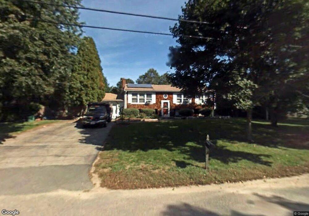
46 Massasoit Ln Hanover, MA 02339
Estimated Value: $622,000 - $741,000
3
Beds
2
Baths
1,509
Sq Ft
$442/Sq Ft
Est. Value
About This Home
This home is located at 46 Massasoit Ln, Hanover, MA 02339 and is currently estimated at $667,545, approximately $442 per square foot. 46 Massasoit Ln is a home located in Plymouth County with nearby schools including Hanover High School.
Ownership History
Date
Name
Owned For
Owner Type
Purchase Details
Closed on
Jun 5, 2006
Sold by
Reynolds Michael and Reynolds Carole D
Bought by
Woods Jennifer L and Odonnell Ryan
Current Estimated Value
Home Financials for this Owner
Home Financials are based on the most recent Mortgage that was taken out on this home.
Original Mortgage
$288,900
Outstanding Balance
$169,659
Interest Rate
6.55%
Mortgage Type
Purchase Money Mortgage
Estimated Equity
$497,886
Purchase Details
Closed on
Apr 8, 1994
Sold by
Collins Steven P and Collins Christine A
Bought by
Reynolds Michael and Mayer Carole D
Purchase Details
Closed on
Apr 29, 1987
Sold by
St Pierre Robert A
Bought by
Collins Steven P
Create a Home Valuation Report for This Property
The Home Valuation Report is an in-depth analysis detailing your home's value as well as a comparison with similar homes in the area
Home Values in the Area
Average Home Value in this Area
Purchase History
| Date | Buyer | Sale Price | Title Company |
|---|---|---|---|
| Woods Jennifer L | $361,250 | -- | |
| Reynolds Michael | $165,000 | -- | |
| Collins Steven P | $166,500 | -- |
Source: Public Records
Mortgage History
| Date | Status | Borrower | Loan Amount |
|---|---|---|---|
| Open | Collins Steven P | $288,900 | |
| Closed | Collins Steven P | $36,150 |
Source: Public Records
Tax History
| Year | Tax Paid | Tax Assessment Tax Assessment Total Assessment is a certain percentage of the fair market value that is determined by local assessors to be the total taxable value of land and additions on the property. | Land | Improvement |
|---|---|---|---|---|
| 2025 | $7,001 | $566,900 | $271,000 | $295,900 |
| 2024 | $7,021 | $546,800 | $271,000 | $275,800 |
| 2023 | $6,792 | $503,500 | $246,300 | $257,200 |
| 2022 | $6,506 | $426,600 | $246,300 | $180,300 |
| 2021 | $6,197 | $379,500 | $212,800 | $166,700 |
| 2020 | $2,770 | $376,600 | $212,800 | $163,800 |
| 2019 | $5,801 | $353,500 | $212,800 | $140,700 |
| 2018 | $5,708 | $350,600 | $212,800 | $137,800 |
| 2017 | $5,724 | $346,500 | $212,800 | $133,700 |
| 2016 | $5,515 | $327,100 | $193,400 | $133,700 |
| 2015 | $4,876 | $301,900 | $193,400 | $108,500 |
Source: Public Records
Map
Nearby Homes
- 95 Tecumseh Dr
- 75 School St
- 561 Circuit St
- 51 Cervelli Farm Dr
- 37 Dr
- 23 Cervelli Farm Dr
- 38 Cervelli Farm Dr
- 9 Cervelli Farm Dr
- 36 Grove St
- 250 Center St
- 108 Waterford Dr
- 139 Fairwood Dr
- 430 Brook Bend Rd
- 114 Graham Hill Dr
- 339 State St
- 35 Sproul Rd
- 823 Market St
- 696 Summer St
- 17 Hayford Trail Unit 12
- 7 Hayford Trail Unit 12
- 32 Massasoit Ln
- 60 Massasoit Ln
- 55 Sequoya Ln
- 43 Sequoya Ln
- 51 Massasoit Ln
- 39 Massasoit Ln
- 67 Sequoya Ln
- 63 Massasoit Ln
- 27 Massasoit Ln
- 31 Sequoya Ln
- 18 Massasoit Ln
- 131 Samoset Dr
- 119 Samoset Dr
- 143 Samoset Dr
- 56 Sequoya Ln
- 18 Pocahontas Ln
- 128 Tecumseh Dr
- 38 Pocahontas Ln
- 44 Sequoya Ln
- 19 Sequoya Ln
Your Personal Tour Guide
Ask me questions while you tour the home.