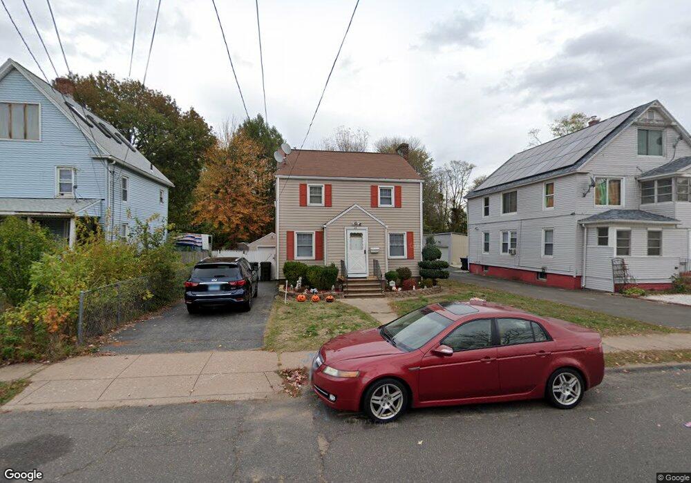
46 Moore Ave East Hartford, CT 06108
Estimated Value: $260,000 - $300,000
3
Beds
2
Baths
1,300
Sq Ft
$216/Sq Ft
Est. Value
About This Home
This home is located at 46 Moore Ave, East Hartford, CT 06108 and is currently estimated at $281,058, approximately $216 per square foot. 46 Moore Ave is a home located in Hartford County with nearby schools including Dr. John A. Langford School, East Hartford Middle School, and East Hartford High School.
Ownership History
Date
Name
Owned For
Owner Type
Purchase Details
Closed on
Sep 3, 2003
Sold by
Cruz Heriberto
Bought by
Allison Stacey-Ann
Current Estimated Value
Home Financials for this Owner
Home Financials are based on the most recent Mortgage that was taken out on this home.
Original Mortgage
$140,800
Outstanding Balance
$64,327
Interest Rate
6.02%
Estimated Equity
$216,731
Purchase Details
Closed on
Dec 16, 1997
Sold by
Sedlacek Mark C and Sedlacek Sharon M
Bought by
Cruz Heriberto
Purchase Details
Closed on
Jul 7, 1994
Sold by
Cole Robert J
Bought by
Sedlacek Mark C and Sedlacek Sharon M
Purchase Details
Closed on
Dec 18, 1989
Sold by
Flint Thomas G
Bought by
Cole Robert J
Create a Home Valuation Report for This Property
The Home Valuation Report is an in-depth analysis detailing your home's value as well as a comparison with similar homes in the area
Home Values in the Area
Average Home Value in this Area
Purchase History
| Date | Buyer | Sale Price | Title Company |
|---|---|---|---|
| Allison Stacey-Ann | $142,000 | -- | |
| Cruz Heriberto | $67,000 | -- | |
| Sedlacek Mark C | $100,000 | -- | |
| Cole Robert J | $125,000 | -- |
Source: Public Records
Mortgage History
| Date | Status | Borrower | Loan Amount |
|---|---|---|---|
| Open | Cole Robert J | $140,800 | |
| Previous Owner | Cole Robert J | $112,000 | |
| Previous Owner | Cole Robert J | $107,000 |
Source: Public Records
Tax History Compared to Growth
Tax History
| Year | Tax Paid | Tax Assessment Tax Assessment Total Assessment is a certain percentage of the fair market value that is determined by local assessors to be the total taxable value of land and additions on the property. | Land | Improvement |
|---|---|---|---|---|
| 2025 | $5,534 | $120,570 | $29,740 | $90,830 |
| 2024 | $5,305 | $120,570 | $29,740 | $90,830 |
| 2023 | $5,129 | $120,570 | $29,740 | $90,830 |
| 2022 | $4,943 | $120,570 | $29,740 | $90,830 |
| 2021 | $4,579 | $92,790 | $22,530 | $70,260 |
| 2020 | $4,632 | $92,790 | $22,530 | $70,260 |
| 2019 | $4,557 | $92,790 | $22,530 | $70,260 |
| 2018 | $4,422 | $92,790 | $22,530 | $70,260 |
| 2017 | $4,366 | $92,790 | $22,530 | $70,260 |
| 2016 | $4,246 | $92,580 | $22,530 | $70,050 |
| 2015 | $4,246 | $92,580 | $22,530 | $70,050 |
| 2014 | $4,203 | $92,580 | $22,530 | $70,050 |
Source: Public Records
Map
Nearby Homes
- 421 Tolland St Unit 209
- 506 Burnside Ave
- 51 Daniel St
- 509 Burnside Ave Unit A18
- 15 Michael Ave
- 453 Burnside Ave
- 89 Henderson Dr
- 32 Columbus St
- 22 Matthew Rd
- 67 Laurel St
- 59 Laraia Ave
- 11 Westbrook St
- 40 Larrabee St
- 30 Oakwood St
- 29 Joanne Dr Unit 29
- 265 Burnside Ave
- 73 Bliss St
- 10 Kenyon Place
- 345 Goodwin St
- 3 Price Ct
- 48 Moore Ave
- 38 Moore Ave
- 52 Moore Ave
- 32 Moore Ave
- 405 Tolland St
- 60 Moore Ave Unit 62
- 30 Moore Ave
- 40 Moore Ave Unit 42
- 49 Moore Ave
- 51 Moore Ave Unit 53
- 33 Moore Ave
- 417 Tolland St
- 41 Moore Ave
- 55 Moore Ave
- 37 Moore Ave
- 24 Moore Ave Unit 26
- 411 Tolland St
- 45 Moore Ave
- 59 Moore Ave
- 20 Moore Ave Unit 22