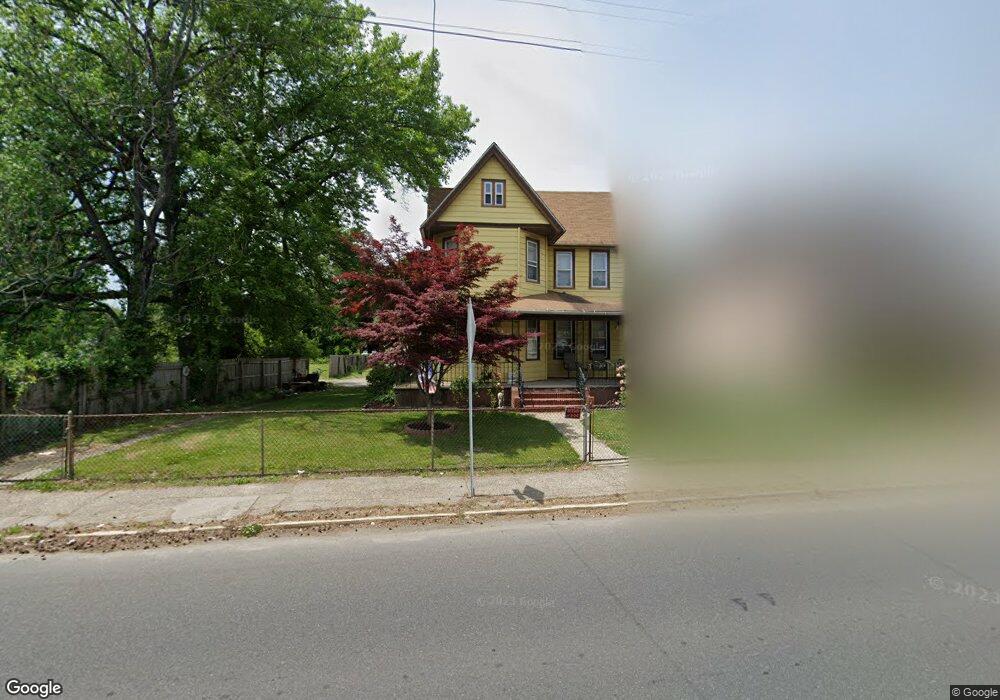
46 N Broad St Penns Grove, NJ 08069
Estimated Value: $129,000 - $253,000
--
Bed
--
Bath
2,106
Sq Ft
$87/Sq Ft
Est. Value
About This Home
This home is located at 46 N Broad St, Penns Grove, NJ 08069 and is currently estimated at $184,113, approximately $87 per square foot. 46 N Broad St is a home located in Salem County with nearby schools including Lafayette-Pershing Elementary School, Field Street Elementary School, and Paul W. Carleton Elementary School.
Ownership History
Date
Name
Owned For
Owner Type
Purchase Details
Closed on
Sep 24, 2020
Sold by
Wiggins Debora A
Bought by
Torres Burgos Adrian and Roberts Bethany Lynn
Current Estimated Value
Home Financials for this Owner
Home Financials are based on the most recent Mortgage that was taken out on this home.
Original Mortgage
$65,786
Interest Rate
2.6%
Mortgage Type
FHA
Purchase Details
Closed on
Mar 24, 1982
Bought by
Wiggins Vass E + Debora A
Create a Home Valuation Report for This Property
The Home Valuation Report is an in-depth analysis detailing your home's value as well as a comparison with similar homes in the area
Home Values in the Area
Average Home Value in this Area
Purchase History
| Date | Buyer | Sale Price | Title Company |
|---|---|---|---|
| Torres Burgos Adrian | $67,000 | None Available | |
| Wiggins Vass E + Debora A | -- | -- |
Source: Public Records
Mortgage History
| Date | Status | Borrower | Loan Amount |
|---|---|---|---|
| Previous Owner | Torres Burgos Adrian | $65,786 |
Source: Public Records
Tax History Compared to Growth
Tax History
| Year | Tax Paid | Tax Assessment Tax Assessment Total Assessment is a certain percentage of the fair market value that is determined by local assessors to be the total taxable value of land and additions on the property. | Land | Improvement |
|---|---|---|---|---|
| 2025 | $6,345 | $114,400 | $16,100 | $98,300 |
| 2024 | $6,132 | $114,400 | $16,100 | $98,300 |
| 2023 | $6,132 | $114,400 | $16,100 | $98,300 |
| 2022 | $5,911 | $114,400 | $16,100 | $98,300 |
| 2021 | $5,208 | $114,400 | $16,100 | $98,300 |
| 2020 | $5,730 | $114,400 | $16,100 | $98,300 |
| 2019 | $5,754 | $114,400 | $16,100 | $98,300 |
| 2018 | $6,031 | $149,500 | $24,100 | $125,400 |
| 2017 | $6,052 | $149,500 | $24,100 | $125,400 |
| 2016 | $5,823 | $149,500 | $24,100 | $125,400 |
| 2015 | $5,578 | $149,500 | $24,100 | $125,400 |
| 2014 | $5,517 | $149,500 | $24,100 | $125,400 |
Source: Public Records
Map
Nearby Homes
- 6 W Griffith St
- 18 Pearl St
- 31 Elvin Ave
- 0 Cumberland Ave
- 3 Naylor Ave
- 113 N Broad St
- 78 W Harmony St
- 0 Lincoln Avenue & Cumberland
- 27 E Line St
- 80 S Broad St
- 88 Railroad Ave
- 35 Franklin St
- 59 61 Broad St
- 54 W Pitman St
- 15 Walnut St
- 34 38 Cumberland Ave
- 39 41 Cumberland Ave
- 99 N Virginia Ave
- 106 S Broad St
- 71 Poplar St
- 48 N Broad St
- 50 N Broad St
- 2 W Griffith St
- 4 W Griffith St
- 49 N Broad St
- 37 N Broad St
- 39 N Broad St Unit 41
- 43 N Broad St Unit 45
- 5 E Harmony St
- 57 N Broad St
- 3 W Griffith St
- 10 W Griffith St Unit 12
- 25 W Harmony St
- 7 E Harmony St
- 9 W Griffith St
- 9 E Griffith St
- 11 W Griffith St
- 63 N Broad St
- 35 W Harmony St
- 13 E Griffith St