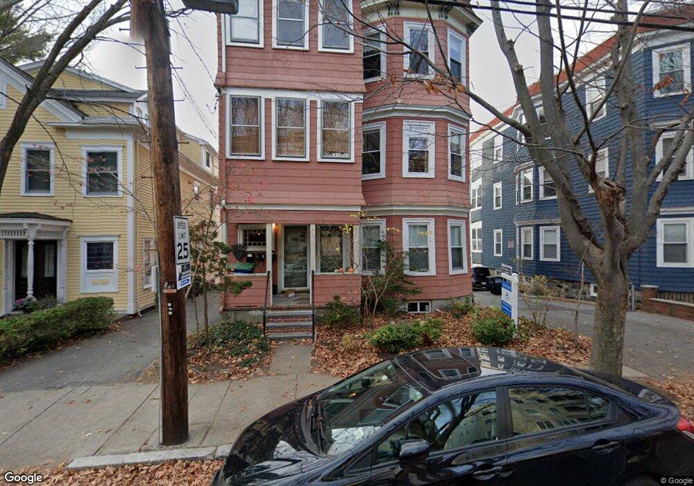
46 Porter St Unit 2 Somerville, MA 02143
Spring Hill NeighborhoodEstimated Value: $691,417 - $900,000
2
Beds
1
Bath
1,044
Sq Ft
$750/Sq Ft
Est. Value
About This Home
This home is located at 46 Porter St Unit 2, Somerville, MA 02143 and is currently estimated at $783,354, approximately $750 per square foot. 46 Porter St Unit 2 is a home located in Middlesex County with nearby schools including Somerville High School and Saint Theresa School.
Ownership History
Date
Name
Owned For
Owner Type
Purchase Details
Closed on
Dec 15, 2009
Sold by
Odonnell Ellen H and Weyant Eric M
Bought by
Quah Kokseng Darrel
Current Estimated Value
Home Financials for this Owner
Home Financials are based on the most recent Mortgage that was taken out on this home.
Original Mortgage
$278,400
Outstanding Balance
$182,704
Interest Rate
5.02%
Mortgage Type
Purchase Money Mortgage
Estimated Equity
$600,650
Purchase Details
Closed on
Jan 2, 2003
Sold by
Mccabe Kathleen C and Oconnell James E
Bought by
Nelson Matthew and Nelson Kelley W
Home Financials for this Owner
Home Financials are based on the most recent Mortgage that was taken out on this home.
Original Mortgage
$260,000
Interest Rate
6.08%
Mortgage Type
Purchase Money Mortgage
Create a Home Valuation Report for This Property
The Home Valuation Report is an in-depth analysis detailing your home's value as well as a comparison with similar homes in the area
Home Values in the Area
Average Home Value in this Area
Purchase History
| Date | Buyer | Sale Price | Title Company |
|---|---|---|---|
| Quah Kokseng Darrel | $348,000 | -- | |
| Nelson Matthew | $325,000 | -- |
Source: Public Records
Mortgage History
| Date | Status | Borrower | Loan Amount |
|---|---|---|---|
| Open | Quah Kokseng Darrel | $278,400 | |
| Previous Owner | Nelson Matthew | $260,000 |
Source: Public Records
Tax History
| Year | Tax Paid | Tax Assessment Tax Assessment Total Assessment is a certain percentage of the fair market value that is determined by local assessors to be the total taxable value of land and additions on the property. | Land | Improvement |
|---|---|---|---|---|
| 2025 | $6,078 | $557,100 | $0 | $557,100 |
| 2024 | $5,706 | $542,400 | $0 | $542,400 |
| 2023 | $5,558 | $537,500 | $0 | $537,500 |
| 2022 | $5,373 | $527,800 | $0 | $527,800 |
| 2021 | $5,268 | $517,000 | $0 | $517,000 |
| 2020 | $5,109 | $506,300 | $0 | $506,300 |
| 2019 | $5,216 | $484,800 | $0 | $484,800 |
| 2018 | $5,698 | $503,800 | $0 | $503,800 |
| 2017 | $4,819 | $412,900 | $0 | $412,900 |
| 2016 | $5,090 | $406,200 | $0 | $406,200 |
| 2015 | $4,896 | $388,300 | $0 | $388,300 |
Source: Public Records
Map
Nearby Homes
- 148 Lowell St Unit 3
- 125 Lowell St Unit 3B
- 125 Lowell St Unit 301
- 125 Lowell St Unit 5C
- 42 Belmont St
- 161 Lowell St Unit 1
- 35 Ibbetson St
- 15 Spring Hill Terrace
- 49 Cherry St Unit 1
- 118 Albion St Unit 2
- 8 Albion Terrace
- 80 Hudson St
- 156 Albion St Unit B
- 156 Albion St Unit 1
- 70 Albion St Unit 3
- 32-40 White St
- 17 Monmouth St
- 13 Warwick St
- 7 Woodbine St
- 1-3 Woodbine St
- 46 Porter St Unit 1
- 46 Porter St
- 48 Porter St Unit 3
- 48 Porter St Unit 2
- 48 Porter St
- 44 Porter St Unit 3
- 44 Porter St Unit 2
- 44 Porter St Unit 3 44
- 44 Porter St Unit 1 44
- 44 Porter St Unit 2 44
- 11 Peterson Terrace
- 11 Peterson Terrace Unit 1
- 13 Peterson Terrace Unit 2
- 13 Peterson Terrace Unit 1
- 34 Patridge Unit 2
- 14 Peterson Terrace
- 14 Peterson Terrace
- 14 Peterson Terrace Unit 2
- 50 Porter St
- 40 Porter St
Your Personal Tour Guide
Ask me questions while you tour the home.