J
Seller's Agent in 2019
Jeremy Root
High Ridge Realty, LLC
Estimated Value: $17,098 - $28,000
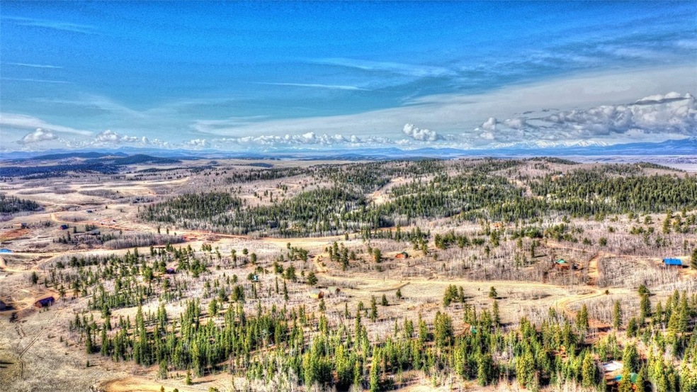
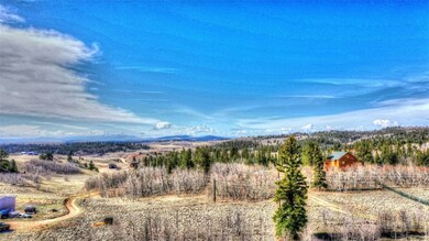
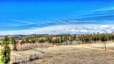
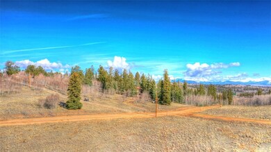
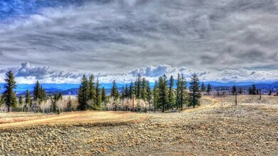
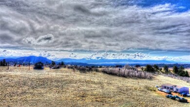
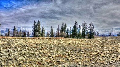
Trees - No. Power - Close. Phone - Yes. This 2 acre lot has great views to the south, power is close. This could be a great lot for camping within Park County regulations, or building a great getaway cabin! 113 EHR F-5
Last Agent to Sell the Property
Jeremy Root
High Ridge Realty, LLC License #FA100077430 Listed on: 05/11/2019
Last Buyer's Agent
Jeremy Root
High Ridge Realty, LLC License #FA100077430 Listed on: 05/11/2019
| Date | Buyer | Sale Price | Title Company |
|---|---|---|---|
| Comstock Don | $13,000 | Fidelity National Title |
| Date | Event | Price | List to Sale | Price per Sq Ft |
|---|---|---|---|---|
| 07/29/2019 07/29/19 | Sold | $13,000 | 0.0% | -- |
| 06/29/2019 06/29/19 | Pending | -- | -- | -- |
| 05/11/2019 05/11/19 | For Sale | $13,000 | -- | -- |
| Year | Tax Paid | Tax Assessment Tax Assessment Total Assessment is a certain percentage of the fair market value that is determined by local assessors to be the total taxable value of land and additions on the property. | Land | Improvement |
|---|---|---|---|---|
| 2025 | $326 | $5,480 | $5,480 | $0 |
| 2024 | $306 | $5,370 | $5,370 | $0 |
| 2023 | $306 | $5,577 | $5,577 | $0 |
| 2022 | $198 | $3,048 | $3,048 | $0 |
| 2021 | $48 | $751 | $751 | $0 |
| 2020 | $186 | $2,840 | $2,840 | $0 |
| 2019 | $181 | $2,840 | $2,840 | $0 |
| 2018 | $193 | $2,840 | $2,840 | $0 |
| 2017 | $166 | $2,970 | $2,970 | $0 |
| 2016 | $188 | $3,320 | $3,320 | $0 |
| 2015 | $192 | $3,320 | $3,320 | $0 |
| 2014 | $143 | $0 | $0 | $0 |
J
Seller's Agent in 2019
Jeremy Root
High Ridge Realty, LLC
Source: Summit MLS
MLS Number: S1013234
APN: 32672
Disclaimer: Certain information contained herein is derived from information provided by parties other than Homes.com. All information provided is deemed reliable, but is not guaranteed to be accurate and should be independently verified.
![]() Copyright © 2026 SAR MLS. The information displayed herein was derived from sources believed to be accurate, but has not been verified by SAR MLS. Buyers are cautioned to verify all information to their own satisfaction. This information is exclusively for viewers’ personal, non-commercial use. Any republication or reproduction of the information herein without the express permission of the SAR MLS is strictly prohibited.
Copyright © 2026 SAR MLS. The information displayed herein was derived from sources believed to be accurate, but has not been verified by SAR MLS. Buyers are cautioned to verify all information to their own satisfaction. This information is exclusively for viewers’ personal, non-commercial use. Any republication or reproduction of the information herein without the express permission of the SAR MLS is strictly prohibited.
Ask me questions while you tour the home.