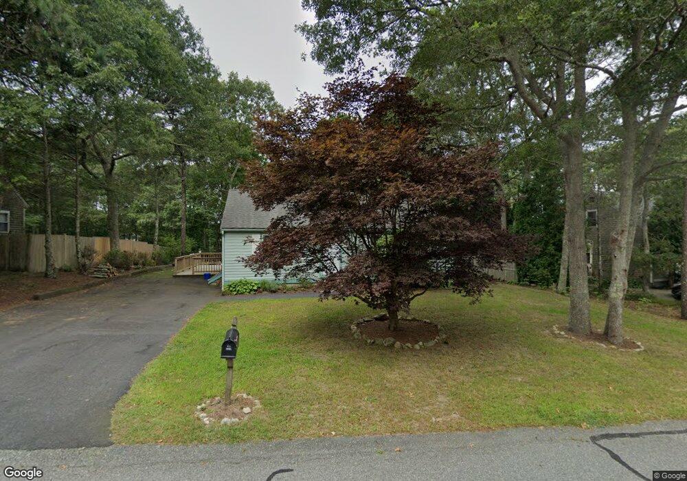
46 Rhine Rd Yarmouth Port, MA 02675
Yarmouth Port NeighborhoodEstimated Value: $300,828 - $395,000
2
Beds
1
Bath
912
Sq Ft
$386/Sq Ft
Est. Value
About This Home
This home is located at 46 Rhine Rd, Yarmouth Port, MA 02675 and is currently estimated at $352,207, approximately $386 per square foot. 46 Rhine Rd is a home located in Barnstable County with nearby schools including Dennis-Yarmouth Regional High School and St. Pius X. School.
Ownership History
Date
Name
Owned For
Owner Type
Purchase Details
Closed on
Jun 25, 2009
Sold by
Matejek Rebecca J and Matejek Jason Rebecca
Bought by
Matejek Kenneth J and Matejek Rebecca J
Current Estimated Value
Purchase Details
Closed on
Apr 10, 1996
Sold by
Keller Michael B
Bought by
Jason Rebecca J
Home Financials for this Owner
Home Financials are based on the most recent Mortgage that was taken out on this home.
Original Mortgage
$90,155
Interest Rate
7.39%
Mortgage Type
Purchase Money Mortgage
Purchase Details
Closed on
Oct 19, 1990
Sold by
Dacey William E
Bought by
Keller Michael B
Home Financials for this Owner
Home Financials are based on the most recent Mortgage that was taken out on this home.
Original Mortgage
$90,100
Interest Rate
10.14%
Mortgage Type
Purchase Money Mortgage
Create a Home Valuation Report for This Property
The Home Valuation Report is an in-depth analysis detailing your home's value as well as a comparison with similar homes in the area
Home Values in the Area
Average Home Value in this Area
Purchase History
| Date | Buyer | Sale Price | Title Company |
|---|---|---|---|
| Matejek Kenneth J | -- | -- | |
| Jason Rebecca J | $94,900 | -- | |
| Keller Michael B | $94,900 | -- |
Source: Public Records
Mortgage History
| Date | Status | Borrower | Loan Amount |
|---|---|---|---|
| Previous Owner | Keller Michael B | $107,000 | |
| Previous Owner | Keller Michael B | $90,155 | |
| Previous Owner | Keller Michael B | $5,632 | |
| Previous Owner | Keller Michael B | $90,100 |
Source: Public Records
Tax History Compared to Growth
Tax History
| Year | Tax Paid | Tax Assessment Tax Assessment Total Assessment is a certain percentage of the fair market value that is determined by local assessors to be the total taxable value of land and additions on the property. | Land | Improvement |
|---|---|---|---|---|
| 2025 | $1,359 | $192,000 | $141,900 | $50,100 |
| 2024 | $1,417 | $192,000 | $149,600 | $42,400 |
| 2023 | $1,557 | $192,000 | $133,300 | $58,700 |
| 2022 | $1,763 | $192,000 | $120,000 | $72,000 |
| 2021 | $1,836 | $192,000 | $120,000 | $72,000 |
| 2020 | $1,920 | $192,000 | $119,900 | $72,100 |
| 2019 | $1,939 | $192,000 | $119,900 | $72,100 |
| 2018 | $1,763 | $171,300 | $69,400 | $101,900 |
| 2017 | $1,716 | $171,300 | $69,400 | $101,900 |
| 2016 | $1,647 | $165,000 | $63,100 | $101,900 |
| 2015 | $1,538 | $153,200 | $63,100 | $90,100 |
Source: Public Records
Map
Nearby Homes
- 16 Warren Rd Unit 16
- 16 Warren Rd
- 32 Deveau Ln
- 8 Rowley Ln
- 40 Deveau Ln
- 209 Union St
- 0 Forsyth Ave
- 68 Seminole Dr
- 14 Many Oaks Cir
- 30 Quartermaster Row
- 33 Sparrow Way
- 72 Quartermaster Row
- 176 Beacon St
- 17 Trowbridge Path
- 76 Captain Chase Rd
- 882 W Yarmouth Rd
- 50 Cottonwood St
- 1 Hamblin Hill
- 105 Webbers Path
- 49 Captain Besse Rd