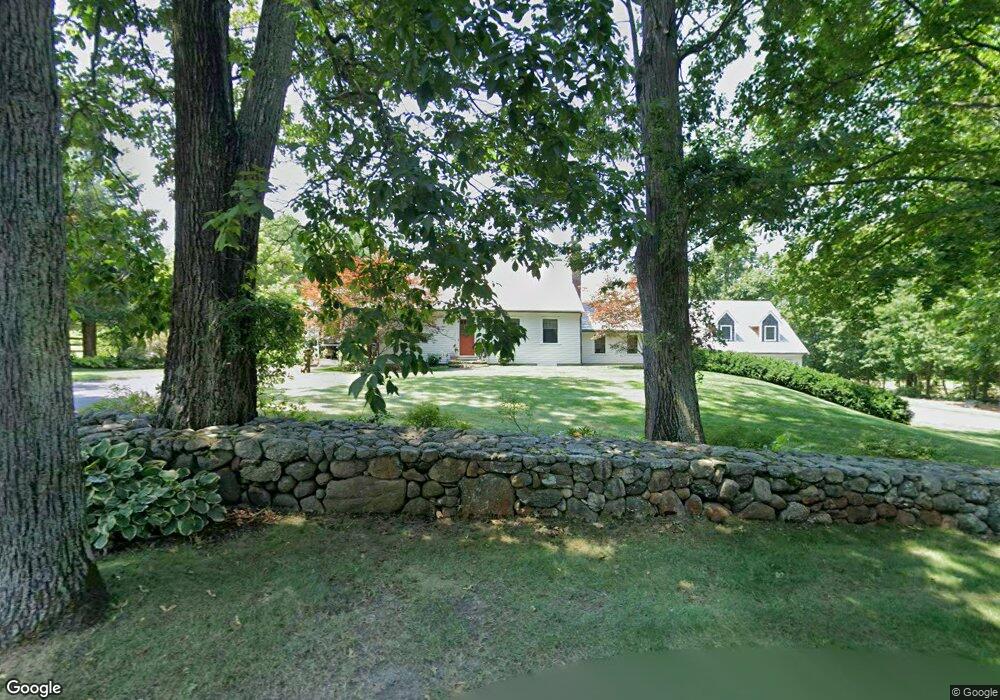
46 Stearns St Carlisle, MA 01741
Estimated Value: $1,303,000 - $1,384,764
3
Beds
3
Baths
2,062
Sq Ft
$656/Sq Ft
Est. Value
About This Home
This home is located at 46 Stearns St, Carlisle, MA 01741 and is currently estimated at $1,351,941, approximately $655 per square foot. 46 Stearns St is a home located in Middlesex County with nearby schools including Carlisle School, Concord Carlisle High School, and Middlesex School.
Ownership History
Date
Name
Owned For
Owner Type
Purchase Details
Closed on
Mar 14, 2013
Sold by
Mcdonough John J
Bought by
Mcdonough Rt and Mcdonough John J
Current Estimated Value
Purchase Details
Closed on
Mar 2, 2005
Sold by
Ruetigers Maureen L and Ruetigers Michael
Bought by
Mcdonough John J
Home Financials for this Owner
Home Financials are based on the most recent Mortgage that was taken out on this home.
Original Mortgage
$1,000,000
Interest Rate
5.66%
Mortgage Type
Purchase Money Mortgage
Purchase Details
Closed on
Mar 15, 2002
Sold by
Dee Barbara W
Bought by
Ruettgers Maureen L and Ruettgers Michael
Create a Home Valuation Report for This Property
The Home Valuation Report is an in-depth analysis detailing your home's value as well as a comparison with similar homes in the area
Home Values in the Area
Average Home Value in this Area
Purchase History
| Date | Buyer | Sale Price | Title Company |
|---|---|---|---|
| Mcdonough Rt | -- | -- | |
| Mcdonough John J | $875,000 | -- | |
| Ruettgers Maureen L | $405,000 | -- |
Source: Public Records
Mortgage History
| Date | Status | Borrower | Loan Amount |
|---|---|---|---|
| Previous Owner | Mcdonough John J | $1,000,000 |
Source: Public Records
Tax History Compared to Growth
Tax History
| Year | Tax Paid | Tax Assessment Tax Assessment Total Assessment is a certain percentage of the fair market value that is determined by local assessors to be the total taxable value of land and additions on the property. | Land | Improvement |
|---|---|---|---|---|
| 2025 | $16,538 | $1,254,800 | $490,100 | $764,700 |
| 2024 | $15,940 | $1,195,800 | $450,800 | $745,000 |
| 2023 | $16,066 | $1,135,400 | $450,800 | $684,600 |
| 2022 | $15,876 | $962,200 | $372,400 | $589,800 |
| 2021 | $15,665 | $962,200 | $372,400 | $589,800 |
| 2020 | $15,821 | $861,700 | $294,000 | $567,700 |
| 2019 | $15,490 | $846,900 | $294,000 | $552,900 |
| 2018 | $3,584 | $846,900 | $294,000 | $552,900 |
| 2017 | $14,621 | $829,800 | $294,000 | $535,800 |
| 2016 | $14,273 | $829,800 | $294,000 | $535,800 |
| 2015 | $12,899 | $678,900 | $282,300 | $396,600 |
| 2014 | $12,655 | $678,900 | $282,300 | $396,600 |
Source: Public Records
Map
Nearby Homes
- 232 Baldwin Rd
- 125 Maple St
- 282 Brook St
- 373 E Riding Dr
- 7 School St
- 383 E Riding Dr
- 11 Kay's Walk
- 225 Lowell St
- 1 Garrison Way Unit 1
- 3 Kay's Walk
- 15 Kay's Walk
- 1 Kay's Walk Unit 1
- 1 Kay's Walk
- 13 Kay's Walk
- 15 Kay's Walk Unit 4
- 3 Kay's Walk Unit 3
- 8 Kay's Walk Unit 13
- 14 Kay's Walk
- 6 Kay's Walk Unit 6
- 6 Kay's Walk