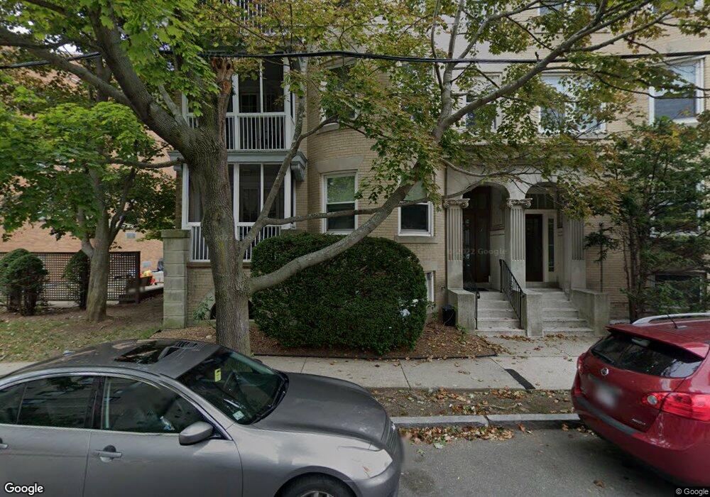
46 Williams St Brookline, MA 02446
Coolidge Corner NeighborhoodEstimated Value: $2,628,000 - $3,448,000
9
Beds
7
Baths
5,466
Sq Ft
$550/Sq Ft
Est. Value
About This Home
This home is located at 46 Williams St, Brookline, MA 02446 and is currently estimated at $3,003,667, approximately $549 per square foot. 46 Williams St is a home located in Norfolk County with nearby schools including Florida Ruffin Ridley, Brookline High School, and Match Charter Public School.
Ownership History
Date
Name
Owned For
Owner Type
Purchase Details
Closed on
Jan 6, 2021
Sold by
Graff Joyce W
Bought by
Joyce Graff Irt
Current Estimated Value
Purchase Details
Closed on
Jul 2, 2020
Sold by
Joyce Graff Irt
Bought by
Graff Joyce W
Purchase Details
Closed on
Mar 1, 2017
Sold by
Wilcox-Graff Joyce
Bought by
Joyce Graff Irt
Purchase Details
Closed on
Aug 27, 2007
Sold by
Williams Rt
Bought by
Graff Joyce W
Home Financials for this Owner
Home Financials are based on the most recent Mortgage that was taken out on this home.
Original Mortgage
$90,000
Interest Rate
6.78%
Mortgage Type
Purchase Money Mortgage
Purchase Details
Closed on
Feb 16, 2007
Sold by
Graff Joyce W and Graff Jay Sara
Bought by
Williams Street Rt
Purchase Details
Closed on
Oct 27, 2006
Sold by
Jay Sara M and Morgenstern Sara
Bought by
46 Williams Street Rt
Create a Home Valuation Report for This Property
The Home Valuation Report is an in-depth analysis detailing your home's value as well as a comparison with similar homes in the area
Home Values in the Area
Average Home Value in this Area
Purchase History
| Date | Buyer | Sale Price | Title Company |
|---|---|---|---|
| Joyce Graff Irt | -- | None Available | |
| Graff Joyce W | -- | None Available | |
| Joyce Graff Irt | -- | -- | |
| Graff Joyce W | -- | -- | |
| Graff Joyce W | -- | -- | |
| Williams Street Rt | -- | -- | |
| 46 Williams Street Rt | -- | -- |
Source: Public Records
Mortgage History
| Date | Status | Borrower | Loan Amount |
|---|---|---|---|
| Previous Owner | Graff Joyce W | $90,000 |
Source: Public Records
Tax History
| Year | Tax Paid | Tax Assessment Tax Assessment Total Assessment is a certain percentage of the fair market value that is determined by local assessors to be the total taxable value of land and additions on the property. | Land | Improvement |
|---|---|---|---|---|
| 2025 | $32,216 | $3,264,000 | $1,094,400 | $2,169,600 |
| 2024 | $32,434 | $3,319,800 | $1,049,200 | $2,270,600 |
| 2023 | $30,959 | $3,105,200 | $953,300 | $2,151,900 |
| 2022 | $30,136 | $2,957,400 | $907,900 | $2,049,500 |
| 2021 | $27,867 | $2,843,600 | $873,000 | $1,970,600 |
| 2020 | $26,392 | $2,792,800 | $783,500 | $2,009,300 |
| 2019 | $24,922 | $2,659,800 | $746,200 | $1,913,600 |
| 2018 | $23,416 | $2,475,300 | $609,100 | $1,866,200 |
| 2017 | $22,755 | $2,303,100 | $574,600 | $1,728,500 |
| 2016 | $21,793 | $2,091,500 | $537,000 | $1,554,500 |
| 2015 | $20,307 | $1,901,400 | $501,900 | $1,399,500 |
| 2014 | $20,746 | $1,821,400 | $419,700 | $1,401,700 |
Source: Public Records
Map
Nearby Homes
- 49 Winchester St Unit 2
- 19 Winchester St Unit 711
- 19 Winchester St Unit 110
- 20 Winchester St Unit 3
- 17 Summit Ave Unit 2
- 1407 Beacon St Unit 8
- 123 Centre St
- 125 Park St Unit 2
- 95 Mason Terrace Unit 6
- 1490 Beacon St Unit 4
- 80 Vernon St Unit PHB
- 80 Vernon St Unit 1-A
- 80 Vernon St Unit 2B
- 80 Vernon St Unit PHA
- 80 Vernon St Unit 3A
- 17 Coolidge St
- 14 Green St Unit PHA
- 25 Webster St
- 62 Fuller St
- 38 Stedman St Unit 38A
- 46 Williams St Unit 406
- 46 Williams St Unit 404
- 46 Williams St Unit 2
- 46 Williams St Unit 1
- 48 Williams St Unit 1
- 48 Williams St Unit 3
- 48 Williams St Unit 2
- 48 Williams St
- 50 Williams St Unit 3
- 50 Williams St Unit 2
- 50 Williams St Unit 1
- 50 Williams St Unit B
- 50 Williams St Unit 50B
- 53 Winchester St
- 51 Winchester St Unit 1
- 51 Winchester St Unit 3
- 51 Winchester St Unit 2
- 51 Winchester St Unit 206
- 67 Winchester St Unit 1
- 40 Williams St Unit 203
Your Personal Tour Guide
Ask me questions while you tour the home.