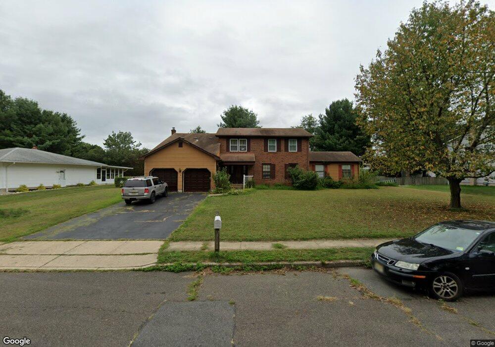
46 Wolfpack Rd Trenton, NJ 08619
University City NeighborhoodEstimated Value: $664,000 - $755,000
4
Beds
4
Baths
3,046
Sq Ft
$234/Sq Ft
Est. Value
About This Home
This home is located at 46 Wolfpack Rd, Trenton, NJ 08619 and is currently estimated at $711,836, approximately $233 per square foot. 46 Wolfpack Rd is a home located in Mercer County with nearby schools including University Heights/H.D. Morrison Elementary School, Richard C. Crockett Middle School, and Nottingham High School - North.
Ownership History
Date
Name
Owned For
Owner Type
Purchase Details
Closed on
Jul 1, 2021
Sold by
Seidl Dalia and Estate Of Mohamed Ghanem
Bought by
Seidl Dalia
Current Estimated Value
Home Financials for this Owner
Home Financials are based on the most recent Mortgage that was taken out on this home.
Original Mortgage
$327,000
Interest Rate
2.9%
Mortgage Type
New Conventional
Purchase Details
Closed on
Aug 13, 1992
Bought by
Ghanem Mohamed and Ghanem Zeinab
Create a Home Valuation Report for This Property
The Home Valuation Report is an in-depth analysis detailing your home's value as well as a comparison with similar homes in the area
Home Values in the Area
Average Home Value in this Area
Purchase History
| Date | Buyer | Sale Price | Title Company |
|---|---|---|---|
| Seidl Dalia | $450,000 | Emerald Title Agency Llc | |
| Ghanem Mohamed | $200,000 | -- |
Source: Public Records
Mortgage History
| Date | Status | Borrower | Loan Amount |
|---|---|---|---|
| Previous Owner | Seidl Dalia | $327,000 |
Source: Public Records
Tax History
| Year | Tax Paid | Tax Assessment Tax Assessment Total Assessment is a certain percentage of the fair market value that is determined by local assessors to be the total taxable value of land and additions on the property. | Land | Improvement |
|---|---|---|---|---|
| 2025 | $13,677 | $388,100 | $101,700 | $286,400 |
| 2024 | $12,819 | $388,100 | $101,700 | $286,400 |
| 2023 | $12,819 | $388,100 | $101,700 | $286,400 |
| 2022 | $12,617 | $388,100 | $101,700 | $286,400 |
| 2021 | $13,828 | $388,100 | $101,700 | $286,400 |
| 2020 | $12,431 | $388,100 | $101,700 | $286,400 |
| 2019 | $12,128 | $388,100 | $101,700 | $286,400 |
| 2018 | $11,985 | $388,100 | $101,700 | $286,400 |
| 2017 | $11,728 | $388,100 | $101,700 | $286,400 |
| 2016 | $10,494 | $388,100 | $101,700 | $286,400 |
| 2015 | $12,281 | $258,600 | $62,900 | $195,700 |
| 2014 | $12,105 | $258,600 | $62,900 | $195,700 |
Source: Public Records
Map
Nearby Homes
- 31 Wolfpack Rd
- 61 Cooney Ave
- 12 Tigers Ct
- 504 Paxson Ave
- 38 Thomas J Rhodes Indust Dr
- 924 Hughes Dr
- 542 Mercerville-Edinburg Rd
- 51 Macon Dr
- 21 Kite Ct Unit D3
- 59 Oneill Ct
- 38 Joyner Ct
- 2911 Mercer Quaker Bridge
- 26 Coral Dr
- 11 Gilpin Ct Unit 167
- 69 Corson Ave
- 20 Coral Dr
- 2 Britton Ct
- 568 Flock Rd
- 322 Fountayne Ln
- 9 Alburtus Ct
- 48 Wolfpack Rd
- 44 Wolfpack Rd
- 31 Tar Heels Rd
- 33 Tar Heels Rd
- 47 Wolfpack Rd
- 45 Wolfpack Rd
- 49 Wolfpack Rd
- 29 Tar Heels Rd
- 42 Wolfpack Rd
- 50 Wolfpack Rd
- 35 Tar Heels Rd
- 43 Wolfpack Rd
- 51 Wolfpack Rd
- 27 Tar Heels Rd
- 48 Terrapin Ln
- 40 Wolfpack Rd
- 50 Terrapin Ln
- 32 Tar Heels Rd
- 46 Terrapin Ln
- 41 Wolfpack Rd
Your Personal Tour Guide
Ask me questions while you tour the home.