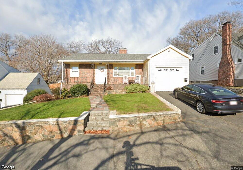
46 Worcester Ave Swampscott, MA 01907
Estimated Value: $845,000 - $1,017,000
3
Beds
2
Baths
2,508
Sq Ft
$380/Sq Ft
Est. Value
About This Home
This home is located at 46 Worcester Ave, Swampscott, MA 01907 and is currently estimated at $952,904, approximately $379 per square foot. 46 Worcester Ave is a home located in Essex County with nearby schools including Swampscott Middle School and Swampscott High School.
Ownership History
Date
Name
Owned For
Owner Type
Purchase Details
Closed on
Jul 30, 2008
Sold by
Faia Joseph and Faia Lisa
Bought by
Collins Neal O and Collins Georgia
Current Estimated Value
Home Financials for this Owner
Home Financials are based on the most recent Mortgage that was taken out on this home.
Original Mortgage
$385,650
Interest Rate
6.47%
Mortgage Type
Purchase Money Mortgage
Purchase Details
Closed on
Jul 27, 2001
Sold by
Dagnese Mariano Est
Bought by
Faia Joseph and Faia Lisa
Create a Home Valuation Report for This Property
The Home Valuation Report is an in-depth analysis detailing your home's value as well as a comparison with similar homes in the area
Home Values in the Area
Average Home Value in this Area
Purchase History
| Date | Buyer | Sale Price | Title Company |
|---|---|---|---|
| Collins Neal O | $428,500 | -- | |
| Collins Neal O | $428,500 | -- | |
| Faia Joseph | $233,000 | -- | |
| Faia Joseph | $233,000 | -- |
Source: Public Records
Mortgage History
| Date | Status | Borrower | Loan Amount |
|---|---|---|---|
| Open | Faia Joseph | $385,000 | |
| Closed | Faia Joseph | $385,650 |
Source: Public Records
Tax History
| Year | Tax Paid | Tax Assessment Tax Assessment Total Assessment is a certain percentage of the fair market value that is determined by local assessors to be the total taxable value of land and additions on the property. | Land | Improvement |
|---|---|---|---|---|
| 2025 | $9,249 | $806,400 | $314,800 | $491,600 |
| 2024 | $8,986 | $782,100 | $301,300 | $480,800 |
| 2023 | $8,585 | $731,300 | $287,800 | $443,500 |
| 2022 | $7,884 | $614,500 | $251,800 | $362,700 |
| 2021 | $7,834 | $567,700 | $233,800 | $333,900 |
| 2020 | $7,583 | $530,300 | $202,400 | $327,900 |
| 2019 | $7,308 | $480,800 | $152,900 | $327,900 |
| 2018 | $7,549 | $471,800 | $143,900 | $327,900 |
| 2017 | $7,725 | $442,700 | $134,900 | $307,800 |
| 2016 | $7,672 | $442,700 | $134,900 | $307,800 |
| 2015 | $7,438 | $433,700 | $125,900 | $307,800 |
| 2014 | $7,198 | $384,900 | $143,900 | $241,000 |
Source: Public Records
Map
Nearby Homes
- 306 Paradise Rd
- 50 Mountwood Rd
- 3 Didio Dr
- 51 Mountwood Rd
- 178 Norfolk Ave
- 64 Stetson Ave
- 445 Essex St Unit 304
- 8 Ryan Place
- 106 Norfolk Ave
- 80 Norfolk Ave Unit 1
- 71 Walnut Rd
- 40 Andrew Rd
- 58 Magnolia Rd
- 29-31 Essex Ave Unit 2
- 40 Buena Vista St
- 75 Bay View Dr
- 146 Burrill St
- 11 Boynton St Unit 104
- 11 Boynton St Unit 101
- 11 Boynton St Unit 102
- 42 Worcester Ave
- 32 Worcester Ave
- 50 Worcester Ave
- 43 Worcester Ave
- 37 Worcester Ave
- 33 Worcester Ave
- 3 Belleair Dr
- 56 Worcester Ave
- 47 Worcester Ave
- 5 Belleair Dr
- 53 Worcester Ave
- 1 Belleair Dr
- 60 Worcester Ave
- 7 Belleair Dr
- 57 Worcester Ave
- 21 Hampshire St
- 20 Worcester Ave
- 64 Worcester Ave Unit 1
- 64 Worcester Ave
- 64 Worcester Ave