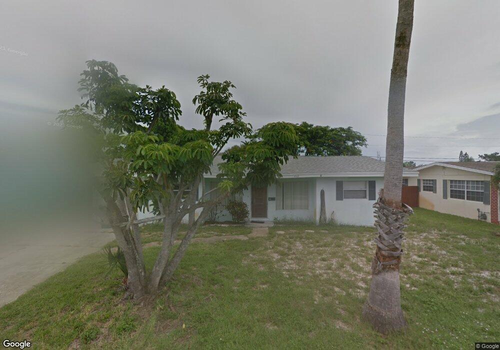
460 Cassia Blvd Satellite Beach, FL 32937
Estimated Value: $379,000 - $522,000
3
Beds
2
Baths
1,436
Sq Ft
$304/Sq Ft
Est. Value
About This Home
This home is located at 460 Cassia Blvd, Satellite Beach, FL 32937 and is currently estimated at $437,194, approximately $304 per square foot. 460 Cassia Blvd is a home located in Brevard County with nearby schools including Surfside Elementary School, Satellite Senior High School, and DeLaura Middle School.
Ownership History
Date
Name
Owned For
Owner Type
Purchase Details
Closed on
Jan 30, 2026
Sold by
Trossman Amy and Trossman Nola
Bought by
Graham Erica Shay and Graham Brett
Current Estimated Value
Home Financials for this Owner
Home Financials are based on the most recent Mortgage that was taken out on this home.
Original Mortgage
$266,000
Outstanding Balance
$266,000
Interest Rate
6.21%
Mortgage Type
New Conventional
Estimated Equity
$171,194
Purchase Details
Closed on
Aug 6, 2025
Sold by
Trossman Amy and Trossman Nola
Bought by
Trossman Amy and Trossman Nola
Purchase Details
Closed on
Jun 30, 1998
Sold by
Erem Helen
Bought by
Trossman Gaenor E
Home Financials for this Owner
Home Financials are based on the most recent Mortgage that was taken out on this home.
Original Mortgage
$52,045
Interest Rate
7.1%
Create a Home Valuation Report for This Property
The Home Valuation Report is an in-depth analysis detailing your home's value as well as a comparison with similar homes in the area
Home Values in the Area
Average Home Value in this Area
Purchase History
| Date | Buyer | Sale Price | Title Company |
|---|---|---|---|
| Graham Erica Shay | $280,000 | Clear Title Organization | |
| Trossman Amy | $100 | None Listed On Document | |
| Trossman Gaenor E | $77,000 | -- |
Source: Public Records
Mortgage History
| Date | Status | Borrower | Loan Amount |
|---|---|---|---|
| Open | Graham Erica Shay | $266,000 | |
| Previous Owner | Trossman Gaenor E | $52,045 |
Source: Public Records
Tax History
| Year | Tax Paid | Tax Assessment Tax Assessment Total Assessment is a certain percentage of the fair market value that is determined by local assessors to be the total taxable value of land and additions on the property. | Land | Improvement |
|---|---|---|---|---|
| 2025 | $1,289 | $352,360 | -- | -- |
| 2024 | $1,241 | $116,350 | -- | -- |
| 2023 | $1,241 | $112,970 | $0 | $0 |
| 2022 | $1,112 | $109,680 | $0 | $0 |
| 2021 | $1,112 | $106,490 | $0 | $0 |
| 2020 | $1,095 | $105,020 | $0 | $0 |
| 2019 | $1,067 | $102,660 | $0 | $0 |
| 2018 | $1,050 | $100,750 | $0 | $0 |
| 2017 | $923 | $98,680 | $0 | $0 |
| 2016 | $918 | $96,660 | $80,000 | $16,660 |
| 2015 | $937 | $95,990 | $70,000 | $25,990 |
| 2014 | $931 | $95,230 | $65,000 | $30,230 |
Source: Public Records
Map
Nearby Homes
- 350 Thyme St
- 368 Ocean Spray Ave
- 366 Ocean Spray Ave
- 360 Cassia Blvd
- 458 Saint Johns Dr
- 445 Saint Johns Dr
- 560 Glenwood Ave
- 1341 S Patrick Dr
- 0000 Cassia Blvd
- 310 Glenwood Ave
- 165 Island View Dr
- 298 Harwood Ave
- 485 Temple St
- 270 Cinnamon Dr
- 240 Greenway Ave
- 255 Kings Way
- 251 Prince William Ct
- 200 Bonnie Ct
- 229 Kings Way
- 405 Hawthorne Ct
- 450 Cassia Blvd
- 470 Cassia Blvd
- 475 Cinnamon Dr
- 465 Cinnamon Dr
- 440 Cassia Blvd
- 480 Cassia Blvd
- 485 Cinnamon Dr
- 455 Cinnamon Dr
- 450 Ocean Spray Ave
- 440 Ocean Spray Ave
- 430 Cassia Blvd
- 400 Laurel St
- 490 Cassia Blvd
- 430 Ocean Spray Ave
- 470 Cinnamon Dr
- 445 Cinnamon Dr
- 404 Laurel St
- 450 Cinnamon Dr
- 420 Cassia Blvd
- 480 Cinnamon Dr
Your Personal Tour Guide
Ask me questions while you tour the home.