
Seller's Agent in 2025
Amber Wilson
Donham Realty
(901) 283-4339
269 Total Sales
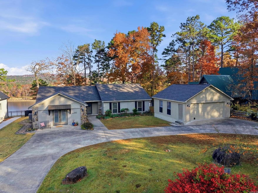
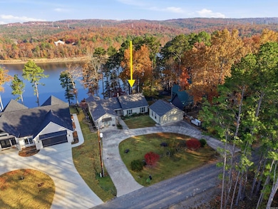
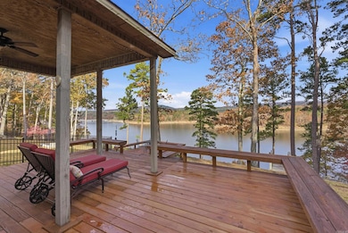

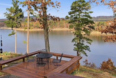
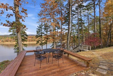
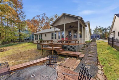
Looking for a Clean & Well maintained Lakefront Home? This is it!! All one-level home with 4 bedrooms, 3 full bathrooms, Lake access & wide open Lake Views with the white line in the water! This Sought after neighborhood has a community boat ramp & a private airstrip. The current owner has made so many updates including all new Energy Star windows , add a Detached 2-car garage, New Roof installed (Summer 2025), hickory engineered hardwood flooring with tiled bathrooms installed, & new water heater added (Summer 2025). See list online under "docs" to see the list of the furniture items that will stay. Washer, Dryer, Refrigerator, oven, & microwave will all stay as well. Multiple decks in your backyard to enjoy the views all year long, plus steps to the lake where you can launch your kayak or paddle boards!
| Date | Type | Sale Price | Title Company |
|---|---|---|---|
| Warranty Deed | $515,000 | First National Title | |
| Warranty Deed | $312,000 | -- | |
| Warranty Deed | $258,000 | -- | |
| Deed | -- | -- |
| Date | Status | Loan Amount | Loan Type |
|---|---|---|---|
| Previous Owner | $249,600 | New Conventional |
| Date | Event | Price | List to Sale | Price per Sq Ft |
|---|---|---|---|---|
| 12/30/2025 12/30/25 | Sold | $515,000 | -0.8% | $234 / Sq Ft |
| 11/25/2025 11/25/25 | For Sale | $519,000 | -- | $236 / Sq Ft |
| Year | Tax Paid | Tax Assessment Tax Assessment Total Assessment is a certain percentage of the fair market value that is determined by local assessors to be the total taxable value of land and additions on the property. | Land | Improvement |
|---|---|---|---|---|
| 2025 | $3,452 | $104,707 | $26,000 | $78,707 |
| 2024 | $2,501 | $77,543 | $20,000 | $57,543 |
| 2023 | $3,001 | $77,543 | $20,000 | $57,543 |
| 2022 | $3,101 | $77,543 | $20,000 | $57,543 |
| 2021 | $2,925 | $73,004 | $22,000 | $51,004 |
| 2020 | $2,925 | $73,004 | $22,000 | $51,004 |
| 2019 | $2,925 | $73,004 | $22,000 | $51,004 |
| 2018 | $2,925 | $73,004 | $22,000 | $51,004 |
| 2017 | $2,804 | $73,004 | $22,000 | $51,004 |
| 2016 | $2,559 | $63,529 | $26,000 | $37,529 |
| 2015 | $2,459 | $63,529 | $26,000 | $37,529 |
| 2014 | -- | $63,529 | $26,000 | $37,529 |
Seller's Agent in 2025
Amber Wilson
Donham Realty
(901) 283-4339
269 Total Sales
M
Buyer's Agent in 2025
Mandy Gail
Compass Rose Realty
(870) 243-5544
96 Total Sales
Source: Cooperative Arkansas REALTORS® MLS
MLS Number: 25046968
APN: 002-08606-002
Disclaimer: Certain information contained herein is derived from information provided by parties other than Homes.com. All information provided is deemed reliable, but is not guaranteed to be accurate and should be independently verified.
![]() IDX information is provided exclusively for personal, non-commercial use, and may not be used for any purpose other than to identify prospective properties consumers may be interested in purchasing.
IDX information is provided exclusively for personal, non-commercial use, and may not be used for any purpose other than to identify prospective properties consumers may be interested in purchasing.
Ask me questions while you tour the home.