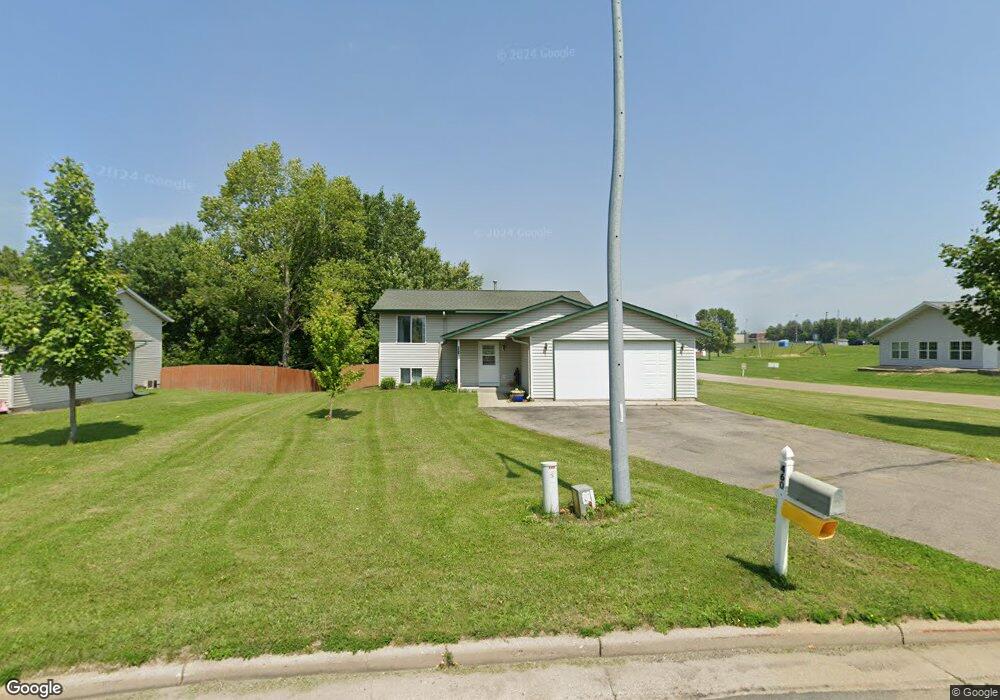
460 High Pointe Dr Ellsworth, WI 54011
Estimated Value: $321,000 - $347,000
4
Beds
2
Baths
--
Sq Ft
16,988
Sq Ft Lot
About This Home
This home is located at 460 High Pointe Dr, Ellsworth, WI 54011 and is currently estimated at $334,367. 460 High Pointe Dr is a home located in Pierce County with nearby schools including Ellsworth High School.
Ownership History
Date
Name
Owned For
Owner Type
Purchase Details
Closed on
Oct 26, 2020
Sold by
Figi Adam E
Bought by
Figi Adam E and Figi Tessa
Current Estimated Value
Purchase Details
Closed on
Apr 8, 2016
Sold by
Betzel Gregory J
Bought by
Figi Adam E
Home Financials for this Owner
Home Financials are based on the most recent Mortgage that was taken out on this home.
Original Mortgage
$153,900
Outstanding Balance
$120,596
Interest Rate
3.68%
Mortgage Type
Purchase Money Mortgage
Estimated Equity
$213,772
Purchase Details
Closed on
Aug 25, 2006
Sold by
Schroeder Kent and Schroeder Kristine
Bought by
Betzel Gregory J
Home Financials for this Owner
Home Financials are based on the most recent Mortgage that was taken out on this home.
Original Mortgage
$124,000
Interest Rate
6.78%
Mortgage Type
New Conventional
Create a Home Valuation Report for This Property
The Home Valuation Report is an in-depth analysis detailing your home's value as well as a comparison with similar homes in the area
Home Values in the Area
Average Home Value in this Area
Purchase History
| Date | Buyer | Sale Price | Title Company |
|---|---|---|---|
| Figi Adam E | -- | Knight Barry Title | |
| Figi Adam E | $162,000 | Pierce County Abstract & Tit | |
| Betzel Gregory J | $164,000 | None Available |
Source: Public Records
Mortgage History
| Date | Status | Borrower | Loan Amount |
|---|---|---|---|
| Open | Figi Adam E | $153,900 | |
| Previous Owner | Betzel Gregory J | $124,000 |
Source: Public Records
Tax History
| Year | Tax Paid | Tax Assessment Tax Assessment Total Assessment is a certain percentage of the fair market value that is determined by local assessors to be the total taxable value of land and additions on the property. | Land | Improvement |
|---|---|---|---|---|
| 2025 | $5,110 | $255,100 | $37,900 | $217,200 |
| 2024 | $4,847 | $255,100 | $37,900 | $217,200 |
| 2023 | $4,496 | $255,100 | $37,900 | $217,200 |
| 2022 | $3,995 | $255,100 | $37,900 | $217,200 |
| 2021 | $3,366 | $147,000 | $32,000 | $115,000 |
| 2020 | $3,352 | $147,000 | $32,000 | $115,000 |
| 2019 | $3,288 | $147,000 | $32,000 | $115,000 |
| 2018 | $3,343 | $147,000 | $32,000 | $115,000 |
| 2017 | $3,346 | $147,000 | $32,000 | $115,000 |
| 2016 | $3,205 | $141,600 | $32,000 | $109,600 |
| 2015 | $2,978 | $141,600 | $32,000 | $109,600 |
| 2014 | $2,793 | $141,600 | $32,000 | $109,600 |
| 2013 | $3,029 | $141,600 | $32,000 | $109,600 |
Source: Public Records
Map
Nearby Homes
- 195 W Humble Ave
- 638 W Dale St
- 236 S Chestnut St
- 232 S Chestnut St
- 234 S Chestnut St
- 230 S Chestnut St
- N5129 732nd St
- 641 W Main St
- N5170 732nd St
- 137 N Oak St
- 375A W Kinne St
- N5190 732nd St
- 118 Bay St
- N5200 732nd St
- N5111 738th St
- 770 W Hill St
- N5161 738th St
- W7429 510th Ave
- 146 E Main St
- 195 W Grove St
- 460 High Pointe Dr
- 460 High Point Dr
- 466 High Pointe Dr
- 466 High Point Dr
- 472 472 W High Point Dr
- 472 High Pointe Dr
- 472 High Point Dr
- 478 High Point Dr
- 478 High Pointe Dr
- 762 S Maple St
- 484 High Pointe Dr
- 712 S Maple St
- 630 S Maple St
- 624 S Maple St
- 490 High Pointe Dr
- 705 S Maple St
- 713 S Maple St
- 498 High Pointe Dr
- 723 S Maple St
Your Personal Tour Guide
Ask me questions while you tour the home.