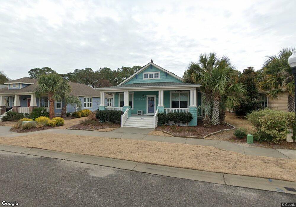
460 Lord Charles Dr Southport, NC 28461
Estimated Value: $556,766 - $663,000
3
Beds
2
Baths
1,728
Sq Ft
$348/Sq Ft
Est. Value
About This Home
This home is located at 460 Lord Charles Dr, Southport, NC 28461 and is currently estimated at $600,942, approximately $347 per square foot. 460 Lord Charles Dr is a home with nearby schools including Southport Elementary School, South Brunswick Middle School, and South Brunswick High School.
Ownership History
Date
Name
Owned For
Owner Type
Purchase Details
Closed on
May 19, 2014
Sold by
Cardinal Builders Co
Bought by
Gould Mary Gail
Current Estimated Value
Home Financials for this Owner
Home Financials are based on the most recent Mortgage that was taken out on this home.
Original Mortgage
$219,500
Outstanding Balance
$167,970
Interest Rate
4.44%
Mortgage Type
New Conventional
Estimated Equity
$432,972
Create a Home Valuation Report for This Property
The Home Valuation Report is an in-depth analysis detailing your home's value as well as a comparison with similar homes in the area
Home Values in the Area
Average Home Value in this Area
Purchase History
| Date | Buyer | Sale Price | Title Company |
|---|---|---|---|
| Gould Mary Gail | $280,000 | None Available |
Source: Public Records
Mortgage History
| Date | Status | Borrower | Loan Amount |
|---|---|---|---|
| Open | Gould Mary Gail | $219,500 |
Source: Public Records
Tax History Compared to Growth
Tax History
| Year | Tax Paid | Tax Assessment Tax Assessment Total Assessment is a certain percentage of the fair market value that is determined by local assessors to be the total taxable value of land and additions on the property. | Land | Improvement |
|---|---|---|---|---|
| 2025 | $3,748 | $512,660 | $80,000 | $432,660 |
| 2024 | $3,748 | $512,660 | $80,000 | $432,660 |
| 2023 | $3,331 | $512,660 | $80,000 | $432,660 |
| 2022 | $3,331 | $340,050 | $65,000 | $275,050 |
| 2021 | $2,928 | $340,050 | $65,000 | $275,050 |
| 2020 | $2,928 | $340,050 | $65,000 | $275,050 |
| 2019 | $2,928 | $66,250 | $65,000 | $1,250 |
| 2018 | $2,410 | $61,430 | $60,000 | $1,430 |
| 2017 | $2,397 | $61,430 | $60,000 | $1,430 |
| 2016 | $2,234 | $61,430 | $60,000 | $1,430 |
| 2015 | $2,234 | $276,900 | $60,000 | $216,900 |
| 2014 | $228 | $30,000 | $30,000 | $0 |
Source: Public Records
Map
Nearby Homes
- 813 Cades Trail
- 818 Cades Trail
- 304 W 11th St
- 1100 Spincast Rd
- 1028 Downrigger Trail
- 1200 N Caswell Ave
- 420 Cades Trail
- 1214 N Caswell Ave
- Lot 5b Hankinsville Rd
- 1218 N Caswell Ave
- 114 W 14th St Unit B
- 1313 N Howe St
- Tr-2 W 9th St
- Tr-1 W 9th St
- 1676 N Howe St
- 2008 Robert Ruark Dr SE
- 2451 Lake Ridge Dr
- 27 Lots N Caswell Ave
- 2443 Lake Ridge Dr
- 1110 Caney Ct
- 456 Lord Charles Dr
- 464 Lord Charles Dr
- 468 Lord Charles Dr
- 452 Lord Charles Dr
- 448 Lord Charles Dr
- 472 Lord Charles Dr
- 444 Lord Charles Dr
- 809 Cades Trail
- 809 Cades Trail
- 811 Cades Trail
- 807 Cades Trail
- 440 Lord Charles Dr
- 805 Cades Trail
- 815 Cades Trail
- 815 Cades Trail
- 832 Cades Trail
- 844 Cades Trail
- 840 Cades Trail
- 836 Cades Trail
- 1136 Delaware St