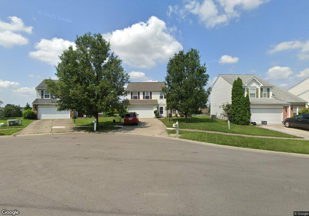
460 Mcdaniels Ln Springboro, OH 45066
Estimated Value: $298,375 - $328,000
3
Beds
3
Baths
1,481
Sq Ft
$214/Sq Ft
Est. Value
About This Home
This home is located at 460 Mcdaniels Ln, Springboro, OH 45066 and is currently estimated at $317,594, approximately $214 per square foot. 460 Mcdaniels Ln is a home located in Montgomery County with nearby schools including Clearcreek Elementary School, Springboro Intermediate School, and Springboro Junior High School.
Ownership History
Date
Name
Owned For
Owner Type
Purchase Details
Closed on
Jun 30, 2003
Sold by
Mazurek Aaron L and Mazurek Kelly B
Bought by
Schweisthal Jason F
Current Estimated Value
Home Financials for this Owner
Home Financials are based on the most recent Mortgage that was taken out on this home.
Original Mortgage
$137,250
Interest Rate
5.3%
Mortgage Type
Balloon
Purchase Details
Closed on
Mar 10, 2000
Sold by
N V R Inc
Bought by
Mazurek Aaron L and Mazurek Kelly B
Home Financials for this Owner
Home Financials are based on the most recent Mortgage that was taken out on this home.
Original Mortgage
$116,500
Interest Rate
7%
Mortgage Type
New Conventional
Purchase Details
Closed on
Dec 29, 1999
Sold by
Henderson Const Inc
Bought by
N V R Inc
Create a Home Valuation Report for This Property
The Home Valuation Report is an in-depth analysis detailing your home's value as well as a comparison with similar homes in the area
Purchase History
| Date | Buyer | Sale Price | Title Company |
|---|---|---|---|
| Schweisthal Jason F | $153,000 | First Title Agency Inc | |
| Mazurek Aaron L | $129,865 | -- | |
| N V R Inc | $23,800 | -- |
Source: Public Records
Mortgage History
| Date | Status | Borrower | Loan Amount |
|---|---|---|---|
| Previous Owner | Schweisthal Jason F | $137,250 | |
| Previous Owner | Mazurek Aaron L | $116,500 |
Source: Public Records
Tax History
| Year | Tax Paid | Tax Assessment Tax Assessment Total Assessment is a certain percentage of the fair market value that is determined by local assessors to be the total taxable value of land and additions on the property. | Land | Improvement |
|---|---|---|---|---|
| 2025 | $3,107 | $79,560 | $20,790 | $58,770 |
| 2024 | $3,107 | $79,560 | $20,790 | $58,770 |
| 2023 | $2,646 | $62,139 | $12,267 | $49,871 |
| 2022 | $2,607 | $62,139 | $12,268 | $49,872 |
| 2021 | $2,426 | $62,139 | $12,268 | $49,872 |
| 2020 | $2,352 | $52,658 | $10,395 | $42,263 |
| 2019 | $2,169 | $52,658 | $10,395 | $42,263 |
| 2018 | $2,170 | $52,658 | $10,395 | $42,263 |
| 2017 | $2,051 | $44,818 | $9,328 | $35,490 |
| 2016 | $2,139 | $44,818 | $9,328 | $35,490 |
| 2015 | $2,143 | $44,818 | $9,328 | $35,490 |
| 2014 | $2,056 | $40,740 | $8,480 | $32,260 |
| 2013 | $2,055 | $49,940 | $10,400 | $39,540 |
Source: Public Records
Map
Nearby Homes
- 25 Blose Ct
- 33 Christman Dr
- 80 Villa Pointe Dr
- 217 Meadow Dr
- 5 Orville Ct
- 165 Meadows Dr
- 80 Gregg Ct
- 250 Ballard Dr
- 10084 Gully Pass Dr Unit 248
- 10084 Gully Pass Dr
- 2002 Glen Valley Dr
- 10010 Washington Glen Dr
- 2005 Glen Valley Dr Unit 210
- 2005 Glen Valley Dr
- 10109 Gully Pass Dr Unit 250
- 10213 Gully Pass Dr Unit 251
- 123 Rippling Brook Ln
- 182 Rippling Brook Ln
- 160 Old Pond Rd
- 1101 Parklake Row
- 450 Mcdaniels Ln
- 470 Mcdaniels Ln
- 440 Mcdaniels Ln
- 80 Sweeney Ct
- 480 Mcdaniels Ln
- 70 Sweeney Ct
- 70 Sweeney Ct
- 90 Sweeney Ct
- 475 Mcdaniels Ln
- 60 Sweeney Ct
- 420 Mcdaniels Ln
- 445 Mcdaniels Ln
- 445 Mcdaniels Ln
- 425 Mcdaniels Ln
- 465 Mcdaniels Ln
- 455 Mcdaniels Ln
- 50 Sweeney Ct
- 410 Mcdaniels Ln
- 415 Mcdaniels Ln
- 95 Sweeney Ct
Your Personal Tour Guide
Ask me questions while you tour the home.