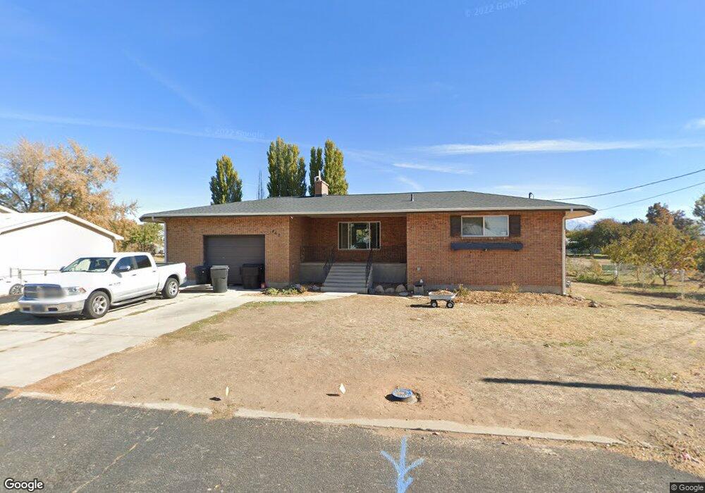
460 N 3500 W Clearfield, UT 84015
Estimated Value: $394,000 - $508,000
--
Bed
2
Baths
1,552
Sq Ft
$306/Sq Ft
Est. Value
About This Home
This home is located at 460 N 3500 W, Clearfield, UT 84015 and is currently estimated at $475,161, approximately $306 per square foot. 460 N 3500 W is a home located in Davis County with nearby schools including West Point School, West Point Junior High School, and Syracuse High School.
Ownership History
Date
Name
Owned For
Owner Type
Purchase Details
Closed on
Nov 16, 2022
Sold by
My Rock Of Gibraltar Llc
Bought by
Valentin-Ortiz Jorge Luis and Valentin Erln Audrey
Current Estimated Value
Home Financials for this Owner
Home Financials are based on the most recent Mortgage that was taken out on this home.
Original Mortgage
$350,000
Outstanding Balance
$338,774
Interest Rate
6.94%
Mortgage Type
VA
Estimated Equity
$136,387
Purchase Details
Closed on
May 13, 2019
Sold by
Porter Kevin
Bought by
My Rock Of Gibraltar Llc
Purchase Details
Closed on
Nov 2, 2005
Sold by
Freston Alice Diane
Bought by
Porter Kevin
Create a Home Valuation Report for This Property
The Home Valuation Report is an in-depth analysis detailing your home's value as well as a comparison with similar homes in the area
Home Values in the Area
Average Home Value in this Area
Purchase History
| Date | Buyer | Sale Price | Title Company |
|---|---|---|---|
| Valentin-Ortiz Jorge Luis | -- | American First Escrow And Titl | |
| My Rock Of Gibraltar Llc | -- | None Available | |
| Porter Kevin | -- | -- | |
| Freston Alice Diane | -- | -- |
Source: Public Records
Mortgage History
| Date | Status | Borrower | Loan Amount |
|---|---|---|---|
| Open | Valentin-Ortiz Jorge Luis | $350,000 |
Source: Public Records
Tax History Compared to Growth
Tax History
| Year | Tax Paid | Tax Assessment Tax Assessment Total Assessment is a certain percentage of the fair market value that is determined by local assessors to be the total taxable value of land and additions on the property. | Land | Improvement |
|---|---|---|---|---|
| 2025 | -- | $233,200 | $146,491 | $86,709 |
| 2024 | -- | $234,300 | $131,690 | $102,610 |
| 2023 | $2,484 | $399,000 | $176,347 | $222,653 |
| 2022 | $2,484 | $428,000 | $173,314 | $254,686 |
| 2021 | $2,546 | $361,000 | $135,398 | $225,602 |
| 2020 | $1,865 | $261,000 | $116,124 | $144,876 |
| 2019 | $1,826 | $252,000 | $111,949 | $140,051 |
| 2018 | $1,677 | $228,000 | $106,828 | $121,172 |
| 2016 | $1,499 | $107,250 | $41,555 | $65,695 |
| 2015 | $1,695 | $114,895 | $41,555 | $73,340 |
| 2014 | $1,816 | $124,877 | $41,555 | $83,322 |
| 2013 | -- | $84,663 | $34,653 | $50,010 |
Source: Public Records
Map
Nearby Homes
- 399 N 3425 W
- 3187 W 525 N
- 3212 W 600 N
- Charleston Plan at Bluff View
- 488 N 3100 W
- 114 3830 W
- 2633 N 2080 W Unit 180
- 2623 N 2080 W Unit 178
- 380 S 4300 W Unit 608
- 997 N 5100 W Unit 213
- 2619 N 2080 W Unit 177
- 2627 N 2080 W Unit 179
- 3232 W 375 N Unit 7
- 3258 W 375 N Unit 9
- 260 W Antelope Dr S
- 4200 W 800 N
- 9 S 3830 W Unit 441
- 357 N 4000 W
- 27 S 3830 W Unit 437
- 28 S 3830 W Unit 424