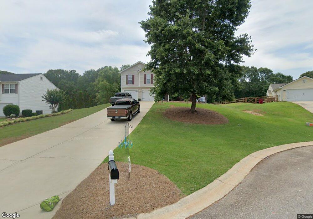
460 Raymond Dr Winder, GA 30680
Estimated Value: $315,015 - $329,000
3
Beds
3
Baths
1,635
Sq Ft
$198/Sq Ft
Est. Value
About This Home
This home is located at 460 Raymond Dr, Winder, GA 30680 and is currently estimated at $323,254, approximately $197 per square foot. 460 Raymond Dr is a home located in Barrow County with nearby schools including Holsenbeck Elementary School, Bear Creek Middle School, and Winder-Barrow High School.
Ownership History
Date
Name
Owned For
Owner Type
Purchase Details
Closed on
Feb 8, 2018
Sold by
Swenson Nicole L
Bought by
Swenson Nicole L and Swenson Stephen P
Current Estimated Value
Purchase Details
Closed on
Jul 29, 2003
Sold by
Southfork Homes Inc
Bought by
Swenson Nicole L
Home Financials for this Owner
Home Financials are based on the most recent Mortgage that was taken out on this home.
Original Mortgage
$116,623
Interest Rate
5.17%
Mortgage Type
FHA
Purchase Details
Closed on
Mar 5, 2003
Sold by
Patterson Phillip Ra
Bought by
Southfork Homes Inc
Create a Home Valuation Report for This Property
The Home Valuation Report is an in-depth analysis detailing your home's value as well as a comparison with similar homes in the area
Home Values in the Area
Average Home Value in this Area
Purchase History
| Date | Buyer | Sale Price | Title Company |
|---|---|---|---|
| Swenson Nicole L | -- | -- | |
| Swenson Nicole L | $118,500 | -- | |
| Southfork Homes Inc | $100,000 | -- |
Source: Public Records
Mortgage History
| Date | Status | Borrower | Loan Amount |
|---|---|---|---|
| Previous Owner | Swenson Nicole L | $116,623 |
Source: Public Records
Tax History
| Year | Tax Paid | Tax Assessment Tax Assessment Total Assessment is a certain percentage of the fair market value that is determined by local assessors to be the total taxable value of land and additions on the property. | Land | Improvement |
|---|---|---|---|---|
| 2025 | $2,630 | $112,756 | $26,000 | $86,756 |
| 2024 | $2,717 | $110,214 | $26,000 | $84,214 |
| 2023 | $2,944 | $104,414 | $19,800 | $84,614 |
| 2022 | $2,238 | $78,590 | $19,800 | $58,790 |
| 2021 | $2,005 | $66,736 | $16,000 | $50,736 |
| 2020 | $1,889 | $62,830 | $16,000 | $46,830 |
| 2019 | $1,634 | $62,830 | $16,000 | $46,830 |
| 2018 | $1,793 | $59,431 | $14,000 | $45,431 |
| 2017 | $1,180 | $40,531 | $10,000 | $30,531 |
| 2016 | $1,194 | $40,874 | $10,000 | $30,874 |
| 2015 | $1,210 | $41,216 | $10,000 | $31,216 |
| 2014 | $1,111 | $37,732 | $6,174 | $31,558 |
| 2013 | -- | $36,188 | $6,174 | $30,014 |
Source: Public Records
Map
Nearby Homes
- 973 Vera Ct
- 917 Justin Dr Unit 3
- 246 Pleasant Hill Church Rd NE
- 388 Kay Dr Unit 1
- 0 Bowman Mill Rd NE Unit 7698431
- 0 Bowman Mill Rd NE Unit 10664956
- 1200 Breckinridge Trail
- 614 Anns Way
- 1553 Shoal Creek Dr
- 1556 Shoal Creek Dr
- 508 Pleasant Hill Church Rd NE
- 83 Beech Creek Cir
- 56 Candler Park Ct
- 91 Beech Creek Cir
- 99 Beech Creek Cir
- 105 Beech Creek Cir
- 315 Paige Way
- 29 Nunnally Rd SE
- 16 Fox Dr
- 160 Azalea Dr
- 458 Raymond Dr
- 462 Raymond Dr
- 456 Raymond Dr
- 464 Raymond Dr
- 461 Raymond Dr
- 454 Raymond Dr
- 466 Raymond Dr
- 466 Raymond Dr Unit 26
- 457 Raymond Dr
- 452 Raymond Dr
- 468 Raymond Dr
- 469 Raymond Dr Unit 37
- 469 Raymond Dr
- 470 Raymond Dr
- 450 Raymond Dr
- 451 Raymond Dr
- 472 Raymond Dr
- 448 Raymond Dr
- 485 Raymond Dr Unit 35
- 485 Raymond Dr
Your Personal Tour Guide
Ask me questions while you tour the home.