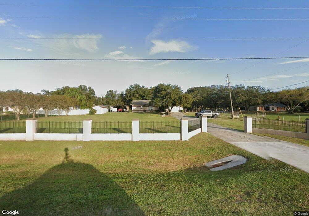
460 Rifle Range Rd Bartow, FL 33830
Estimated Value: $339,000 - $448,000
3
Beds
3
Baths
2,446
Sq Ft
$167/Sq Ft
Est. Value
About This Home
This home is located at 460 Rifle Range Rd, Bartow, FL 33830 and is currently estimated at $409,174, approximately $167 per square foot. 460 Rifle Range Rd is a home located in Polk County with nearby schools including Alturas Elementary School, Bartow Elementary Academy, and Union Academy.
Ownership History
Date
Name
Owned For
Owner Type
Purchase Details
Closed on
Apr 10, 2017
Sold by
Deutsche Bank National Trust Co
Bought by
Gerber Adam and Gerber Andrea
Current Estimated Value
Home Financials for this Owner
Home Financials are based on the most recent Mortgage that was taken out on this home.
Original Mortgage
$124,400
Outstanding Balance
$103,773
Interest Rate
4.3%
Mortgage Type
New Conventional
Estimated Equity
$305,401
Purchase Details
Closed on
Dec 8, 2015
Sold by
Zamarripa Maria E
Bought by
Deutsche Bank National Trust Company
Create a Home Valuation Report for This Property
The Home Valuation Report is an in-depth analysis detailing your home's value as well as a comparison with similar homes in the area
Home Values in the Area
Average Home Value in this Area
Purchase History
| Date | Buyer | Sale Price | Title Company |
|---|---|---|---|
| Gerber Adam | $131,000 | Premium Title Services Inc | |
| Deutsche Bank National Trust Company | $114,100 | None Available |
Source: Public Records
Mortgage History
| Date | Status | Borrower | Loan Amount |
|---|---|---|---|
| Open | Gerber Adam | $124,400 |
Source: Public Records
Tax History Compared to Growth
Tax History
| Year | Tax Paid | Tax Assessment Tax Assessment Total Assessment is a certain percentage of the fair market value that is determined by local assessors to be the total taxable value of land and additions on the property. | Land | Improvement |
|---|---|---|---|---|
| 2025 | $2,644 | $196,206 | -- | -- |
| 2024 | $2,468 | $190,676 | -- | -- |
| 2023 | $2,468 | $185,122 | $0 | $0 |
| 2022 | $2,376 | $179,730 | $0 | $0 |
| 2021 | $2,371 | $174,495 | $0 | $0 |
| 2020 | $2,333 | $172,086 | $0 | $0 |
| 2018 | $1,986 | $145,741 | $29,000 | $116,741 |
| 2017 | $2,476 | $141,733 | $0 | $0 |
| 2016 | $2,454 | $139,434 | $0 | $0 |
| 2015 | $782 | $89,845 | $0 | $0 |
| 2014 | $1,090 | $89,132 | $0 | $0 |
Source: Public Records
Map
Nearby Homes
- 537 Heather Ct
- 7208 Thomas Jefferson Cir W
- 113 Patrick Henry Rd
- 408 Old Bartow Lake Wales Rd
- 457 Adriel Ave
- 0 S Rifle Range Rd Unit MFRL4940247
- 0 Monroe Dr
- 2414 Gerber Dairy Rd
- 371 Highlands Way
- 340 S Hankin Rd
- 0 Patricia Dr Unit MFRL4948414
- 1140 Jody Rd
- 215 10th Wahneta St W
- 482 Elliott Rd
- 306 Avenue A E
- 3548 Elliott Rd
- 3552 Elliott Rd
- 0 Gerber Dairy Rd Unit MFRO6269500
- 0 Gerber Dairy Rd Unit MFRO6269494
- 0 Gerber Dairy Rd Unit MFRO6269496
- 5089 Rifle Range Rd
- 5125 Rifle Range Rd
- 420 Rifle Range Rd
- 508 Rifle Range Rd
- 485 Heather Ct
- 495 Heather Ct
- 475 Heather Ct
- 505 Heather Ct
- 5161 Rifle Range Rd
- 0 Rifle Range Rd Unit P4901074
- 0 Rifle Range Rd Unit L4922883
- 0 Rifle Range Rd Unit P4904465
- 515 Heather Ct
- 480 Heather Ct
- 512 Rifle Range Rd
- 5021 Rifle Range Rd
- 445 Heather Ct
- 525 Heather Ct
- 270 Rifle Range Rd
- 490 Heather Ct