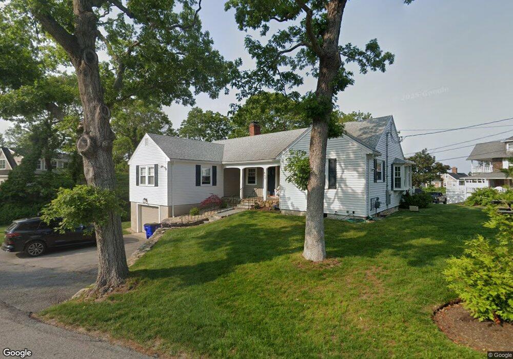
460 Williston Rd Sagamore Beach, MA 02562
Estimated Value: $872,000 - $1,069,247
2
Beds
3
Baths
1,260
Sq Ft
$741/Sq Ft
Est. Value
About This Home
This home is located at 460 Williston Rd, Sagamore Beach, MA 02562 and is currently estimated at $933,812, approximately $741 per square foot. 460 Williston Rd is a home located in Barnstable County with nearby schools including Bourne High School, Bridgeview Montessori School, and New Testament Christian School.
Ownership History
Date
Name
Owned For
Owner Type
Purchase Details
Closed on
Aug 28, 2023
Sold by
English Philip and English Brenda L
Bought by
106 Concord Ave Rlty Llc
Current Estimated Value
Purchase Details
Closed on
Apr 18, 2023
Sold by
Leire Thomas A and Leire Jennifer F
Bought by
English Philip and English Brenda L
Home Financials for this Owner
Home Financials are based on the most recent Mortgage that was taken out on this home.
Original Mortgage
$599,200
Interest Rate
6.13%
Mortgage Type
Purchase Money Mortgage
Purchase Details
Closed on
Aug 17, 2012
Sold by
Julia M Wuethrich Ft and Wuethrich
Bought by
Leire Thomas A and Liere Jennifer F
Home Financials for this Owner
Home Financials are based on the most recent Mortgage that was taken out on this home.
Original Mortgage
$312,000
Interest Rate
3.67%
Mortgage Type
New Conventional
Purchase Details
Closed on
Jul 11, 2008
Sold by
Wuethrich Julia M
Bought by
Julia M Wuethrich Ft and Wuethrich
Create a Home Valuation Report for This Property
The Home Valuation Report is an in-depth analysis detailing your home's value as well as a comparison with similar homes in the area
Home Values in the Area
Average Home Value in this Area
Purchase History
| Date | Buyer | Sale Price | Title Company |
|---|---|---|---|
| 106 Concord Ave Rlty Llc | $769,000 | None Available | |
| 106 Concord Ave Rlty Llc | $769,000 | None Available | |
| English Philip | $749,000 | None Available | |
| English Philip | $749,000 | None Available | |
| Leire Thomas A | $390,000 | -- | |
| Leire Thomas A | $390,000 | -- | |
| Julia M Wuethrich Ft | -- | -- | |
| Julia M Wuethrich Ft | -- | -- |
Source: Public Records
Mortgage History
| Date | Status | Borrower | Loan Amount |
|---|---|---|---|
| Previous Owner | English Philip | $599,200 | |
| Previous Owner | Leire Thomas A | $312,000 |
Source: Public Records
Tax History Compared to Growth
Tax History
| Year | Tax Paid | Tax Assessment Tax Assessment Total Assessment is a certain percentage of the fair market value that is determined by local assessors to be the total taxable value of land and additions on the property. | Land | Improvement |
|---|---|---|---|---|
| 2025 | $7,493 | $959,400 | $632,400 | $327,000 |
| 2024 | $6,487 | $808,800 | $602,300 | $206,500 |
| 2023 | $4,724 | $536,200 | $325,700 | $210,500 |
| 2022 | $4,594 | $455,300 | $288,300 | $167,000 |
| 2021 | $4,463 | $414,400 | $262,300 | $152,100 |
| 2020 | $4,344 | $404,500 | $259,800 | $144,700 |
| 2019 | $4,166 | $396,400 | $259,800 | $136,600 |
| 2018 | $3,908 | $370,800 | $247,500 | $123,300 |
| 2017 | $3,650 | $354,400 | $245,200 | $109,200 |
| 2016 | $3,579 | $352,300 | $245,200 | $107,100 |
| 2015 | $3,548 | $352,300 | $245,200 | $107,100 |
Source: Public Records
Map
Nearby Homes
- 5 Pocasset Rd
- 10 Tecumseh Rd
- 20 Brady Rd
- 133 Phillips Rd
- 5 Oakwood Dr
- 67 Phillips Rd
- 67 Phillips Rd
- 1 Wildwood Ln Unit D
- 368 Old Plymouth Rd
- 0 State Rd
- 29 Sheppard Rd
- 11 Village Green Dr Unit B
- 18 Ocean Pines Dr Unit A
- 18 Ocean Pines Dr Unit B
- 16 Ocean Pines Dr Unit B
- 26 Spencer Dr
- 42 Siasconset Dr
- 38 Siasconset Dr
- 4 Fieldwood Dr
- 4 Fieldwood Dr
- 460 Williston Rd
- 453 Williston Rd
- 47 Samoset Rd
- 461 Williston Rd
- 1 Hawes Rd
- 462 Williston Rd
- 4 Hawes Rd
- 5 Hawes Rd
- 49 Samoset Rd
- 20 Wampanoag Rd
- 22 Wampanoag Rd Unit Y/Round
- 22 Wampanoag Rd
- 22 Wampanoag Rd Unit 24
- 10 Wampanoag Rd
- 470 Williston Rd
- 449 Williston Rd
- 22-24 Wampanoag Rd
- 20 Wampanoag Rd
- 56 Samoset Rd
- 11 Hawes Rd