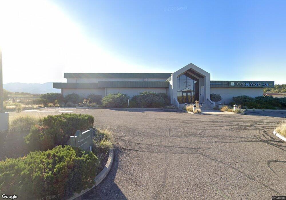
4600 S Genesis Dr Cottonwood, AZ 86326
--
Bed
--
Bath
27,964
Sq Ft
10.08
Acres
About This Home
This home is located at 4600 S Genesis Dr, Cottonwood, AZ 86326. 4600 S Genesis Dr is a home located in Yavapai County with nearby schools including Dr Daniel Bright Elementary School, Cottonwood Elementary School, and Cottonwood Community School.
Ownership History
Date
Name
Owned For
Owner Type
Purchase Details
Closed on
Jun 11, 2021
Sold by
Flynn Robert G
Bought by
Hollister Cottonwood Llc
Purchase Details
Closed on
Jan 23, 2004
Sold by
Flynn Robert
Bought by
Flynn Robert G
Home Financials for this Owner
Home Financials are based on the most recent Mortgage that was taken out on this home.
Original Mortgage
$269,250
Interest Rate
5.79%
Mortgage Type
New Conventional
Purchase Details
Closed on
Dec 29, 2003
Sold by
G M Fratelli Llc
Bought by
Arizona Public Service Co
Home Financials for this Owner
Home Financials are based on the most recent Mortgage that was taken out on this home.
Original Mortgage
$269,250
Interest Rate
5.79%
Mortgage Type
New Conventional
Purchase Details
Closed on
Jul 29, 2003
Sold by
Mongini House I
Bought by
G M Fratelli Llc
Create a Home Valuation Report for This Property
The Home Valuation Report is an in-depth analysis detailing your home's value as well as a comparison with similar homes in the area
Home Values in the Area
Average Home Value in this Area
Purchase History
| Date | Buyer | Sale Price | Title Company |
|---|---|---|---|
| Hollister Cottonwood Llc | -- | None Listed On Document | |
| Flynn Robert G | -- | Transnation Title Ins Co | |
| Arizona Public Service Co | $1,089,000 | Transnation Title | |
| G M Fratelli Llc | -- | Transnation Title Ins Co |
Source: Public Records
Mortgage History
| Date | Status | Borrower | Loan Amount |
|---|---|---|---|
| Previous Owner | Flynn Robert G | $269,250 |
Source: Public Records
Tax History Compared to Growth
Tax History
| Year | Tax Paid | Tax Assessment Tax Assessment Total Assessment is a certain percentage of the fair market value that is determined by local assessors to be the total taxable value of land and additions on the property. | Land | Improvement |
|---|---|---|---|---|
| 2026 | $19,962 | -- | -- | -- |
| 2024 | $19,754 | -- | -- | -- |
| 2023 | $19,754 | $304,398 | $31,000 | $273,398 |
| 2022 | $20,027 | $184,091 | $13,041 | $171,050 |
| 2021 | $21,098 | $138,260 | $11,855 | $126,405 |
| 2020 | $21,206 | $0 | $0 | $0 |
| 2019 | $20,740 | $0 | $0 | $0 |
| 2018 | $20,361 | $0 | $0 | $0 |
| 2017 | $19,830 | $0 | $0 | $0 |
| 2016 | $20,575 | $0 | $0 | $0 |
| 2015 | $24,217 | $0 | $0 | $0 |
| 2014 | $22,426 | $0 | $0 | $0 |
Source: Public Records
Map
Nearby Homes
- 6000 E Coury Dr
- 00 S Misty Ln
- 0000 Highway 260
- 4000 Mahoney Rd
- 3836 W Center Ln
- 3780 W Northern Ave
- 1750 Highway 260
- 0000 S Heritage Trail
- 4380 E Prairie Ln
- 2780 S Rio Verde Dr
- 4249 E Vista Dr
- 2694 S Cliff View Dr
- 0 Riverbend Rd Unit 6935702
- 2743 Yuma Cir
- 2649 S Village Dr
- 4359 E Butte Dr
- 3619 Western Dr
- 2527 S Rio Verde Dr
- 3380 W Cloverleaf Ranch Rd
- 4253 E Mission Ln
- 02 Genesis Dr
- 0 Genesis Dr Unit 519108
- 4850 S Genesis Dr
- 0 Highway 260 Unit 102565
- 0 Highway 260 Unit 102561
- 0 Highway 260 Unit 102564
- 0 Highway 260 Unit 102562
- 0 Highway 260 Unit 102563
- 0 Highway 260 Unit 411628
- 0 Highway 260 Unit 113637
- 0 Highway 260 Unit 411081
- 0 Highway 260 Unit 411838
- 0 Highway 260 Unit 410182
- 0 Highway 260 Unit 410131
- 0 Highway 260 Unit 396043
- 0 Highway 260 Unit 373285
- 0 Highway 260 Unit 374578
- 0 Highway 260 Unit 365916
- 0 Highway 260 Unit 397452
- 0 Highway 260 Unit 386944