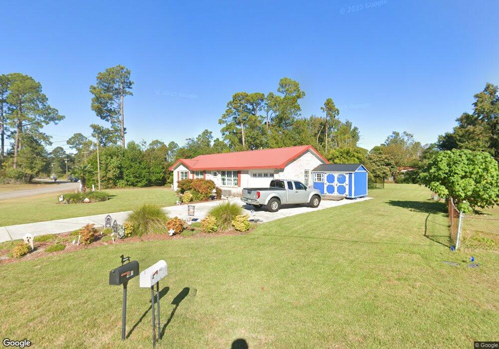
4601 Middlesex Rd Wilmington, NC 28405
Estimated Value: $257,000 - $295,000
3
Beds
2
Baths
1,040
Sq Ft
$266/Sq Ft
Est. Value
About This Home
This home is located at 4601 Middlesex Rd, Wilmington, NC 28405 and is currently estimated at $276,314, approximately $265 per square foot. 4601 Middlesex Rd is a home located in New Hanover County with nearby schools including Wrightsboro Elementary School, Holly Shelter Middle School, and Emsley A. Laney High School.
Ownership History
Date
Name
Owned For
Owner Type
Purchase Details
Closed on
Mar 12, 1998
Sold by
Eisgin Inc
Bought by
Burdette James H Lisa D
Current Estimated Value
Purchase Details
Closed on
Jul 16, 1997
Sold by
Williams Lennon Earl Estate
Bought by
Eisgin Inc
Purchase Details
Closed on
Feb 14, 1996
Sold by
Williams Lennon E
Bought by
Williams Lennon Earl Estate
Purchase Details
Closed on
Jan 2, 1996
Sold by
Williams Lennon E Emily
Bought by
Williams Lennon E
Purchase Details
Closed on
Sep 1, 1978
Bought by
Williams Lennon E Emily D
Create a Home Valuation Report for This Property
The Home Valuation Report is an in-depth analysis detailing your home's value as well as a comparison with similar homes in the area
Home Values in the Area
Average Home Value in this Area
Purchase History
| Date | Buyer | Sale Price | Title Company |
|---|---|---|---|
| Burdette James H Lisa D | $96,000 | -- | |
| Eisgin Inc | $73,000 | -- | |
| Williams Lennon Earl Estate | -- | -- | |
| Williams Lennon E | -- | -- | |
| Williams Lennon E Emily D | $11,000 | -- |
Source: Public Records
Tax History
| Year | Tax Paid | Tax Assessment Tax Assessment Total Assessment is a certain percentage of the fair market value that is determined by local assessors to be the total taxable value of land and additions on the property. | Land | Improvement |
|---|---|---|---|---|
| 2025 | $1,207 | $299,300 | $133,000 | $166,300 |
| 2023 | $1,021 | $182,400 | $77,300 | $105,100 |
| 2022 | $1,030 | $182,400 | $77,300 | $105,100 |
| 2021 | $1,011 | $182,400 | $77,300 | $105,100 |
| 2020 | $824 | $130,200 | $47,300 | $82,900 |
| 2019 | $824 | $130,200 | $47,300 | $82,900 |
| 2018 | $824 | $130,200 | $47,300 | $82,900 |
| 2017 | $843 | $130,200 | $47,300 | $82,900 |
| 2016 | $668 | $96,400 | $40,500 | $55,900 |
| 2015 | $621 | $96,400 | $40,500 | $55,900 |
| 2014 | $610 | $96,400 | $40,500 | $55,900 |
Source: Public Records
Map
Nearby Homes
- 1206 Kings Grant Rd
- 1329 Avon Ct
- 318 Springdale Dr
- 4307 Reed Ct
- 4618 Riplee Dr
- 314 Brookfield Dr
- 1408 Branch Row
- 1404 Branch Row
- 719 Grathwol Dr
- 111 Deerwood Dr
- 129 Elder Dr
- 318 N Crestwood Dr
- 906 Litchfield Way Unit L
- 713 Clearwater Ct Unit A
- 805 March Ct Unit B
- 804 Bryce Ct Unit I
- 1013 Glenlea Dr
- 1018 Lord Thomas Rd
- 354 Milford Rd
- 4418 Dewberry Rd
- 4605 Middlesex Rd
- 4529 Kings Dr
- 4525 Kings Dr
- 110 Kenneth Ct
- 4573 Middlesex Rd
- 114 Kenneth Ct
- 4602 Middlesex Rd
- 4609 Middlesex Rd
- 106 Kenneth Ct
- 4610 Middlesex Rd
- 4570 Middlesex Rd
- 4521 Kings Dr
- 118 Kenneth Ct
- 1110 Kenningston St
- 1206 Kenningston St
- 4569 Middlesex Rd
- 4613 Middlesex Rd
- 1210 Kenningston St
- 4614 Middlesex Rd
- 4566 Middlesex Rd
Your Personal Tour Guide
Ask me questions while you tour the home.