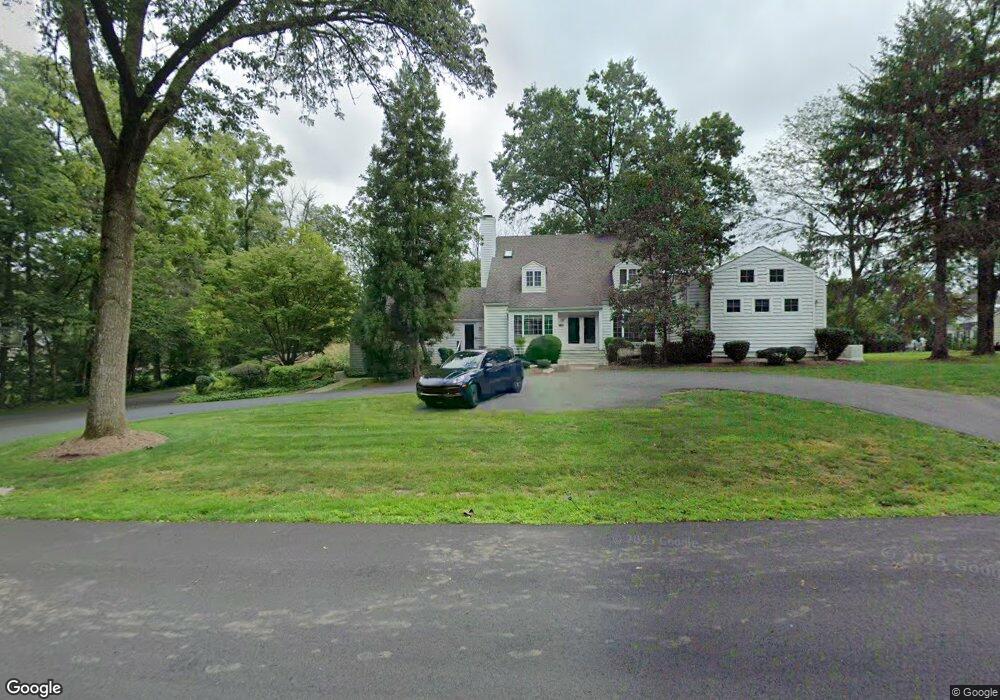
4601 Province Line Rd Princeton, NJ 08540
Estimated Value: $1,501,000 - $1,998,626
--
Bed
--
Bath
3,068
Sq Ft
$544/Sq Ft
Est. Value
About This Home
This home is located at 4601 Province Line Rd, Princeton, NJ 08540 and is currently estimated at $1,669,875, approximately $544 per square foot. 4601 Province Line Rd is a home located in Mercer County with nearby schools including Johnson Park School, Princeton Middle School, and Princeton High School.
Ownership History
Date
Name
Owned For
Owner Type
Purchase Details
Closed on
Jun 28, 2005
Current Estimated Value
Purchase Details
Closed on
Aug 22, 2001
Sold by
Meckstroth Richard
Bought by
Dehaven Richard and Dehaven Michelle
Home Financials for this Owner
Home Financials are based on the most recent Mortgage that was taken out on this home.
Original Mortgage
$460,000
Interest Rate
6.99%
Create a Home Valuation Report for This Property
The Home Valuation Report is an in-depth analysis detailing your home's value as well as a comparison with similar homes in the area
Home Values in the Area
Average Home Value in this Area
Purchase History
| Date | Buyer | Sale Price | Title Company |
|---|---|---|---|
| -- | $1,175,000 | -- | |
| Dehaven Richard | $575,000 | -- |
Source: Public Records
Mortgage History
| Date | Status | Borrower | Loan Amount |
|---|---|---|---|
| Previous Owner | Dehaven Richard | $460,000 |
Source: Public Records
Tax History Compared to Growth
Tax History
| Year | Tax Paid | Tax Assessment Tax Assessment Total Assessment is a certain percentage of the fair market value that is determined by local assessors to be the total taxable value of land and additions on the property. | Land | Improvement |
|---|---|---|---|---|
| 2025 | $22,438 | $842,600 | $428,500 | $414,100 |
| 2024 | $21,183 | $842,600 | $428,500 | $414,100 |
| 2023 | $21,183 | $842,600 | $428,500 | $414,100 |
| 2022 | $20,492 | $842,600 | $428,500 | $414,100 |
| 2021 | $20,551 | $842,600 | $428,500 | $414,100 |
| 2020 | $20,391 | $842,600 | $428,500 | $414,100 |
| 2019 | $21,765 | $917,600 | $503,500 | $414,100 |
| 2018 | $21,398 | $917,600 | $503,500 | $414,100 |
| 2017 | $20,620 | $896,500 | $503,500 | $393,000 |
| 2016 | $20,297 | $896,500 | $503,500 | $393,000 |
| 2015 | $19,831 | $896,500 | $503,500 | $393,000 |
| 2014 | $19,589 | $896,500 | $503,500 | $393,000 |
Source: Public Records
Map
Nearby Homes
- 168 Stone Cliff Rd
- 188 Stone Cliff Rd
- 174 Stone Cliff Rd
- 302 Stone Cliff Rd
- 196 Stone Cliff Rd
- 4571 Province Line Rd
- 156 Stone Cliff Rd
- 318 Stone Cliff Rd
- 181 Stone Cliff Rd
- 135 Stone Cliff Rd
- 140 Stone Cliff Rd
- 4690 Province Line Rd
- 324 Stone Cliff Rd
- 197 Stone Cliff Rd
- 4553 Province Line Rd
- 134 Stone Cliff Rd
- 129 Stone Cliff Rd
- 330 Stone Cliff Rd
- 460 Christopher Dr
- 128 Stone Cliff Rd