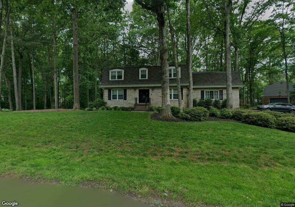
4601 Spalding Dr Dumfries, VA 22025
Estimated Value: $680,117 - $793,000
4
Beds
4
Baths
2,240
Sq Ft
$330/Sq Ft
Est. Value
About This Home
This home is located at 4601 Spalding Dr, Dumfries, VA 22025 and is currently estimated at $739,529, approximately $330 per square foot. 4601 Spalding Dr is a home located in Prince William County with nearby schools including John F. Pattie Sr. Elementary School, Graham Park Middle School, and Forest Park High School.
Ownership History
Date
Name
Owned For
Owner Type
Purchase Details
Closed on
Mar 27, 2001
Sold by
Michaud Charles R
Bought by
Zetts Robert S
Current Estimated Value
Home Financials for this Owner
Home Financials are based on the most recent Mortgage that was taken out on this home.
Original Mortgage
$205,600
Outstanding Balance
$75,453
Interest Rate
6.96%
Estimated Equity
$664,076
Create a Home Valuation Report for This Property
The Home Valuation Report is an in-depth analysis detailing your home's value as well as a comparison with similar homes in the area
Home Values in the Area
Average Home Value in this Area
Purchase History
| Date | Buyer | Sale Price | Title Company |
|---|---|---|---|
| Zetts Robert S | $257,000 | -- |
Source: Public Records
Mortgage History
| Date | Status | Borrower | Loan Amount |
|---|---|---|---|
| Open | Zetts Robert S | $205,600 |
Source: Public Records
Tax History Compared to Growth
Tax History
| Year | Tax Paid | Tax Assessment Tax Assessment Total Assessment is a certain percentage of the fair market value that is determined by local assessors to be the total taxable value of land and additions on the property. | Land | Improvement |
|---|---|---|---|---|
| 2025 | $6,160 | $668,700 | $244,300 | $424,400 |
| 2024 | $6,160 | $619,400 | $226,300 | $393,100 |
| 2023 | $6,183 | $594,200 | $215,500 | $378,700 |
| 2022 | $6,419 | $569,300 | $205,200 | $364,100 |
| 2021 | $6,057 | $496,700 | $178,400 | $318,300 |
| 2020 | $7,197 | $464,300 | $166,700 | $297,600 |
| 2019 | $6,648 | $428,900 | $154,400 | $274,500 |
| 2018 | $5,513 | $456,600 | $164,300 | $292,300 |
| 2017 | $5,381 | $436,900 | $156,500 | $280,400 |
| 2016 | $5,360 | $439,400 | $156,500 | $282,900 |
| 2015 | $5,246 | $446,800 | $158,000 | $288,800 |
| 2014 | $5,246 | $420,700 | $147,800 | $272,900 |
Source: Public Records
Map
Nearby Homes
- 15900 Moncure Dr
- 4504 Andrews Place
- 4710 Pinecrest Ct
- 4696 Fishermans Cove
- 15978 Cove Ln
- 4893 Benecia Ln
- 4745 Timber Ridge Dr
- 15745 Widewater Dr
- 15425 Beachview Dr
- 4884 Saltwater Dr
- 15350 Edgehill Dr
- 15869 Pebblewood St
- 15431 Silvan Glen Dr
- 15998 Cove Ln
- 15697 Viewpoint Cir
- 15675 Viewpoint Cir
- 15725 Marbury Heights Way
- 15378 Inlet Place
- 15730 Marbury Heights Way
- 15350 Maywood Dr
- 4603 Spalding Dr
- 15800 Moncure Dr
- 15797 Moncure Dr
- 4703 Pleasant Hill Place
- 15801 Marlington Dr
- 15794 Moncure Dr
- 15795 Moncure Ct
- 15701 Chapman Place
- 15794 Moncure Dr
- 15703 Chapman Place
- 15798 Fawn Place
- 15801 Moncure Dr
- 15793 Moncure Ct
- 15802 Moncure Dr
- 4602 Spalding Dr
- 4702 Harmony Place
- 15796 Fawn Place
- 15787 Butler Place
- 15795 Beacon Hill Place
- 15797 Beacon Hill Place