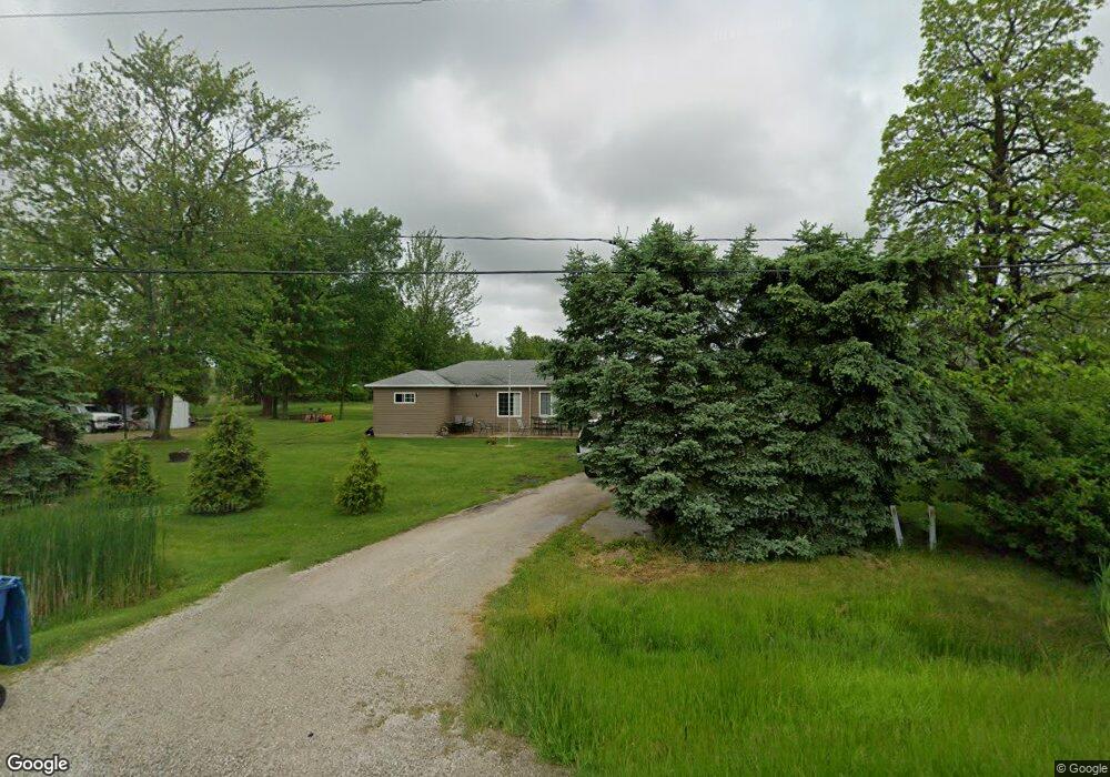
4601 West Harbor Rd Port Clinton, OH 43452
Estimated Value: $158,000 - $185,000
2
Beds
1
Bath
1,223
Sq Ft
$140/Sq Ft
Est. Value
About This Home
This home is located at 4601 West Harbor Rd, Port Clinton, OH 43452 and is currently estimated at $171,205, approximately $139 per square foot. 4601 West Harbor Rd is a home located in Ottawa County with nearby schools including Bataan Memorial Primary School, Bataan Memorial Intermediate School, and Port Clinton Middle School.
Ownership History
Date
Name
Owned For
Owner Type
Purchase Details
Closed on
May 9, 2016
Sold by
Howell Kenneth J and Howell Viola
Bought by
Bacak Brian E
Current Estimated Value
Home Financials for this Owner
Home Financials are based on the most recent Mortgage that was taken out on this home.
Original Mortgage
$75,931
Outstanding Balance
$60,545
Interest Rate
3.71%
Mortgage Type
New Conventional
Estimated Equity
$110,660
Purchase Details
Closed on
May 24, 2012
Sold by
Howell Omer F and Howell Martha F
Bought by
Howell Kenneth J
Create a Home Valuation Report for This Property
The Home Valuation Report is an in-depth analysis detailing your home's value as well as a comparison with similar homes in the area
Home Values in the Area
Average Home Value in this Area
Purchase History
| Date | Buyer | Sale Price | Title Company |
|---|---|---|---|
| Bacak Brian E | $78,300 | Attorney | |
| Howell Kenneth J | -- | Attorney |
Source: Public Records
Mortgage History
| Date | Status | Borrower | Loan Amount |
|---|---|---|---|
| Open | Bacak Brian E | $75,931 |
Source: Public Records
Tax History Compared to Growth
Tax History
| Year | Tax Paid | Tax Assessment Tax Assessment Total Assessment is a certain percentage of the fair market value that is determined by local assessors to be the total taxable value of land and additions on the property. | Land | Improvement |
|---|---|---|---|---|
| 2024 | $1,415 | $43,299 | $8,222 | $35,077 |
| 2023 | $1,415 | $33,905 | $5,870 | $28,035 |
| 2022 | $1,230 | $33,905 | $5,870 | $28,035 |
| 2021 | $1,228 | $33,910 | $5,870 | $28,040 |
| 2020 | $1,127 | $29,850 | $5,060 | $24,790 |
| 2019 | $1,116 | $29,850 | $5,060 | $24,790 |
| 2018 | $1,114 | $29,850 | $5,060 | $24,790 |
| 2017 | $1,043 | $27,490 | $4,910 | $22,580 |
| 2016 | $713 | $27,490 | $4,910 | $22,580 |
| 2015 | $678 | $27,490 | $4,910 | $22,580 |
| 2014 | $664 | $26,360 | $4,910 | $21,450 |
| 2013 | $665 | $26,360 | $4,910 | $21,450 |
Source: Public Records
Map
Nearby Homes
- 265 S Meachem Rd
- 265 S Meachem Rd Unit 62
- 265 S Meachem Rd Unit 24
- 265 S Meachem Rd Unit 41
- 265 S Meachem Rd Unit 39
- 3800 W Lakeshore Dr
- 295 Meachem Rd
- 5225 W Lakeshore Dr
- 2915 W Risingsun Rd
- 2915 W Rising Sun Rd
- 2860 W Rising Sun Rd
- 2738 W Columbus St
- 2400 Sandy Ln
- 1805 W Lakeshore Dr Unit 3
- 1805 W Lakeshore Dr
- 51 N Schooner Point Dr
- 89 N Schooner Point Dr Unit 89
- 87 N Schooner Point Dr
- 85 Schooner Point Dr
- 141 N Wexford Dr E
- 4589 West Harbor Rd
- 4589 W Harbor Rd
- 4577 West Harbor Rd
- 4577 W Harbor Rd
- 4565 West Harbor Rd
- 4553 West Harbor Rd
- 4551 West Harbor Rd
- 4551 W Harbor Rd
- 4529 West Harbor Rd
- 4529 W Harbor Rd
- 4515 West Harbor Rd
- 4515 W Harbor Rd
- 4405 W Harbor Rd
- 235 N Camp Rd
- 4650 W Harbor Rd
- 275 N Camp Rd
- 4253 West Harbor Rd
- 4925 West Harbor Rd
- 4231 West Harbor Rd
- 517 N Camp Rd