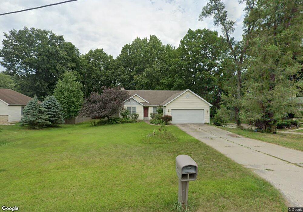
4603 Council Circle Dr Berrien Springs, MI 49103
Estimated Value: $289,000 - $435,000
4
Beds
3
Baths
2,728
Sq Ft
$130/Sq Ft
Est. Value
About This Home
This home is located at 4603 Council Circle Dr, Berrien Springs, MI 49103 and is currently estimated at $355,606, approximately $130 per square foot. 4603 Council Circle Dr is a home located in Berrien County with nearby schools including Sylvester Elementary School, Mars Elementary School, and Berrien Springs Middle School.
Ownership History
Date
Name
Owned For
Owner Type
Purchase Details
Closed on
Oct 21, 2025
Sold by
Mcmaster Gloria Dawn and Mann Susan Gail
Bought by
Mann Susan Gail and Mcmaster Gloria Doll
Current Estimated Value
Purchase Details
Closed on
Jun 12, 2024
Sold by
Doll L Beverly
Bought by
Mann Doll L and Mann Susan Gail
Purchase Details
Closed on
Jun 11, 2024
Sold by
Thomas J Doll J and Thomas Beverly L
Bought by
Doll L Beverly
Purchase Details
Closed on
Nov 22, 2006
Sold by
Doll Thomas J and Doll Beverly
Bought by
Thomas J & Beverly Doll Revocable Trust
Purchase Details
Closed on
May 5, 2005
Sold by
Appignani Peter L and Appignani Letitia A
Bought by
Doll Thomas J and Doll Beverly
Purchase Details
Closed on
Apr 9, 1999
Purchase Details
Closed on
Oct 16, 1997
Purchase Details
Closed on
May 12, 1997
Purchase Details
Closed on
Jan 8, 1997
Purchase Details
Closed on
Jul 6, 1994
Purchase Details
Closed on
Jul 29, 1985
Purchase Details
Closed on
May 24, 1979
Purchase Details
Closed on
May 17, 1979
Create a Home Valuation Report for This Property
The Home Valuation Report is an in-depth analysis detailing your home's value as well as a comparison with similar homes in the area
Home Values in the Area
Average Home Value in this Area
Purchase History
| Date | Buyer | Sale Price | Title Company |
|---|---|---|---|
| Mann Susan Gail | -- | None Listed On Document | |
| Mann Doll L | -- | None Listed On Document | |
| Doll L Beverly | -- | None Listed On Document | |
| Thomas J & Beverly Doll Revocable Trust | -- | None Available | |
| Doll Thomas J | $200,000 | Chicago Title | |
| -- | $171,500 | -- | |
| -- | $100 | -- | |
| -- | $100 | -- | |
| -- | $16,000 | -- | |
| -- | -- | -- | |
| -- | $7,100 | -- | |
| -- | $2,500 | -- | |
| -- | $2,500 | -- |
Source: Public Records
Tax History Compared to Growth
Tax History
| Year | Tax Paid | Tax Assessment Tax Assessment Total Assessment is a certain percentage of the fair market value that is determined by local assessors to be the total taxable value of land and additions on the property. | Land | Improvement |
|---|---|---|---|---|
| 2025 | $4,147 | $159,000 | $0 | $0 |
| 2024 | $3,202 | $155,000 | $0 | $0 |
| 2023 | $3,068 | $134,500 | $0 | $0 |
| 2022 | $2,973 | $121,900 | $0 | $0 |
| 2021 | $3,657 | $119,800 | $0 | $0 |
| 2020 | $3,627 | $109,500 | $0 | $0 |
| 2019 | $3,594 | $109,000 | $4,600 | $104,400 |
| 2018 | $3,313 | $109,000 | $0 | $0 |
| 2017 | $3,344 | $101,800 | $0 | $0 |
| 2016 | $3,281 | $82,700 | $0 | $0 |
| 2015 | $3,281 | $82,200 | $0 | $0 |
| 2014 | $2,668 | $79,500 | $0 | $0 |
Source: Public Records
Map
Nearby Homes
- 10749 Kings Ln
- 4376 E Snow Rd
- 4129 E Snow Rd
- Lot B 4331 Lake Chapin Rd
- 10809 Concord Dr
- 0 E Shawnee Rd Unit 25004845
- 317 S Harrison St
- 201 S Harrison St
- 305 S Main St
- 402 S Main St
- 308 S Mechanic St
- 312 N Cass St
- 537 N Main St
- 628 St Joseph Ave
- 604 N Mechanic St
- 10595 US Highway 31
- 315 E Washington St
- 9030 Maplewood Dr
- 9086 3rd St
- 11108 Berry St
- 4603 Council Circle Dr
- 4619 Council Circle Dr
- 4585 Council Circle Dr
- 4604 Council Circle Dr
- 4586 Council Circle Dr
- 4622 E Moccasin Trail
- 4627 Council Circle Dr
- 4590 E Moccasin Trail
- 0 S Moccasin Trail
- 10390 S Moccasin Trail
- 4927 Council Circle Dr
- 10372 S Moccasin Trail
- 4640 E Moccasin Trail
- 10408 S Moccasin Trail
- 4601 E Moccasin Trail
- 10350 S Moccasin Trail
- 10422 S Moccasin Trail
- 4615 E Moccasin Trail
- 4585 E Moccasin Trail
- 10442 S Moccasin Trail