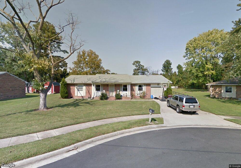
4604 Moore Cir Chesapeake, VA 23321
Western Branch NeighborhoodEstimated Value: $366,175 - $415,000
3
Beds
2
Baths
1,600
Sq Ft
$243/Sq Ft
Est. Value
About This Home
This home is located at 4604 Moore Cir, Chesapeake, VA 23321 and is currently estimated at $389,544, approximately $243 per square foot. 4604 Moore Cir is a home located in Chesapeake City with nearby schools including Edwin W. Chittum Elementary School, Jolliff Middle School, and Western Branch High School.
Ownership History
Date
Name
Owned For
Owner Type
Purchase Details
Closed on
May 31, 2013
Sold by
M And R Homes Llc
Bought by
Blankenship Heather E
Current Estimated Value
Home Financials for this Owner
Home Financials are based on the most recent Mortgage that was taken out on this home.
Original Mortgage
$218,960
Outstanding Balance
$154,430
Interest Rate
3.3%
Mortgage Type
FHA
Estimated Equity
$235,114
Purchase Details
Closed on
Sep 3, 2008
Sold by
S N B Holdings
Bought by
Knarr Warren K
Home Financials for this Owner
Home Financials are based on the most recent Mortgage that was taken out on this home.
Original Mortgage
$247,000
Interest Rate
6.69%
Mortgage Type
New Conventional
Purchase Details
Closed on
Jun 3, 2008
Sold by
Saunders Helen W
Bought by
S N B Holdings
Create a Home Valuation Report for This Property
The Home Valuation Report is an in-depth analysis detailing your home's value as well as a comparison with similar homes in the area
Home Values in the Area
Average Home Value in this Area
Purchase History
| Date | Buyer | Sale Price | Title Company |
|---|---|---|---|
| Blankenship Heather E | $223,000 | -- | |
| Knarr Warren K | $260,000 | -- | |
| S N B Holdings | $120,000 | -- |
Source: Public Records
Mortgage History
| Date | Status | Borrower | Loan Amount |
|---|---|---|---|
| Open | Blankenship Heather E | $218,960 | |
| Previous Owner | Knarr Warren K | $247,000 |
Source: Public Records
Tax History Compared to Growth
Tax History
| Year | Tax Paid | Tax Assessment Tax Assessment Total Assessment is a certain percentage of the fair market value that is determined by local assessors to be the total taxable value of land and additions on the property. | Land | Improvement |
|---|---|---|---|---|
| 2025 | $3,180 | $340,400 | $165,000 | $175,400 |
| 2024 | $3,180 | $314,900 | $160,000 | $154,900 |
| 2023 | $2,749 | $295,600 | $150,000 | $145,600 |
| 2022 | $2,754 | $272,700 | $125,000 | $147,700 |
| 2021 | $2,503 | $238,400 | $105,000 | $133,400 |
| 2020 | $2,460 | $234,300 | $105,000 | $129,300 |
| 2019 | $2,434 | $231,800 | $100,000 | $131,800 |
| 2018 | $2,494 | $216,600 | $80,000 | $136,600 |
| 2017 | $2,379 | $226,600 | $90,000 | $136,600 |
| 2016 | $2,274 | $216,600 | $80,000 | $136,600 |
| 2015 | $2,274 | $216,600 | $80,000 | $136,600 |
| 2014 | $2,274 | $216,600 | $80,000 | $136,600 |
Source: Public Records
Map
Nearby Homes
- 2019 River Pearl Way
- 2071 River Pearl Way
- 4910 Breck Ln
- 4912 Breck Ln
- 4901 Apricot Way
- 4920 Breck Ln
- 4903 Apricot Way
- 4905 Apricot Way
- 2119 Seastone Trace
- 4909 Apricot Way
- 4930 Breck Ln
- 4911 Apricot Way
- 4915 Apricot Way
- 4917 Apricot Way
- 4921 Apricot Way
- 2133 Portsmouth Blvd
- 1709 Swan Lake Crescent
- 4644 Leeward Dr
- 2613 Leytonstone Dr Unit 377
- 4316 Hillingdon Bend Unit 302
- 4600 Moore Cir
- 4608 Moore Cir
- 1951 Old Jolliff Rd
- 4601 Moore Cir
- 1901 Old Jolliff Rd
- 4605 Moore Cir
- 4609 Moore Cir
- 1955 Old Jolliff Rd
- 1937 Old Jolliff Rd
- 4700 Harlan Ct
- 4604 Jaye Cir
- 4608 Jaye Cir
- 1940 Old Jolliff Rd
- 4612 Jaye Cir
- 4704 Harlan Ct
- 4616 Jaye Cir
- 4600 Jaye Cir
- 4701 Harlan Ct
- 4620 Jaye Cir
- 4605 Jaye Cir
