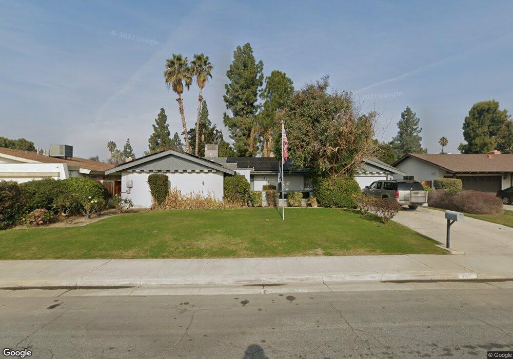
4604 Perris Way Bakersfield, CA 93309
Park Stockdale NeighborhoodEstimated Value: $339,000 - $388,000
4
Beds
2
Baths
1,603
Sq Ft
$227/Sq Ft
Est. Value
About This Home
This home is located at 4604 Perris Way, Bakersfield, CA 93309 and is currently estimated at $363,175, approximately $226 per square foot. 4604 Perris Way is a home located in Kern County with nearby schools including Caroline Harris Elementary School, Curran Middle School, and Bakersfield High School.
Ownership History
Date
Name
Owned For
Owner Type
Purchase Details
Closed on
Nov 13, 2024
Sold by
Clear Recon Corp
Bought by
Secretary Of Housing And Urban Development
Current Estimated Value
Purchase Details
Closed on
Jun 28, 2007
Sold by
Wilson James
Bought by
Wilson James and Wilson Mary A
Purchase Details
Closed on
Jun 23, 2005
Sold by
Wilson James and Wilson Mary A
Bought by
Wilson James
Home Financials for this Owner
Home Financials are based on the most recent Mortgage that was taken out on this home.
Original Mortgage
$306,375
Interest Rate
4.89%
Mortgage Type
Reverse Mortgage Home Equity Conversion Mortgage
Create a Home Valuation Report for This Property
The Home Valuation Report is an in-depth analysis detailing your home's value as well as a comparison with similar homes in the area
Home Values in the Area
Average Home Value in this Area
Purchase History
| Date | Buyer | Sale Price | Title Company |
|---|---|---|---|
| Secretary Of Housing And Urban Development | $341,333 | None Listed On Document | |
| Wilson James | -- | None Available | |
| Wilson James | -- | Title Company |
Source: Public Records
Mortgage History
| Date | Status | Borrower | Loan Amount |
|---|---|---|---|
| Previous Owner | Wilson James | $306,375 |
Source: Public Records
Tax History
| Year | Tax Paid | Tax Assessment Tax Assessment Total Assessment is a certain percentage of the fair market value that is determined by local assessors to be the total taxable value of land and additions on the property. | Land | Improvement |
|---|---|---|---|---|
| 2025 | $964 | $195,426 | $67,967 | $127,459 |
| 2024 | $964 | $191,595 | $66,635 | $124,960 |
| 2023 | $999 | $187,839 | $65,329 | $122,510 |
| 2022 | $1,052 | $184,157 | $64,049 | $120,108 |
| 2021 | $952 | $180,547 | $62,794 | $117,753 |
| 2020 | $951 | $178,697 | $62,151 | $116,546 |
| 2019 | $946 | $178,697 | $62,151 | $116,546 |
| 2018 | $952 | $171,760 | $59,739 | $112,021 |
| 2017 | $959 | $168,393 | $58,568 | $109,825 |
| 2016 | $916 | $165,092 | $57,420 | $107,672 |
| 2015 | $896 | $162,613 | $56,558 | $106,055 |
| 2014 | $819 | $156,000 | $39,000 | $117,000 |
Source: Public Records
Map
Nearby Homes
- 5101 Dunsmuir Rd Unit 13
- 5400 Dunsmuir Rd Unit 23
- 207 N Stine Rd
- 9 Dunlap St
- 4425 Charter Oaks Ave
- 108 Curran St
- 3800 Stockdale Hwy Unit 8
- 3800 Stockdale Hwy Unit 2
- 4600 Randy Ave
- 4300 Garnsey Ln
- 360 Garnsey Ave
- 905 Charter Oaks Ct
- 402 Westwood St
- 4201 Charter Oaks Ave
- 4212 Charter Oaks Ave
- 305 Jones St
- 4412 Joanne Ave
- 5500 Lennox Ave Unit 36
- 513 Prosser Ave
- 619 Palo Verde St
- 4612 Perris Way
- 4600 Perris Way
- 4609 La Mirada Dr
- 4605 La Mirada Dr
- 4613 La Mirada Dr
- 4512 Perris Way
- 4601 La Mirada Dr
- 4605 Perris Way
- 4613 Perris Way
- 4601 Perris Way
- 4700 Perris Way
- 4513 La Mirada Dr
- 4513 Perris Way
- 4701 La Mirada Dr
- 4508 Perris Way
- 4701 Perris Way
- 4612 Stanton Way
- 4610 Stanton Way
- 0 La Mirada Dr
- 4509 La Mirada Dr
Your Personal Tour Guide
Ask me questions while you tour the home.