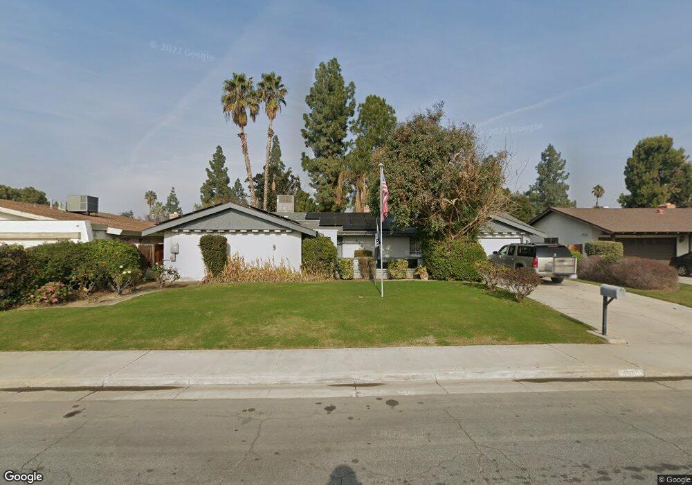
4604 Perris Way Bakersfield, CA 93309
Park Stockdale NeighborhoodEstimated Value: $338,000 - $373,000
About This Home
This home is located at 4604 Perris Way, Bakersfield, CA 93309 and is currently estimated at $358,989, approximately $223 per square foot. 4604 Perris Way is a home located in Kern County with nearby schools including Martin Luther King Jr. Elementary School, Caroline Harris Elementary School, and Curran Middle School.
Ownership History
We collect this data history from publicly available records. To have your information removed, we recommend requesting removal directly through your county’s website.
Purchase Details
Purchase Details
Purchase Details
Home Financials for this Owner
Home Financials are based on the most recent Mortgage that was taken out on this home.Home Values in the Area
Average Home Value in this Area
Purchase History
We collect this data history from publicly available records. To have your information removed, we recommend requesting removal directly through your county’s website.
| Date | Buyer | Sale Price | Title Company |
|---|---|---|---|
| $341,333 | None Listed On Document | ||
| -- | None Available | ||
| -- | Title Company |
Mortgage History
We collect this data history from publicly available records. To have your information removed, we recommend requesting removal directly through your county’s website.
| Date | Status | Borrower | Loan Amount |
|---|---|---|---|
| Previous Owner | $306,375 | ||
| Previous Owner | $25,000 | ||
| Previous Owner | $76,404 | ||
| Previous Owner | $85,177 | ||
| Previous Owner | $10,000 |
Tax History
We collect this data history from publicly available records. To have your information removed, we recommend requesting removal directly through your county’s website.
| Year | Tax Paid | Tax Assessment Tax Assessment Total Assessment is a certain percentage of the fair market value that is determined by local assessors to be the total taxable value of land and additions on the property. | Land | Improvement |
|---|---|---|---|---|
| 2025 | $964 | $195,426 | $67,967 | $127,459 |
| 2024 | $964 | $191,595 | $66,635 | $124,960 |
| 2023 | $999 | $187,839 | $65,329 | $122,510 |
| 2022 | $1,052 | $184,157 | $64,049 | $120,108 |
| 2021 | $952 | $180,547 | $62,794 | $117,753 |
| 2020 | $951 | $178,697 | $62,151 | $116,546 |
| 2019 | $946 | $178,697 | $62,151 | $116,546 |
| 2018 | $952 | $171,760 | $59,739 | $112,021 |
| 2017 | $959 | $168,393 | $58,568 | $109,825 |
| 2016 | $916 | $165,092 | $57,420 | $107,672 |
| 2015 | $896 | $162,613 | $56,558 | $106,055 |
| 2014 | $819 | $156,000 | $39,000 | $117,000 |
Map
- 5201 Dunsmuir Rd Unit 38
- 5100 Dunsmuir Rd Unit 11
- 207 N Stine Rd
- 132 Morrison St
- 3999 Marella Way
- 9 Dunlap St
- 924 Montclair St
- 4425 Charter Oaks Ave
- 3800 Stockdale Hwy Unit 25
- 217 Garnsey Ave
- 4600 Randy Ave
- 360 Garnsey Ave
- 402 Westwood St
- 3622 Dalen Place
- 4212 Charter Oaks Ave
- 4714 Frazier Ave
- 4301 California Ave Unit 1
- 513 Prosser Ave
- 300 S Garnsey Ave
- 4608 Fishering Dr
- 4600 Perris Way
- 4612 Perris Way
- 4609 La Mirada Dr
- 4605 La Mirada Dr
- 4613 La Mirada Dr
- 4512 Perris Way
- 4601 La Mirada Dr
- 4605 Perris Way
- 4613 Perris Way
- 4601 Perris Way
- 4700 Perris Way
- 4513 La Mirada Dr
- 4513 Perris Way
- 4701 La Mirada Dr
- 4508 Perris Way
- 4612 Stanton Way
- 4701 Perris Way
- 4610 Stanton Way
- 4509 La Mirada Dr
- 0 La Mirada Dr
Ask me questions while you tour the home.