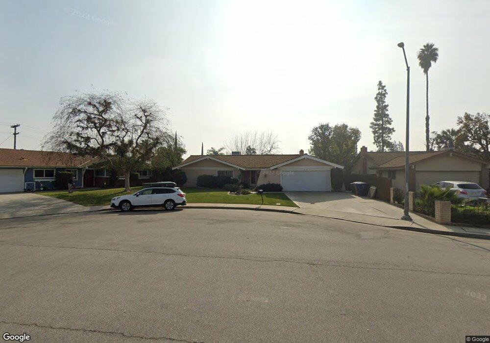
4605 Stanton Way Bakersfield, CA 93309
Park Stockdale NeighborhoodEstimated Value: $308,925 - $359,000
4
Beds
2
Baths
1,494
Sq Ft
$226/Sq Ft
Est. Value
About This Home
This home is located at 4605 Stanton Way, Bakersfield, CA 93309 and is currently estimated at $337,231, approximately $225 per square foot. 4605 Stanton Way is a home located in Kern County with nearby schools including Caroline Harris Elementary School, Curran Middle School, and Bakersfield High School.
Ownership History
Date
Name
Owned For
Owner Type
Purchase Details
Closed on
Sep 30, 2022
Sold by
Darlene Schimnowski
Bought by
Darlene R Schimnowski Trust
Current Estimated Value
Purchase Details
Closed on
Feb 3, 2000
Sold by
Hauss Beverly J Rev Liv Tr and Beverly L
Bought by
Schimnowski Darlene
Home Financials for this Owner
Home Financials are based on the most recent Mortgage that was taken out on this home.
Original Mortgage
$95,000
Interest Rate
8.14%
Purchase Details
Closed on
Nov 30, 1993
Sold by
Hauss Beverly J
Bought by
Hauss Beverly J
Create a Home Valuation Report for This Property
The Home Valuation Report is an in-depth analysis detailing your home's value as well as a comparison with similar homes in the area
Home Values in the Area
Average Home Value in this Area
Purchase History
| Date | Buyer | Sale Price | Title Company |
|---|---|---|---|
| Darlene R Schimnowski Trust | -- | -- | |
| Schimnowski Darlene | $100,500 | Chicago Title Co | |
| Hauss Beverly J | -- | -- |
Source: Public Records
Mortgage History
| Date | Status | Borrower | Loan Amount |
|---|---|---|---|
| Previous Owner | Schimnowski Darlene | $95,000 |
Source: Public Records
Tax History
| Year | Tax Paid | Tax Assessment Tax Assessment Total Assessment is a certain percentage of the fair market value that is determined by local assessors to be the total taxable value of land and additions on the property. | Land | Improvement |
|---|---|---|---|---|
| 2025 | $2,406 | $154,437 | $46,095 | $108,342 |
| 2024 | $2,351 | $151,410 | $45,192 | $106,218 |
| 2023 | $2,351 | $148,442 | $44,306 | $104,136 |
| 2022 | $2,291 | $145,533 | $43,438 | $102,095 |
| 2021 | $2,182 | $142,681 | $42,587 | $100,094 |
| 2020 | $2,145 | $141,219 | $42,151 | $99,068 |
| 2019 | $2,101 | $141,219 | $42,151 | $99,068 |
| 2018 | $2,053 | $135,737 | $40,515 | $95,222 |
| 2017 | $2,039 | $133,076 | $39,721 | $93,355 |
| 2016 | $1,876 | $130,468 | $38,943 | $91,525 |
| 2015 | $1,863 | $128,510 | $38,359 | $90,151 |
| 2014 | $1,801 | $125,994 | $37,608 | $88,386 |
Source: Public Records
Map
Nearby Homes
- 9 Dunlap St
- 5400 Dunsmuir Rd Unit 23
- 207 N Stine Rd
- 3800 Stockdale Hwy Unit 2
- 4600 Randy Ave
- 402 Westwood St
- 4714 Frazier Ave
- 4425 Charter Oaks Ave
- 360 Garnsey Ave
- 513 Prosser Ave
- 905 Charter Oaks Ct
- 312 Real Rd
- 4629 Fishering Dr
- 4212 Charter Oaks Ave
- 5500 Lennox Ave Unit 36
- 5501 Demaret Ave
- 3820 Apache Ave
- 619 Palo Verde St
- 340 Western Dr
- 700 New Stine Rd Unit 10
- 4609 Stanton Way
- 4601 Stanton Way
- 4604 El Monte Way
- 4608 El Monte Way
- 4613 Stanton Way
- 4600 El Monte Way
- 4600 Stanton Way
- 4612 El Monte Way
- 137 N McDonald Way
- 141 N McDonald Way
- 4608 Stanton Way
- 4610 Stanton Way
- 133 N McDonald Way
- 4604 Stanton Way
- 4615 Stanton Way
- 145 N McDonald Way
- 4612 Stanton Way
- 4616 El Monte Way
- 129 N McDonald Way
- 4601 El Monte Way
Your Personal Tour Guide
Ask me questions while you tour the home.