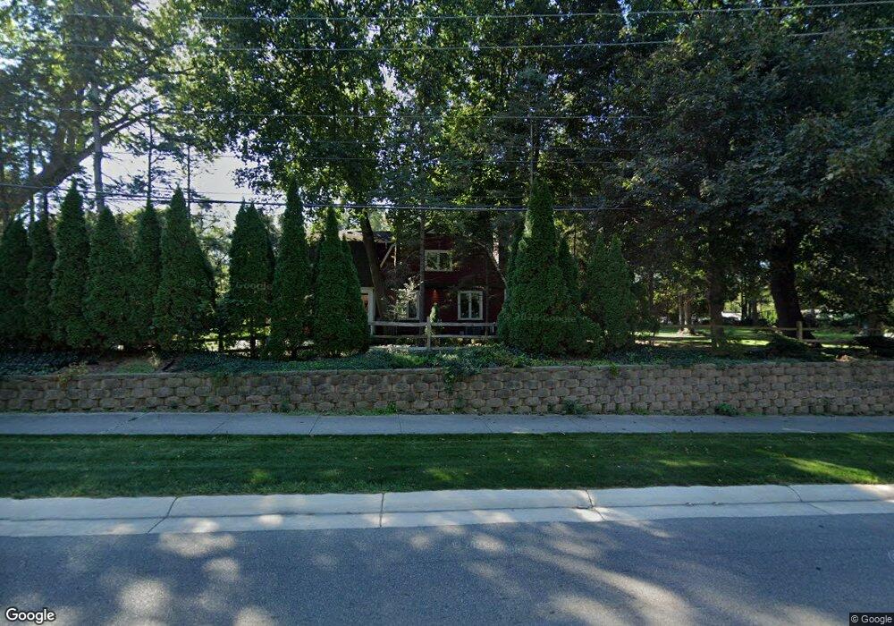
4605 W Maple Rd Bloomfield Hills, MI 48301
Estimated Value: $580,196 - $743,000
4
Beds
2
Baths
2,681
Sq Ft
$237/Sq Ft
Est. Value
About This Home
This home is located at 4605 W Maple Rd, Bloomfield Hills, MI 48301 and is currently estimated at $634,799, approximately $236 per square foot. 4605 W Maple Rd is a home located in Oakland County with nearby schools including Conant Elementary School, South Hills Middle School, and Bloomfield Hills High School.
Ownership History
Date
Name
Owned For
Owner Type
Purchase Details
Closed on
Feb 28, 2018
Sold by
Hynes James L and Hynes Laurie Lennon
Bought by
Hynes James L and Hynes Laurie Lennon
Current Estimated Value
Purchase Details
Closed on
Jul 15, 2003
Sold by
Pearlman Shamuel
Bought by
Hynes James and Lennon Laurie
Purchase Details
Closed on
Sep 15, 2000
Sold by
Coplin William
Bought by
Pearlman Shamuel
Purchase Details
Closed on
Aug 20, 1996
Sold by
Sabol David A
Bought by
Coplin William
Home Financials for this Owner
Home Financials are based on the most recent Mortgage that was taken out on this home.
Original Mortgage
$192,000
Interest Rate
8.47%
Create a Home Valuation Report for This Property
The Home Valuation Report is an in-depth analysis detailing your home's value as well as a comparison with similar homes in the area
Home Values in the Area
Average Home Value in this Area
Purchase History
| Date | Buyer | Sale Price | Title Company |
|---|---|---|---|
| Hynes James L | -- | None Available | |
| Hynes James | $418,000 | Blue Water Title Company | |
| Pearlman Shamuel | $330,000 | -- | |
| Coplin William | $240,000 | -- |
Source: Public Records
Mortgage History
| Date | Status | Borrower | Loan Amount |
|---|---|---|---|
| Previous Owner | Coplin William | $192,000 |
Source: Public Records
Tax History Compared to Growth
Tax History
| Year | Tax Paid | Tax Assessment Tax Assessment Total Assessment is a certain percentage of the fair market value that is determined by local assessors to be the total taxable value of land and additions on the property. | Land | Improvement |
|---|---|---|---|---|
| 2024 | $3,092 | $231,120 | $0 | $0 |
| 2023 | $2,992 | $211,500 | $0 | $0 |
| 2022 | $5,623 | $208,090 | $0 | $0 |
| 2021 | $5,583 | $195,700 | $0 | $0 |
| 2020 | $2,737 | $187,350 | $0 | $0 |
| 2019 | $5,253 | $183,760 | $0 | $0 |
| 2018 | $5,277 | $168,580 | $0 | $0 |
| 2017 | $5,240 | $162,890 | $0 | $0 |
| 2016 | $5,250 | $160,320 | $0 | $0 |
| 2015 | -- | $164,550 | $0 | $0 |
| 2014 | -- | $149,060 | $0 | $0 |
| 2011 | -- | $122,950 | $0 | $0 |
Source: Public Records
Map
Nearby Homes
- 4665 W Maple Rd
- 6720 Castle Dr
- 6701 Franklin Rd
- 6940 Castle Dr
- 4456 W Maple Rd
- 6041 Eastmoor Rd
- 6420 Apple Grove Ln Unit 10
- 6750 Wing Lake Rd
- 4603 Hedgewood Dr
- 5897 Sutters Ln
- 6730 Halyard Rd
- 4776 Walnut Lake Rd
- 4647 Private Lake Dr
- 4597 Broughton Dr
- 4428 Old Trinity Ct
- 6572 Spruce Dr
- 7100 Wing Lake Rd
- 7310 Sandy Creek Ln
- 5611 Priory Ln
- 5605 Woodwind Dr
- 6543 Castle Dr
- 6569 Castle Dr
- 6514 Castle Dr
- 4630 W Maple Rd
- 6550 Castle Dr
- 6560 Indianwood Trail
- 6601 Castle Dr
- 6590 Indianwood Trail
- 6630 Indianwood Trail
- 6600 Castle Dr
- 6610 Castle Dr
- 6631 Castle Dr
- 4580 W Maple Rd
- 4612 W Maple Rd
- 4580 Cherokee Ln
- 6630 Castle Dr
- 4566 W Maple Rd
- 4555 W Maple Rd
- 6660 Indianwood Trail
- 6565 Indianwood Trail