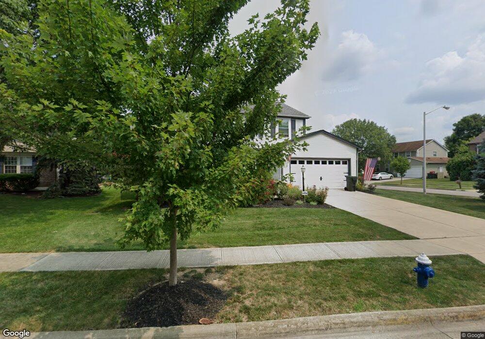
4606 Brownstone Dr Hilliard, OH 43026
Estimated Value: $408,905 - $467,000
4
Beds
3
Baths
2,036
Sq Ft
$211/Sq Ft
Est. Value
About This Home
This home is located at 4606 Brownstone Dr, Hilliard, OH 43026 and is currently estimated at $429,726, approximately $211 per square foot. 4606 Brownstone Dr is a home located in Franklin County with nearby schools including Avery Elementary School, Hilliard Tharp Sixth Grade Elementary School, and Hilliard Weaver Middle School.
Ownership History
Date
Name
Owned For
Owner Type
Purchase Details
Closed on
Nov 30, 2022
Sold by
Obrien Edward J and Obrien Patricia B
Bought by
Edward J Obrien And Patricia B Obrien Revocab and Obrien
Current Estimated Value
Purchase Details
Closed on
Dec 29, 1999
Sold by
Shuneson Craig R and Shuneson Lisa G
Bought by
Obrien Edward J and Obrien Patricia D
Home Financials for this Owner
Home Financials are based on the most recent Mortgage that was taken out on this home.
Original Mortgage
$146,250
Interest Rate
7.76%
Purchase Details
Closed on
Dec 3, 1992
Bought by
Shuneson Craig R and Shuneson Lisa G
Purchase Details
Closed on
Nov 27, 1990
Purchase Details
Closed on
Aug 1, 1990
Create a Home Valuation Report for This Property
The Home Valuation Report is an in-depth analysis detailing your home's value as well as a comparison with similar homes in the area
Home Values in the Area
Average Home Value in this Area
Purchase History
| Date | Buyer | Sale Price | Title Company |
|---|---|---|---|
| Edward J Obrien And Patricia B Obrien Revocab | -- | None Listed On Document | |
| Obrien Edward J | $162,500 | Title First Agency Inc | |
| Shuneson Craig R | $126,000 | -- | |
| -- | $120,500 | -- | |
| -- | $19,500 | -- |
Source: Public Records
Mortgage History
| Date | Status | Borrower | Loan Amount |
|---|---|---|---|
| Previous Owner | Obrien Edward J | $146,250 |
Source: Public Records
Tax History
| Year | Tax Paid | Tax Assessment Tax Assessment Total Assessment is a certain percentage of the fair market value that is determined by local assessors to be the total taxable value of land and additions on the property. | Land | Improvement |
|---|---|---|---|---|
| 2025 | $8,267 | $123,420 | $41,130 | $82,290 |
| 2024 | $8,267 | $123,420 | $41,130 | $82,290 |
| 2023 | $6,731 | $123,420 | $41,130 | $82,290 |
| 2022 | $5,615 | $81,940 | $21,000 | $60,940 |
| 2021 | $5,612 | $81,940 | $21,000 | $60,940 |
| 2020 | $5,598 | $81,940 | $21,000 | $60,940 |
| 2019 | $5,495 | $68,460 | $17,500 | $50,960 |
| 2018 | $5,252 | $68,460 | $17,500 | $50,960 |
| 2017 | $5,475 | $68,460 | $17,500 | $50,960 |
| 2016 | $5,325 | $61,640 | $16,490 | $45,150 |
| 2015 | $5,029 | $61,640 | $16,490 | $45,150 |
| 2014 | $5,038 | $61,640 | $16,490 | $45,150 |
| 2013 | $2,436 | $58,730 | $15,715 | $43,015 |
Source: Public Records
Map
Nearby Homes
- 5609 Imperial Ln
- 4851 Leybourne Dr
- 5621 Imperial Ln
- 4825 Diplomat Way
- 4897 Diplomat Way
- 4854 Piedmont Dr
- 4914 Diplomat Way
- 4275 Wayne St
- 4990 Pegasus Ct
- 5602 Eventing Way Unit 18
- 5518 Eventing Way
- 5593 Haydens Reserve Way Unit 5593
- 5154 Brandy Creek Dr
- 5385 Cedar Branch Way
- 5178 Brandy Creek Dr Unit 239
- 5176 Dry Creek Dr
- 4669 Community Way Unit 35
- 4725 Hoffman Farms Dr
- 5583 Mesa Falls St Unit 15
- 4668 Community Way
- 4624 Brownstone Dr
- 5353 Hessler Cir
- 4634 Brownstone Dr
- 5344 Hessler Cir
- 5340 Hessler Cir
- 5367 Hessler Cir
- 5348 Hessler Cir
- 4621 Brownstone Dr
- 4611 Brownstone Dr
- 4631 Brownstone Dr
- 5373 Hessler Cir
- 4601 Brownstone Dr
- 4644 Brownstone Dr
- 5352 Hessler Cir
- 4591 Brownstone Dr
- 4641 Brownstone Dr
- 5377 Hessler Cir
- 4584 Marilyn St
- 4590 Marilyn St
- 4654 Brownstone Dr
Your Personal Tour Guide
Ask me questions while you tour the home.