
Seller's Agent in 2025
Carol Daniels
Glenda Williamson Realty
(217) 620-6450
4 in this area
78 Total Sales
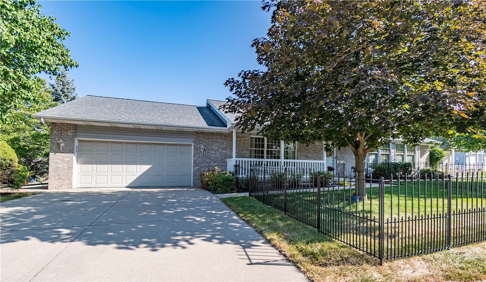


Check, check, check! ALL of the boxes! This lovely Home in the desirable Country Manor subdivision will have you scheduling those movers! 3- Bedrooms/2.5 Bathrooms, Main Floor laundry and the cutest window seats in 2 of the bedrooms. The Family room features a cozy gas fireplace as well as a wet bar! Recent improvements include Stainless kitchen appliances, professional interior painting, new light fixtures/ceiling fans throughout, new side garage and back exterior doors, window sashes and beautiful Mohawk Rev Wood plank flooring creating a move-in ready environment with low maintenance features. Adding to the outdoor space functionality is a New Gazebo and a Spacious Custom Shed with a loft and its own porch swing! All appliances stay! Large closets and walk-up basement provide plenty of storage. Don't miss out on this great ranch home!
Last Agent to Sell the Property
Glenda Williamson Realty License #475175963 Listed on: 09/05/2025
| Date | Type | Sale Price | Title Company |
|---|---|---|---|
| Warranty Deed | $212,000 | None Listed On Document | |
| Deed | $114,000 | -- |
| Date | Status | Loan Amount | Loan Type |
|---|---|---|---|
| Open | $169,600 | New Conventional |
| Date | Event | Price | List to Sale | Price per Sq Ft |
|---|---|---|---|---|
| 10/24/2025 10/24/25 | Sold | $255,000 | -5.5% | $130 / Sq Ft |
| 09/05/2025 09/05/25 | For Sale | $269,900 | -- | $138 / Sq Ft |
| Year | Tax Paid | Tax Assessment Tax Assessment Total Assessment is a certain percentage of the fair market value that is determined by local assessors to be the total taxable value of land and additions on the property. | Land | Improvement |
|---|---|---|---|---|
| 2024 | $5,266 | $58,393 | $12,914 | $45,479 |
| 2023 | $4,971 | $54,259 | $12,000 | $42,259 |
| 2022 | $2,750 | $51,017 | $11,283 | $39,734 |
| 2021 | $2,764 | $48,366 | $10,697 | $37,669 |
| 2020 | $2,633 | $46,226 | $10,224 | $36,002 |
| 2019 | $2,633 | $46,226 | $10,224 | $36,002 |
| 2018 | $2,600 | $45,213 | $10,000 | $35,213 |
| 2017 | $3,416 | $44,655 | $9,877 | $34,778 |
| 2016 | $3,456 | $42,973 | $9,871 | $33,102 |
| 2015 | $3,284 | $42,421 | $9,744 | $32,677 |
| 2014 | $3,080 | $42,421 | $9,744 | $32,677 |
| 2013 | $3,065 | $42,421 | $9,744 | $32,677 |
Seller's Agent in 2025
Carol Daniels
Glenda Williamson Realty
(217) 620-6450
4 in this area
78 Total Sales
L
Buyer's Agent in 2025
Lori Eaton
Glenda Williamson Realty
(217) 875-8081
1 in this area
79 Total Sales
Source: Central Illinois Board of REALTORS®
MLS Number: 6254986
APN: 09-13-17-480-008
Ask me questions while you tour the home.